
ROB
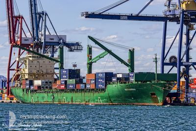
Container Ship
Current Trip
| Time Travelled | 4 days |
|---|---|
| Remaining Time | 6 days |
| Distance Travelled | 1213.42 nm |
| Remaining Distance | 1644.26 nm |
| AVG Speed | 11.1 Knots |
| MAX Speed | 14.4 Knots |
| AVG Wind | 17.9 knots |
| MAX Wind | 26.8 knots |
| MIN Temp | 10°C / 50°F |
| MAX Temp | 15.1°C / 59.18°F |
| Draught | 10.6 m |
| Position Received | 43 m ago |
Current Position
| Longitude | 6.62503° |
|---|---|
| Latitude | 55.83025° |
| Status | Under way using engine |
| Speed | 10.8 Knots |
| Course | 196.1° |
| Area | North Sea |
| Station | T-AIS |
| Position Received | 43 m ago |
Info
Information
The current position of ROB is in North Sea with coordinates 55.83025° / 6.62503° as reported on 2024-06-11 23:23 by AIS to our vessel tracker app. The vessel's current speed is 10.8 Knots and is heading at the port of CASABLANCA. The estimated time of arrival as calculated by vessel tracking app is 2024-06-18 05:12 LT
The vessel ROB (IMO: 9236652, MMSI: 636019341) is a Container Ship that was built in 2001 ( 23 years old ). It's sailing under the flag of [LR] Liberia.
In this page you can find informations about the vessels current position, last detected port calls, and current voyage information. If the vessels is not in coverage by AIS you will find the latest position.
The current position of ROB is detected by our AIS receivers and we are not responsible for the reliability of the data. The last position was recorded while the vessel was in Coverage by the Ais receivers of our vessel tracking app.
The current draught of ROB as reported by AIS is 10.6 meters
Weather
| Temperature | 11.3°C / 52.34°F |
|---|---|
| Wind Speed | 21 knots |
| Direction | 315° NW |
| Pressure | 1012.2 hPa |
| Humidity | 70.5 % |
| Cloud Coverage | 45 % |
Featured Company
Last Port Calls
| Port | Arrival | Departure | Time In Port |
|---|---|---|---|
| 2024-06-06 03:56 | 2024-06-07 17:13 | 1 d | |
| 2024-06-02 02:08 | 2024-06-04 07:54 | 2 d | |
| 2024-05-21 22:35 | 2024-05-24 17:22 | 2 d | |
| 2024-05-10 02:59 | 2024-05-13 04:09 | 3 d | |
| 2024-05-06 08:05 | 2024-05-08 20:52 | 2 d | |
| 2024-04-30 02:27 | 2024-05-04 22:26 | 4 d | |
| 2024-04-26 18:59 | 2024-04-27 20:09 | 1 d | |
| 2024-04-21 05:44 | 2024-04-26 09:29 | 5 d | |
| 2024-04-08 15:50 | 2024-04-09 07:25 | 15 h | |
| 2024-04-01 20:23 | 2024-04-02 22:30 | 1 d |
Most Visited Ports (Last year)
| Port | Arrivals | |
|---|---|---|
| 10 | ||
| 6 | ||
| 5 | ||
| 4 | ||
| 3 | ||
| 2 |
Last Trips
| Origin | Departure | Destination | Arrival | Distance | |
|---|---|---|---|---|---|
| 2024-06-04 09:54 | 2024-06-06 06:56 | 593.58 nm | |||
| 2024-05-24 18:22 | 2024-06-02 04:08 | 2421.17 nm | |||
| 2024-05-13 06:09 | 2024-05-21 23:35 | 2413.95 nm | |||
| 2024-05-08 23:52 | 2024-05-10 04:59 | 383.71 nm | |||
| 2024-05-05 01:26 | 2024-05-06 11:05 | 448.67 nm | |||
| 2024-04-27 23:09 | 2024-04-30 05:27 | 511.54 nm | |||
| 2024-04-26 11:29 | 2024-04-26 21:59 | 140.27 nm | |||
| 2024-04-09 10:25 | 2024-04-21 07:44 | 4042.13 nm | |||
| 2024-04-03 00:30 | 2024-04-08 18:50 | 636.98 nm | |||
| 2024-03-18 11:50 | 2024-04-01 22:23 | 4430.01 nm |
Events
| Time | Event | Details | Position / Dest | Info |
|---|---|---|---|---|
| 2024-06-11 23:58 | Status Changed | Default Under way using engine |
55.73833 / 6.53500
MACAS
|
Speed: 10.8 kn Course: 196.1° |
| 2024-06-11 22:19 | Status Changed | Under way using engine Default |
55.99359 / 6.78648
MACAS
|
Speed: 10.4 kn Course: 214° |
| 2024-06-11 22:09 | Status Changed | Default Under way using engine |
56.01863 / 6.81792
MACAS
|
Speed: 10.5 kn Course: 213.3° |
| 2024-06-11 13:11 | Change Sea Area | Danish part of the North Sea Danish part of the Skaggerak |
57.40769 / 8.07293
North Sea
MACAS
|
Speed: 9.9 kn Course: 231.5° |
| 2024-06-11 12:25 | ETA Changed | 2024/06/18 07:00 2024/06/16 23:00 |
57.48460 / 8.25771
MACAS
|
Speed: 10.3 kn Course: 242° |
| 2024-06-11 03:28 | Change Sea Area | Danish part of the Skaggerak Danish part of the Kattegat |
57.80862 / 10.94894
Skaggerak
MACAS
|
Speed: 12.2 kn Course: 310.4° |
| 2024-06-11 02:22 | Change Sea Area | Danish part of the Kattegat Swedish part of the Kattegat |
57.65452 / 11.20145
Kattegat
MACAS
|
Speed: 10.5 kn Course: 319.9° |
| 2024-06-10 22:05 | Change Sea Area | Swedish part of the Kattegat Danish part of the Kattegat |
56.99289 / 11.76387
Kattegat
MACAS
|
Speed: 9.8 kn Course: 340.4° |
| 2024-06-10 08:35 | Change Sea Area | Danish part of the Kattegat Danish part of the Baltic Sea |
54.73834 / 10.78237
Kattegat
MACAS
|
Speed: 12.1 kn Course: 21.6° |
| 2024-06-10 07:56 | Change Sea Area | Danish part of the Baltic Sea German part of the Baltic Sea |
54.63777 / 10.90016
Baltic Sea
MACAS
|
Speed: 14 kn Course: 300.3° |