
RODA
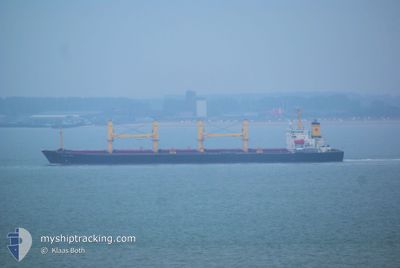
Bulk Carrier
Current Trip
| Time Travelled | 4 days |
|---|---|
| Remaining Time | 6 days |
| Distance Travelled | 590.53 nm |
| Remaining Distance | 801.79 nm |
| AVG Speed | 9.2 Knots |
| MAX Speed | 9.2 Knots |
| AVG Wind | 4.7 knots |
| MAX Wind | 12 knots |
| MIN Temp | 18°C / 64.4°F |
| MAX Temp | 28.1°C / 82.58°F |
| Draught | 11.4 m |
| Position Received | 3 m ago |
Current Position
| Longitude | 28.72938° |
|---|---|
| Latitude | 40.95508° |
| Status | At anchor |
| Speed | |
| Course | 224° |
| Area | Sea of Marmara |
| Station | T-AIS |
| Position Received | 3 m ago |
Info
Information
The current position of RODA is in Sea of Marmara with coordinates 40.95508° / 28.72938° as reported on 2024-06-03 08:50 by AIS to our vessel tracker app. The vessel's current speed is 0 Knots and is heading at the port of MERSIN. The estimated time of arrival as calculated by vessel tracking app is 2024-06-09 20:02 LT
The vessel RODA (IMO: 9077305, MMSI: 355814000) is a Bulk Carrier that was built in 1995 ( 29 years old ). It's sailing under the flag of [PA] Panama.
In this page you can find informations about the vessels current position, last detected port calls, and current voyage information. If the vessels is not in coverage by AIS you will find the latest position.
The current position of RODA is detected by our AIS receivers and we are not responsible for the reliability of the data. The last position was recorded while the vessel was in Coverage by the Ais receivers of our vessel tracking app.
The current draught of RODA as reported by AIS is 11.4 meters
Weather
| Temperature | 27.7°C / 81.86°F |
|---|---|
| Wind Speed | 3 knots |
| Direction | 141° SE |
| Pressure | 1015.1 hPa |
| Humidity | 43.2 % |
| Cloud Coverage | --- |
Featured Company
Last Port Calls
| Port | Arrival | Departure | Time In Port |
|---|---|---|---|
| 2024-05-28 22:28 | 2024-05-29 09:17 | 10 h | |
| 2024-05-28 02:05 | 2024-05-28 22:03 | 19 h | |
| 2024-05-27 20:39 | 2024-05-28 01:41 | 5 h | |
| 2024-05-27 01:21 | 2024-05-27 20:11 | 18 h | |
| 2024-05-26 21:41 | 2024-05-27 00:49 | 3 h | |
| 2024-05-26 20:15 | 2024-05-26 21:40 | 1 h | |
| 2024-05-26 12:05 | 2024-05-26 19:36 | 7 h | |
| 2024-05-22 11:28 | 2024-05-22 13:22 | 1 h | |
| 2024-04-29 10:31 | 2024-04-29 18:58 | 8 h | |
| 2024-04-29 07:25 | 2024-04-29 10:25 | 3 h |
Last Trips
| Origin | Departure | Destination | Arrival | Distance | |
|---|---|---|---|---|---|
| 2024-05-29 01:03 | 2024-05-29 01:28 | 3.25 nm | |||
| 2024-05-28 04:41 | 2024-05-28 05:05 | 2.19 nm | |||
| 2024-05-27 23:11 | 2024-05-27 23:39 | 2.93 nm | |||
| 2024-05-27 03:49 | 2024-05-27 04:21 | 7.75 nm | |||
| 2024-05-27 00:40 | 2024-05-27 00:41 | 0.93 nm | |||
| 2024-05-26 22:36 | 2024-05-26 23:15 | 11.05 nm | |||
| 2024-05-22 16:22 | 2024-05-26 15:05 | 482.84 nm | |||
| 2024-04-29 21:58 | 2024-05-22 14:28 | 2110.17 nm | |||
| 2024-04-29 13:25 | 2024-04-29 13:31 | 1.61 nm | |||
| 2024-04-29 09:55 | 2024-04-29 10:25 | 5.73 nm |
Events
| Time | Event | Details | Position / Dest | Info |
|---|---|---|---|---|
| 2024-06-03 05:05 | Status Changed | At anchor Default |
40.95385 / 28.72602
TRMER
|
Speed: Course: 91° |
| 2024-06-03 05:02 | Status Changed | Default At anchor |
40.95383 / 28.72598
TRMER
|
Speed: Course: 91° |
| 2024-06-02 23:41 | Status Changed | At anchor Default |
40.95447 / 28.72628
TRMER
|
Speed: Course: -1° |
| 2024-06-02 23:37 | Status Changed | Default At anchor |
40.95334 / 28.72500
TRMER
|
Speed: Course: 111° |
| 2024-06-02 21:14 | Status Changed | At anchor Default |
40.95427 / 28.72618
TRMER
|
Speed: Course: 99° |
| 2024-06-02 21:08 | Status Changed | Default At anchor |
40.95417 / 28.72622
TRMER
|
Speed: Course: 99° |
| 2024-06-01 23:53 | STOP Moving | 2.43 nm, East of AMBARLI |
40.95432 / 28.72743
TRMER
|
Speed: 0.2 kn Course: 85° |
| 2024-06-01 23:53 | Status Changed | At anchor Under way using engine |
40.95428 / 28.72737
TRMER
|
Speed: 0.6 kn Course: 83° |
| 2024-06-01 19:35 | Change Sea Area | Turkish part of the Sea of Marmara Turkish part of the Black Sea |
41.22858 / 29.12790
Sea of Marmara
TRMER
|
Speed: 7.5 kn Course: 206.8° |
| 2024-06-01 16:46 | Status Changed | Under way using engine Default |
41.44533 / 29.35490
TRMER
|
Speed: 5.1 kn Course: 225° |