
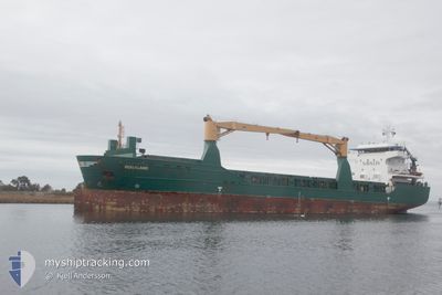
ROGALAND
General Cargo
Current Trip
KANTVIK VIA SKAW
| Time Travelled | 2 days |
|---|---|
| Remaining Time | --- |
| Distance Travelled | 598.81 nm |
| Remaining Distance | --- |
| AVG Speed | 10.5 Knots |
| MAX Speed | 12.1 Knots |
| AVG Wind | 12 knots |
| MAX Wind | 21.9 knots |
| MIN Temp | 16.5°C / 61.7°F |
| MAX Temp | 23.9°C / 75.02°F |
| Draught | 8.2 m |
| Position Received | 30 m ago |
Current Position
| Longitude | -9.82729° |
|---|---|
| Latitude | 39.96430° |
| Status | Under way using engine |
| Speed | 10 Knots |
| Course | 0.2° |
| Area | North Atlantic Ocean |
| Station | T-AIS |
| Position Received | 30 m ago |
Info
Information
The current position of ROGALAND is in North Atlantic Ocean with coordinates 39.96430° / -9.82729° as reported on 2024-06-16 03:59 by AIS to our vessel tracker app. The vessel's current speed is 10 Knots
The vessel ROGALAND (IMO: 9505596, MMSI: 305677000) is a General Cargo that was built in 2011 ( 13 years old ). It's sailing under the flag of [AG] Antigua Barbuda.
In this page you can find informations about the vessels current position, last detected port calls, and current voyage information. If the vessels is not in coverage by AIS you will find the latest position.
The current position of ROGALAND is detected by our AIS receivers and we are not responsible for the reliability of the data. The last position was recorded while the vessel was in Coverage by the Ais receivers of our vessel tracking app.
The current draught of ROGALAND as reported by AIS is 8.2 meters
Weather
| Temperature | 17.2°C / 62.96°F |
|---|---|
| Wind Speed | 5 knots |
| Direction | 336° NNW |
| Pressure | 1016.9 hPa |
| Humidity | 86.3 % |
| Cloud Coverage | 80 % |
Featured Company
Last Port Calls
| Port | Arrival | Departure | Time In Port |
|---|---|---|---|
| 2024-06-13 04:37 | 2024-06-13 20:14 | 15 h | |
| 2024-06-06 06:10 | 2024-06-11 16:05 | 5 d | |
| 2024-05-25 14:39 | 2024-05-26 10:13 | 19 h | |
| 2024-05-17 10:54 | 2024-05-18 00:38 | 13 h | |
| 2024-05-12 13:19 | 2024-05-16 00:16 | 3 d | |
| 2024-04-30 15:01 | 2024-04-30 19:02 | 4 h | |
| 2024-04-27 06:12 | 2024-04-28 03:20 | 21 h | |
| 2024-04-26 01:53 | 2024-04-27 02:22 | 1 d | |
| 2024-04-11 07:28 | 2024-04-12 13:45 | 1 d | |
| 2024-04-07 17:11 | 2024-04-09 11:39 | 1 d |
Last Trips
| Origin | Departure | Destination | Arrival | Distance | |
|---|---|---|---|---|---|
| 2024-06-11 17:05 | 2024-06-13 06:37 | 400.84 nm | |||
| 2024-05-26 12:13 | 2024-06-06 07:10 | 2246.95 nm | |||
| 2024-05-18 02:38 | 2024-05-25 16:39 | 1958.64 nm | |||
| 2024-05-16 01:16 | 2024-05-17 12:54 | 400.53 nm | |||
| 2024-04-30 21:02 | 2024-05-12 14:19 | 2240.01 nm | |||
| 2024-04-28 05:20 | 2024-04-30 17:01 | 646.78 nm | |||
| 2024-04-27 04:22 | 2024-04-27 08:12 | 38.39 nm | |||
| 2024-04-12 15:45 | 2024-04-26 03:53 | 2945.33 nm | |||
| 2024-04-09 11:39 | 2024-04-11 09:28 | 404.10 nm | |||
| 2024-04-06 10:25 | 2024-04-07 17:11 | 263.03 nm |
Events
| Time | Event | Details | Position / Dest | Info |
|---|---|---|---|---|
| 2024-06-16 03:59 | Status Changed | Default Under way using engine |
39.96569 / -9.82723
KANTVIK VIA SKAW
|
Speed: 10 kn Course: 0.2° |
| 2024-06-16 03:59 | Status Changed | Under way using engine Default |
39.96430 / -9.82729
KANTVIK VIA SKAW
|
Speed: 10.2 kn Course: 2° |
| 2024-06-16 03:28 | Status Changed | Default Under way using engine |
39.87653 / -9.83218
KANTVIK VIA SKAW
|
Speed: 9.8 kn Course: 1.2° |
| 2024-06-16 03:17 | Status Changed | Under way using engine Default |
39.84635 / -9.83347
KANTVIK VIA SKAW
|
Speed: 10.1 kn Course: 3° |
| 2024-06-16 03:03 | Status Changed | Default Under way using engine |
39.80715 / -9.83584
KANTVIK VIA SKAW
|
Speed: 10.1 kn Course: 1.2° |
| 2024-06-15 13:38 | ETA Changed | 2024/06/25 05:00 2024/06/24 15:00 |
37.60431 / -9.49687
KANTVIK VIA SKAW
|
Speed: 10.3 kn Course: 345.4° |
| 2024-06-15 13:32 | Status Changed | Under way using engine Default |
37.59080 / -9.49219
KANTVIK VIA SKAW
|
Speed: 10.2 kn Course: 344° |
| 2024-06-15 13:23 | IN Coverage |
37.59779 / -9.49465
North Atlantic Ocean
KANTVIK VIA SKAW
|
Speed: 10.4 kn Course: 345.3° |
|
| 2024-06-15 07:43 | Status Changed | Default Under way using engine |
36.72552 / -9.01655
KANTVIK VIA SKAW
|
Speed: 10.8 kn Course: 288.5° |
| 2024-06-15 07:43 | OUT of Coverage |
36.72490 / -9.01431
North Atlantic Ocean
KANTVIK VIA SKAW
|
Speed: 10.8 kn Course: 288.5° |