
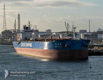
RONG LIN WAN
Tanker
Current Trip
SOHAR
| Time Travelled | 8 days |
|---|---|
| Remaining Time | --- |
| Distance Travelled | 2456.54 nm |
| Remaining Distance | --- |
| AVG Speed | 11.5 Knots |
| MAX Speed | 13.6 Knots |
| AVG Wind | 15.5 knots |
| MAX Wind | 26 knots |
| MIN Temp | 26.2°C / 79.16°F |
| MAX Temp | 33°C / 91.4°F |
| Draught | 13 m |
| Position Received | 9 d ago |
Current Position
| Longitude | 56.66876° |
|---|---|
| Latitude | 24.75568° |
| Status | Under way using engine |
| Speed | 8.2 Knots |
| Course | 191.6° |
| Area | Gulf of Oman |
| Station | T-AIS |
| Position Received | 9 d ago |
Info
Information
The current position of RONG LIN WAN is in Gulf of Oman with coordinates 24.75568° / 56.66876° as reported on 2024-06-16 06:06 by AIS to our vessel tracker app. The vessel's current speed is 8.2 Knots
The vessel RONG LIN WAN (IMO: 9783423, MMSI: 563026200) is a Tanker It's sailing under the flag of [SG] Singapore.
In this page you can find informations about the vessels current position, last detected port calls, and current voyage information. If the vessels is not in coverage by AIS you will find the latest position.
The current position of RONG LIN WAN is detected by our AIS receivers and we are not responsible for the reliability of the data. The last position was recorded while the vessel was in Coverage by the Ais receivers of our vessel tracking app.
The current draught of RONG LIN WAN as reported by AIS is 13 meters
Weather
| Temperature | 26.6°C / 79.88°F |
|---|---|
| Wind Speed | 22 knots |
| Direction | 131° SE |
| Pressure | 1012.2 hPa |
| Humidity | 84 % |
| Cloud Coverage | 55 % |
Featured Company
Last Port Calls
| Port | Arrival | Departure | Time In Port |
|---|---|---|---|
| 2024-06-16 11:33 | 2024-06-17 08:01 | 20 h | |
| 2024-06-11 17:01 | 2024-06-13 11:35 | 1 d | |
| 2024-04-24 05:03 | 2024-04-25 16:02 | 1 d | |
| 2024-04-19 04:50 | 2024-04-21 19:19 | 2 d | |
| 2024-04-15 22:24 | 2024-04-17 02:31 | 1 d | |
| 2024-04-13 02:16 | 2024-04-15 19:35 | 2 d |
Most Visited Ports (Last year)
| Port | Arrivals | |
|---|---|---|
| 4 | ||
| 3 | ||
| 3 | ||
| 2 | ||
| 2 | ||
| 2 |
Last Trips
| Origin | Departure | Destination | Arrival | Distance | |
|---|---|---|---|---|---|
| 2024-06-13 14:35 | 2024-06-16 15:33 | 438.06 nm | |||
| 2024-04-25 18:02 | 2024-06-11 20:01 | 11637.43 nm | |||
| 2024-04-21 21:19 | 2024-04-24 07:03 | 180.75 nm | |||
| 2024-04-17 04:31 | 2024-04-19 06:50 | 539.10 nm | |||
| 2024-04-15 21:35 | 2024-04-16 00:24 | 19.85 nm | |||
| 2024-03-02 02:03 | 2024-04-13 04:16 | 11431.70 nm |
Events
| Time | Event | Details | Position / Dest | Info |
|---|---|---|---|---|
| 2024-06-17 11:22 | START Moving |
24.51660 / 57.08719
SOHAR
|
Speed: 3.1 kn Course: 111° |
|
| 2024-06-17 11:09 | STOP Moving |
24.51388 / 57.08293
SOHAR
|
Speed: 0.3 kn Course: 29° |
|
| 2024-06-17 08:01 | PORT DEPARTURE |
|
24.52986 / 56.62899
SOHAR
|
Speed: 8 kn Course: 359° |
| 2024-06-17 07:49 | START Moving |
24.50590 / 56.62896
[OM] SOHAR
|
Speed: 4.3 kn Course: 359° |
|
| 2024-06-16 12:09 | STOP Moving |
24.49707 / 56.63193
[OM] SOHAR
|
Speed: 0.1 kn Course: 49° |
|
| 2024-06-16 11:33 | PORT ARRIVAL |
|
24.52051 / 56.62923
[OM] SOHAR
|
Speed: 8.3 kn Course: 178° |
| 2024-06-16 10:05 | START Moving | 8.25 nm, North of SOHAR |
24.64149 / 56.65849
SOHAR
|
Speed: 3.2 kn Course: 317° |
| 2024-06-16 08:37 | STOP Moving | 8.08 nm, North of SOHAR |
24.63769 / 56.66280
SOHAR
|
Speed: 0.3 kn Course: 19° |
| 2024-06-16 06:08 | Status Changed | Default Under way using engine |
24.75013 / 56.66755
SOHAR
|
Speed: 8.2 kn Course: 191.6° |
| 2024-06-16 06:06 | OUT of Coverage |
24.75568 / 56.66876
Gulf of Oman
SOHAR
|
Speed: 8.2 kn Course: 191.6° |