
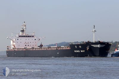
RONG MAY
Cargo
Current Trip
GIGIB>USDVT
| Time Travelled | 26 days |
|---|---|
| Remaining Time | --- |
| Distance Travelled | 6627.04 nm |
| Remaining Distance | --- |
| AVG Speed | 11.1 Knots |
| MAX Speed | 15.2 Knots |
| AVG Wind | 10.3 knots |
| MAX Wind | 32 knots |
| MIN Temp | 10°C / 50°F |
| MAX Temp | 31.3°C / 88.34°F |
| Draught | 8.8 m |
| Position Received | 15 h, 4 m ago |
Current Position
| Longitude | -89.67122° |
|---|---|
| Latitude | 29.46710° |
| Status | Under way using engine |
| Speed | 8.3 Knots |
| Course | 304.2° |
| Area | Gulf of Mexico |
| Station | T-AIS |
| Position Received | 15 h, 4 m ago |
Info
Information
The current position of RONG MAY is in Gulf of Mexico with coordinates 29.46710° / -89.67122° as reported on 2024-05-28 08:50 by AIS to our vessel tracker app. The vessel's current speed is 8.3 Knots
The vessel RONG MAY (IMO: 9774484, MMSI: 636017370) is a Cargo It's sailing under the flag of [LR] Liberia.
In this page you can find informations about the vessels current position, last detected port calls, and current voyage information. If the vessels is not in coverage by AIS you will find the latest position.
The current position of RONG MAY is detected by our AIS receivers and we are not responsible for the reliability of the data. The last position was recorded while the vessel was in Coverage by the Ais receivers of our vessel tracking app.
The current draught of RONG MAY as reported by AIS is 8.8 meters
Weather
| Temperature | 30°C / 86°F |
|---|---|
| Wind Speed | 12 knots |
| Direction | 148° SSE |
| Pressure | 1015.4 hPa |
| Humidity | 63.5 % |
| Cloud Coverage | 67 % |
Featured Company
Last Port Calls
| Port | Arrival | Departure | Time In Port |
|---|---|---|---|
| 2024-04-27 16:16 | 2024-05-02 14:59 | 4 d | |
| 2024-03-22 05:03 | 2024-03-26 18:51 | 4 d | |
| 2024-03-11 01:53 | 2024-03-19 09:11 | 8 d |
Last Trips
| Origin | Departure | Destination | Arrival | Distance | |
|---|---|---|---|---|---|
| 2024-03-26 13:51 | 2024-04-27 19:16 | 6722.65 nm | |||
| 2024-03-19 04:11 | 2024-03-22 00:03 | 299.65 nm | |||
| 2024-01-29 22:33 | 2024-03-10 20:53 | 9039.44 nm |
Events
| Time | Event | Details | Position / Dest | Info |
|---|---|---|---|---|
| 2024-05-28 10:52 | STOP Moving | 1.39 nm, South East of MYRTLE GROVE |
29.61725 / -89.89412
GIGIB>USDVT
|
Speed: 0.2 kn Course: 306° |
| 2024-05-28 08:55 | Status Changed | Default Under way using engine |
29.47574 / -89.68301
GIGIB>USDVT
|
Speed: 8.3 kn Course: 304.2° |
| 2024-05-28 08:50 | Status Changed | Under way using engine Default |
29.46710 / -89.67122
GIGIB>USDVT
|
Speed: 8.3 kn Course: 293° |
| 2024-05-28 08:50 | OUT of Coverage |
29.46710 / -89.67122
Gulf of Mexico
GIGIB>USDVT
|
Speed: 8.3 kn Course: 304.2° |
|
| 2024-05-28 08:38 | Status Changed | Default Under way using engine |
29.45847 / -89.64299
GIGIB>USDVT
|
Speed: 8.4 kn Course: 275.3° |
| 2024-05-28 07:21 | Status Changed | Under way using engine Default |
29.35712 / -89.51097
GIGIB>USDVT
|
Speed: 8.2 kn Course: 296° |
| 2024-05-28 07:15 | Status Changed | Default Under way using engine |
29.35084 / -89.49567
GIGIB>USDVT
|
Speed: 8.1 kn Course: 269.7° |
| 2024-05-28 06:51 | Status Changed | Under way using engine Default |
29.36244 / -89.44215
GIGIB>USDVT
|
Speed: 8.5 kn Course: 297° |
| 2024-05-28 06:47 | Status Changed | Default Under way using engine |
29.35794 / -89.42991
GIGIB>USDVT
|
Speed: 8.3 kn Course: 294.6° |
| 2024-05-28 06:43 | ETA Changed | 2024/05/28 10:00 2024/05/27 03:30 |
29.35466 / -89.42232
GIGIB>USDVT
|
Speed: 8.3 kn Course: 294.6° |