
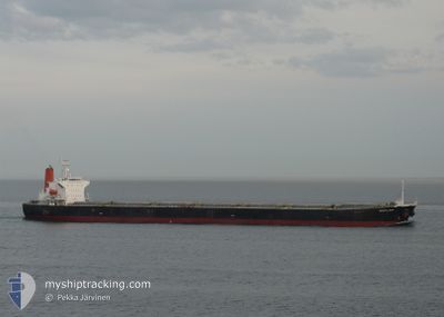
ROSCO LEMON
Bulk Carrier
Aktuelle Reise
MUARA BERAU
| Bisherige Reisezeit | 7 Tage |
|---|---|
| Verbleibende Reisezeit | --- |
| Zurückgelegte Distanz | 1845.00 nm |
| Verbleibende Distanz | --- |
| Durchschnittliche Geschwindigkeit | 11 Knoten |
| Maximale Geschwindigkeit | 14.4 Knoten |
| Durchschnittliche Windgeschwindigkeit | 15.5 Knoten |
| Maximale Windgeschwindigkeit | 24.4 Knoten |
| Minimale Temperatur | 22.3°C / 72.14°F |
| Maximale Temperatur | 30.5°C / 86.9°F |
| Tiefgang | 6.6 m |
| Position erhalten | 1 d alt |
Aktuelle Position
| Länge | --- |
|---|---|
| Breite | --- |
| Zustand | Under way using engine |
| Geschwindigkeit | 9.7 Knoten |
| Kurs | 159° |
| Gebiet | Java Sea |
| Station | T-AIS |
| Position erhalten | 1 d alt |
Schiffsdetails
Information
Die ROSCO LEMON befindet sich derzeit in Java Sea mit den Koordinaten -3.43690° / 110.04199°, Diese Position wurde am 2024-10-29 23:22 von unserer Schiffsverfolgungs-App über AIS erfasst. Das Schiff fährt momentan mit einer Geschwindigkeit von 9.7 Knoten
Das Schiff ROSCO LEMON (IMO: 9254707, MMSI: 477831500) ist Bulk Carrier das wurde im Jahr 2002 ( 22 Jahre alt ) gebaut. und fährt unter der Flagge von [HK] Hong Kong.
Auf dieser Seite erhalten Sie Informationen zur aktuellen Position des Schiffes, zu den letzten bekannten Hafenanläufen und zu den aktuellen Reiseinformationen. Sollte das Schiff nicht durch AIS abgedeckt sein, wird die zuletzt erfasste Position angezeigt.
Die ROSCO LEMON wird durch unsere AIS-Empfänger ermittelt. Wir übernehmen keine Gewähr für die Richtigkeit der Daten. Die letzte Position wurde von unseren AIS-Empfängern aufgezeichnet, während das Schiff in Reichweite war.
Der aktuelle Entwurf von ROSCO LEMON, wie von AIS gemeldet, betragt 6.6 meter
Wetter
| Temperatur | 26.6°C / 79.88°F |
|---|---|
| Windgeschwindigkeit | 9 Knoten |
| Windrichtung | 34° NE |
| Luftdruck | 1009.8 hPa |
| Luftfeuchtigkeit | 84.4 % |
| Wolken | 100 % |
Featured Company
Meistbesuchte Häfen (Letztes Jahr)
| Hafen | Ankünfte | |
|---|---|---|
| 4 | ||
| 3 | ||
| 2 | ||
| 1 | ||
| 1 | ||
| 1 |
Letzte Reisen
| Herkunft | Abfahrt | Ziel | Ankunft | Distanz | |
|---|---|---|---|---|---|
| 2024-09-29 17:41 | 2024-10-21 10:22 | 3294.03 nm | |||
| 2024-09-14 16:46 | 2024-09-25 08:33 | 1511.35 nm | |||
| 2024-09-01 06:12 | 2024-09-13 22:27 | 2310.59 nm | |||
| 2024-08-07 12:16 | 2024-08-30 02:17 | 4104.29 nm | |||
| 2024-06-22 08:13 | 2024-08-05 11:04 | 4246.15 nm |
Events
| Zeit | Ereignis | Details | Position / Ziel | Information |
|---|---|---|---|---|
| 2024-10-31 05:55 | STOP Bewegung |
-3.72095 / 114.42028
MUARA BERAU
|
Geschwindigkeit: 0.3 kn Kurs: 186° |
|
| 2024-10-29 23:33 | geänderter Status | Default Under way using engine |
-3.46381 / 110.05336
MUARA BERAU
|
Geschwindigkeit: 9.7 kn Kurs: 159° |
| 2024-10-29 23:22 | außerhalb Abdeckung |
-3.43690 / 110.04199
Java Sea
|
Geschwindigkeit: 9.7 kn Kurs: 159° |
|
| 2024-10-29 20:20 | Ändere Seegebiet | Indonesian part of the Java Sea Chinese part of the South China Sea |
-2.98705 / 109.83573
Java Sea
|
Geschwindigkeit: 10 kn Kurs: 156.5° |
| 2024-10-29 20:18 | geänderter Status | Under way using engine Default |
-2.98270 / 109.83390
MUARA BERAU
|
Geschwindigkeit: 10.1 kn Kurs: 156° |
| 2024-10-29 20:18 | in Abdeckung |
-2.98705 / 109.83573
Java Sea
|
Geschwindigkeit: 10 kn Kurs: 156.5° |
|
| 2024-10-24 00:11 | ABFAHRTSHAFEN |
|
21.59502 / 108.65431
MUARA BERAU
|
Geschwindigkeit: 9.9 kn Kurs: 206° |
| 2024-10-23 23:16 | START Bewegung |
21.70629 / 108.59263
[CN] QINZHOU
|
Geschwindigkeit: 3.8 kn Kurs: 134° |