
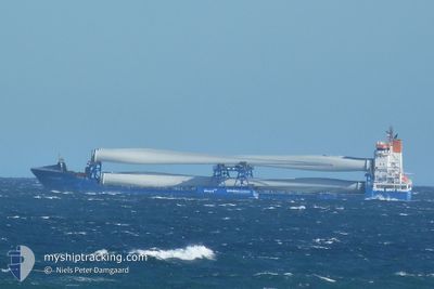
ROTRA MARE
Container Ship
Current Trip
| Time Travelled | 3 days |
|---|---|
| Remaining Time | --- |
| Distance Travelled | 563.97 nm |
| Remaining Distance | 0.73 nm |
| AVG Speed | 9.3 Knots |
| MAX Speed | 13.2 Knots |
| AVG Wind | 12.3 knots |
| MAX Wind | 22 knots |
| MIN Temp | 9.9°C / 49.82°F |
| MAX Temp | 18.3°C / 64.94°F |
| Draught | 5.9 m |
| Position Received | 1 m ago |
Current Position
| Longitude | 10.04734° |
|---|---|
| Latitude | 57.05602° |
| Status | Moored |
| Speed | |
| Course | 126° |
| Area | Kattegat |
| Station | T-AIS |
| Position Received | 1 m ago |
Info
Information
The current position of ROTRA MARE is in Kattegat with coordinates 57.05602° / 10.04734° as reported on 2024-05-17 03:38 by AIS to our vessel tracker app. The vessel's current speed is 0 Knots and is heading at the port of AALBORG. The estimated time of arrival as calculated by vessel tracking app is 2024-05-15 19:00 LT
The vessel ROTRA MARE (IMO: 9365996, MMSI: 246051000) is a Container Ship that was built in 2008 ( 16 years old ). It's sailing under the flag of [NL] Netherlands.
In this page you can find informations about the vessels current position, last detected port calls, and current voyage information. If the vessels is not in coverage by AIS you will find the latest position.
The current position of ROTRA MARE is detected by our AIS receivers and we are not responsible for the reliability of the data. The last position was recorded while the vessel was in Coverage by the Ais receivers of our vessel tracking app.
The current draught of ROTRA MARE as reported by AIS is 5.9 meters
Weather
| Temperature | 11.5°C / 52.7°F |
|---|---|
| Wind Speed | 11 knots |
| Direction | 104° ESE |
| Pressure | 1017.2 hPa |
| Humidity | 79.6 % |
| Cloud Coverage | 30 % |
Featured Company
Last Port Calls
| Port | Arrival | Departure | Time In Port |
|---|---|---|---|
| 2024-05-12 08:54 | 2024-05-13 18:06 | 1 d | |
| 2024-05-05 17:14 | 2024-05-07 09:36 | 1 d | |
| 2024-04-29 15:57 | 2024-04-29 22:50 | 6 h | |
| 2024-04-26 04:39 | 2024-04-26 13:53 | 9 h | |
| 2024-04-21 04:32 | 2024-04-21 13:12 | 8 h | |
| 2024-04-16 21:00 | 2024-04-17 12:45 | 15 h | |
| 2024-04-11 09:39 | 2024-04-11 20:06 | 10 h | |
| 2024-04-06 20:17 | 2024-04-08 12:44 | 1 d | |
| 2024-04-01 16:38 | 2024-04-03 16:16 | 1 d | |
| 2024-03-31 18:03 | 2024-04-01 16:23 | 22 h |
Last Trips
| Origin | Departure | Destination | Arrival | Distance | |
|---|---|---|---|---|---|
| 2024-05-07 10:36 | 2024-05-12 09:54 | 724.24 nm | |||
| 2024-04-30 00:50 | 2024-05-05 18:14 | 706.76 nm | |||
| 2024-04-26 15:53 | 2024-04-29 17:57 | 623.81 nm | |||
| 2024-04-21 15:12 | 2024-04-26 06:39 | 627.88 nm | |||
| 2024-04-17 14:45 | 2024-04-21 06:32 | 629.03 nm | |||
| 2024-04-11 22:06 | 2024-04-16 23:00 | 627.86 nm | |||
| 2024-04-08 14:44 | 2024-04-11 11:39 | 631.32 nm | |||
| 2024-04-03 18:16 | 2024-04-06 22:17 | 627.01 nm | |||
| 2024-04-01 18:23 | 2024-04-01 18:38 | 0.69 nm | |||
| 2024-03-29 15:40 | 2024-03-31 20:03 | 545.76 nm |
Events
| Time | Event | Details | Position / Dest | Info |
|---|---|---|---|---|
| 2024-05-15 22:50 | Status Changed | Moored Under way using engine |
57.05603 / 10.04739
AALBORG
|
Speed: 0.1 kn Course: 128° |
| 2024-05-15 22:42 | STOP Moving | 2.87 nm, East of AALBORG |
57.05620 / 10.04734
AALBORG
|
Speed: 0.3 kn Course: 132° |
| 2024-05-15 22:21 | START Moving | 3.43 nm, East of AALBORG |
57.05180 / 10.06369
AALBORG
|
Speed: 3.1 kn Course: 317° |
| 2024-05-15 22:04 | STOP Moving | 3.68 nm, East of AALBORG |
57.04979 / 10.07077
AALBORG
|
Speed: 0.2 kn Course: 298° |
| 2024-05-15 11:41 | Change Sea Area | Danish part of the Kattegat Danish part of the Skaggerak |
57.76070 / 10.78554
Kattegat
AALBORG
|
Speed: 9.5 kn Course: 165.5° |
| 2024-05-15 03:08 | Detected in Sea | Danish part of the Skaggerak |
57.47828 / 7.96335
Skaggerak
AALBORG
|
Speed: 12 kn Course: 78.5° |
| 2024-05-15 02:59 | Change Sea Area | Danish part of the North Sea Norwegian part of the North Sea |
57.47246 / 7.90792
North Sea
AALBORG
|
Speed: 11.9 kn Course: 79.1° |
| 2024-05-14 11:18 | Status Changed | Under way using engine Default |
57.54493 / 2.42506
AALBORG
|
Speed: 11.2 kn Course: 106° |
| 2024-05-14 11:16 | Status Changed | Default Under way using engine |
57.54677 / 2.41282
AALBORG
|
Speed: 11 kn Course: 105.1° |
| 2024-05-14 10:53 | Status Changed | Under way using engine Default |
57.55325 / 2.27882
AALBORG
|
Speed: 11.5 kn Course: 91° |