
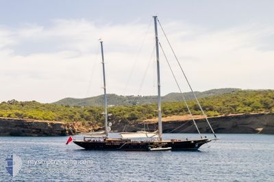
ROXANE
Sailing
Current Trip
| Time Travelled | 7 days |
|---|---|
| Remaining Time | --- |
| Distance Travelled | 86.03 nm |
| Remaining Distance | --- |
| AVG Speed | 9.9 Knots |
| MAX Speed | 11.5 Knots |
| AVG Wind | 9 knots |
| MAX Wind | 19 knots |
| MIN Temp | 15.4°C / 59.72°F |
| MAX Temp | 29.1°C / 84.38°F |
| Draught | 3.6 m |
| Position Received | 3 m ago |
Current Position
| Longitude | 7.06091° |
|---|---|
| Latitude | 43.52970° |
| Status | At anchor |
| Speed | |
| Course | 236° |
| Area | Mediterranean Sea - Western Basin |
| Station | T-AIS |
| Position Received | 3 m ago |
Info
Information
The current position of ROXANE is in Mediterranean Sea - Western Basin with coordinates 43.52970° / 7.06091° as reported on 2024-06-15 20:05 by AIS to our vessel tracker app. The vessel's current speed is 0 Knots
The vessel ROXANE (MMSI: 248548000) is a Sailing It's sailing under the flag of [MT] Malta.
In this page you can find informations about the vessels current position, last detected port calls, and current voyage information. If the vessels is not in coverage by AIS you will find the latest position.
The current position of ROXANE is detected by our AIS receivers and we are not responsible for the reliability of the data. The last position was recorded while the vessel was in Coverage by the Ais receivers of our vessel tracking app.
The current draught of ROXANE as reported by AIS is 3.6 meters
Weather
| Temperature | 20.6°C / 69.08°F |
|---|---|
| Wind Speed | 7 knots |
| Direction | 224° SW |
| Pressure | 1009.9 hPa |
| Humidity | 80.5 % |
| Cloud Coverage | 44 % |
Featured Company
Last Port Calls
| Port | Arrival | Departure | Time In Port |
|---|---|---|---|
| 2024-05-28 11:35 | 2024-06-08 07:56 | 10 d | |
| 2024-04-11 13:24 | 2024-05-24 10:19 | ||
| 2024-04-11 06:33 |
Most Visited Ports (Last year)
| Port | Arrivals | |
|---|---|---|
| 6 | ||
| 2 | ||
| 1 | ||
| 1 | ||
| 1 |
Last Trips
| Origin | Departure | Destination | Arrival | Distance | |
|---|---|---|---|---|---|
| 2024-05-24 12:19 | 2024-05-28 13:35 | 58.79 nm | |||
| 2024-04-11 08:33 | 2024-04-11 15:24 | 70.82 nm |
Events
| Time | Event | Details | Position / Dest | Info |
|---|---|---|---|---|
| 2024-06-15 15:23 | Status Changed | At anchor Under way using engine |
43.52971 / 7.06137
FR CEQ
|
Speed: 0.2 kn Course: 213° |
| 2024-06-15 15:20 | STOP Moving | 1.78 nm, South East of CANNES |
43.52988 / 7.06131
FR CEQ
|
Speed: 0.2 kn Course: 213° |
| 2024-06-15 13:33 | ETA Changed | 2024/06/15 17:30 |
43.36955 / 6.79957
FR CEQ
|
Speed: 10.9 kn Course: 57.6° |
| 2024-06-15 12:51 | START Moving | 1.7 nm, North East of SAINT TROPEZ |
43.29408 / 6.65949
FR CEQ
|
Speed: 10.5 kn Course: 55.8° |
| 2024-06-15 12:29 | Status Changed | Under way using engine At anchor |
43.27739 / 6.62516
FR CEQ
|
Speed: 0.2 kn Course: 195° |
| 2024-06-15 12:27 | Destination Changed | FR CEQ FR STP |
43.27738 / 6.62521
FR CEQ
|
Speed: 0.2 kn Course: 195° |
| 2024-06-15 12:27 | ETA Changed | 2024/06/15 17:30 2024/06/12 20:15 |
43.27738 / 6.62521
FR CEQ
|
Speed: 0.2 kn Course: 195° |
| 2024-06-15 03:14 | IN Coverage |
43.27724 / 6.62554
Mediterranean Sea - Western Basin
|
Speed: Course: 200° |
|
| 2024-06-15 02:12 | OUT of Coverage |
43.27723 / 6.62556
Mediterranean Sea - Western Basin
|
Speed: Course: 208° |
|
| 2024-06-14 22:47 | IN Coverage |
43.27707 / 6.62566
Mediterranean Sea - Western Basin
|
Speed: 0.1 kn Course: 247° |