
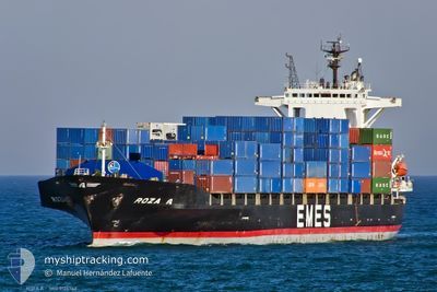
ROZA A
Container Ship
Current Trip
| Time Travelled | 1 day |
|---|---|
| Remaining Time | 33 mins |
| Distance Travelled | 393.83 nm |
| Remaining Distance | 6.51 nm |
| AVG Speed | 11.8 Knots |
| MAX Speed | 13.9 Knots |
| AVG Wind | 10 knots |
| MAX Wind | 17 knots |
| MIN Temp | 16.4°C / 61.52°F |
| MAX Temp | 29°C / 84.2°F |
| Draught | 8.2 m |
| Position Received | 1 m ago |
Current Position
| Longitude | 29.60763° |
|---|---|
| Latitude | 40.74102° |
| Status | Under way using engine |
| Speed | 10.8 Knots |
| Course | 99.1° |
| Area | Sea of Marmara |
| Station | T-AIS |
| Position Received | 1 m ago |
Info
Information
The current position of ROZA A is in Sea of Marmara with coordinates 40.74102° / 29.60763° as reported on 2024-06-28 11:51 by AIS to our vessel tracker app. The vessel's current speed is 10.8 Knots and is heading at the port of EVYAP. The estimated time of arrival as calculated by vessel tracking app is 2024-06-28 12:25 LT
The vessel ROZA A (IMO: 9126742, MMSI: 271001057) is a Container Ship that was built in 1997 ( 27 years old ). It's sailing under the flag of [TR] Turkey.
In this page you can find informations about the vessels current position, last detected port calls, and current voyage information. If the vessels is not in coverage by AIS you will find the latest position.
The current position of ROZA A is detected by our AIS receivers and we are not responsible for the reliability of the data. The last position was recorded while the vessel was in Coverage by the Ais receivers of our vessel tracking app.
The current draught of ROZA A as reported by AIS is 8.2 meters
Weather
| Temperature | 29.1°C / 84.38°F |
|---|---|
| Wind Speed | 4 knots |
| Direction | 289° WNW |
| Pressure | 1007.4 hPa |
| Humidity | 50.9 % |
| Cloud Coverage | --- |
Featured Company
Last Port Calls
| Port | Arrival | Departure | Time In Port |
|---|---|---|---|
| 2024-06-25 07:02 | 2024-06-27 03:34 | 1 d | |
| 2024-06-22 19:34 | 2024-06-23 17:20 | 21 h | |
| 2024-06-19 13:17 | 2024-06-20 20:45 | 1 d | |
| 2024-06-13 22:30 | 2024-06-14 11:21 | 12 h | |
| 2024-06-10 05:28 | 2024-06-11 04:05 | 22 h | |
| 2024-06-08 07:00 | 2024-06-09 11:23 | 1 d | |
| 2024-06-03 00:14 | 2024-06-04 08:28 | 1 d | |
| 2024-05-31 02:04 | 2024-05-31 09:38 | 7 h | |
| 2024-05-27 11:36 | 2024-05-29 14:03 | 2 d | |
| 2024-05-23 09:16 | 2024-05-25 02:04 | 1 d |
Most Visited Ports (Last year)
| Port | Arrivals | |
|---|---|---|
| 20 | ||
| 19 | ||
| 13 | ||
| 8 | ||
| 7 | ||
| 4 |
Last Trips
| Origin | Departure | Destination | Arrival | Distance | |
|---|---|---|---|---|---|
| 2024-06-23 20:20 | 2024-06-25 10:02 | 376.55 nm | |||
| 2024-06-21 00:45 | 2024-06-22 22:34 | 621.70 nm | |||
| 2024-06-14 14:21 | 2024-06-19 17:17 | 654.24 nm | |||
| 2024-06-11 07:05 | 2024-06-14 01:30 | 10.51 nm | |||
| 2024-06-09 14:23 | 2024-06-10 08:28 | 11.10 nm | |||
| 2024-06-04 12:28 | 2024-06-08 10:00 | 632.11 nm | |||
| 2024-05-31 12:38 | 2024-06-03 04:14 | 642.34 nm | |||
| 2024-05-29 17:03 | 2024-05-31 05:04 | 16.91 nm | |||
| 2024-05-25 06:04 | 2024-05-27 14:36 | 613.93 nm | |||
| 2024-05-19 16:24 | 2024-05-23 13:16 | 639.41 nm |
Events
| Time | Event | Details | Position / Dest | Info |
|---|---|---|---|---|
| 2024-06-28 01:19 | Status Changed | Under way using engine Default |
40.50137 / 26.96418
TREVY
|
Speed: 12.9 kn Course: 67° |
| 2024-06-28 01:03 | IN Coverage |
40.50137 / 26.96418
Sea of Marmara
TREVY
|
Speed: 12.9 kn Course: 66.7° |
|
| 2024-06-28 00:00 | Status Changed | Default Under way using engine |
40.37633 / 26.67652
TREVY
|
Speed: 12.7 kn Course: 45.7° |
| 2024-06-27 23:49 | OUT of Coverage |
40.34769 / 26.64887
Sea of Marmara
TREVY
|
Speed: 12.7 kn Course: 45.7° |
|
| 2024-06-27 23:47 | Status Changed | Under way using engine Default |
40.34317 / 26.64270
TREVY
|
Speed: 12.4 kn Course: 45° |
| 2024-06-27 23:30 | Status Changed | Default Under way using engine |
40.30018 / 26.58282
TREVY
|
Speed: 12.4 kn Course: 45.4° |
| 2024-06-27 21:13 | Change Sea Area | Turkish part of the Sea of Marmara Turkish part of the Aegean Sea |
40.01946 / 26.19229
Sea of Marmara
TREVY
|
Speed: 5.8 kn Course: 76.5° |
| 2024-06-27 20:59 | Status Changed | Under way using engine Default |
40.01227 / 26.15032
TREVY
|
Speed: 9.6 kn Course: 69° |
| 2024-06-27 20:53 | Status Changed | Default Under way using engine |
40.00718 / 26.13063
TREVY
|
Speed: 9.9 kn Course: 76.3° |
| 2024-06-27 20:44 | Change Sea Area | Turkish part of the Aegean Sea Greek part of the Aegean Sea |
40.00113 / 26.10101
Aegean Sea
TREVY
|
Speed: 9.8 kn Course: 76.4° |