
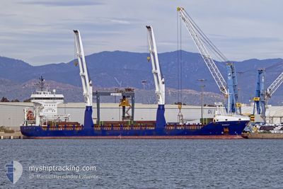
RUDOLF
General Cargo
Current Trip
| Time Travelled | 3 days |
|---|---|
| Remaining Time | --- |
| Distance Travelled | 757.12 nm |
| Remaining Distance | --- |
| AVG Speed | 11.6 Knots |
| MAX Speed | 13.6 Knots |
| AVG Wind | 4.5 knots |
| MAX Wind | 13.4 knots |
| MIN Temp | 16°C / 60.8°F |
| MAX Temp | 22.2°C / 71.96°F |
| Draught | 5.4 m |
| Position Received | 14 h, 8 m ago |
Current Position
| Longitude | 13.13092° |
|---|---|
| Latitude | 40.13527° |
| Status | Under way using engine |
| Speed | 11.5 Knots |
| Course | 310.4° |
| Area | Tyrrhenian Sea |
| Station | T-AIS |
| Position Received | 14 h, 8 m ago |
Info
Information
The current position of RUDOLF is in Tyrrhenian Sea with coordinates 40.13527° / 13.13092° as reported on 2024-05-31 12:12 by AIS to our vessel tracker app. The vessel's current speed is 11.5 Knots
The vessel RUDOLF (IMO: 9535591, MMSI: 305598000) is a General Cargo that was built in 2010 ( 14 years old ). It's sailing under the flag of [AG] Antigua Barbuda.
In this page you can find informations about the vessels current position, last detected port calls, and current voyage information. If the vessels is not in coverage by AIS you will find the latest position.
The current position of RUDOLF is detected by our AIS receivers and we are not responsible for the reliability of the data. The last position was recorded while the vessel was in Coverage by the Ais receivers of our vessel tracking app.
The current draught of RUDOLF as reported by AIS is 5.4 meters
Weather
| Temperature | 19.2°C / 66.56°F |
|---|---|
| Wind Speed | 17 knots |
| Direction | 262° W |
| Pressure | 1011.9 hPa |
| Humidity | 69.9 % |
| Cloud Coverage | 1 % |
Featured Company
Last Port Calls
| Port | Arrival | Departure | Time In Port |
|---|---|---|---|
| 2024-05-28 06:08 | 2024-05-28 16:34 | 10 h | |
| 2024-05-18 07:24 | 2024-05-24 12:11 | 6 d | |
| 2024-05-15 04:16 | 2024-05-15 18:54 | 14 h | |
| 2024-04-28 12:34 | 2024-05-03 15:26 | 5 d | |
| 2024-04-27 03:27 | 2024-04-28 09:53 | 1 d | |
| 2024-04-23 13:28 | 2024-04-25 01:32 | 1 d | |
| 2024-04-20 18:17 | 2024-04-22 13:53 | 1 d | |
| 2024-04-09 12:34 | 2024-04-11 04:01 | 1 d | |
| 2024-04-02 13:33 | 2024-04-07 20:30 | 5 d |
Most Visited Ports (Last year)
| Port | Arrivals | |
|---|---|---|
| 7 | ||
| 4 | ||
| 4 | ||
| 2 | ||
| 2 | ||
| 2 |
Last Trips
| Origin | Departure | Destination | Arrival | Distance | |
|---|---|---|---|---|---|
| 2024-05-24 15:11 | 2024-05-28 08:08 | 1014.02 nm | |||
| 2024-05-03 19:26 | 2024-05-18 10:24 | 3625.81 nm | |||
| 2024-05-03 19:26 | 2024-05-15 06:16 | 2890.66 nm | |||
| 2024-04-28 13:53 | 2024-04-28 16:34 | 27.70 nm | |||
| 2024-04-25 05:32 | 2024-04-27 07:27 | 283.15 nm | |||
| 2024-04-22 17:53 | 2024-04-23 17:28 | 220.97 nm | |||
| 2024-04-11 07:01 | 2024-04-20 22:17 | 519.51 nm | |||
| 2024-04-08 00:30 | 2024-04-09 15:34 | 493.86 nm | |||
| 2024-03-18 09:34 | 2024-04-02 17:33 | 2050.37 nm |
Events
| Time | Event | Details | Position / Dest | Info |
|---|---|---|---|---|
| 2024-05-31 12:27 | Status Changed | Default Under way using engine |
40.16664 / 13.08324
IT GOA
|
Speed: 11.5 kn Course: 310.4° |
| 2024-05-31 12:12 | Status Changed | Under way using engine Default |
40.13527 / 13.13092
IT GOA
|
Speed: 11.3 kn Course: 311° |
| 2024-05-31 12:12 | IN Coverage |
40.13527 / 13.13092
Tyrrhenian Sea
IT GOA
|
Speed: 11.5 kn Course: 310.4° |
|
| 2024-05-31 12:12 | OUT of Coverage |
40.13527 / 13.13092
Tyrrhenian Sea
IT GOA
|
Speed: 11.5 kn Course: 310.4° |
|
| 2024-05-31 09:57 | Status Changed | Default Under way using engine |
39.85793 / 13.53971
IT GOA
|
Speed: 10.9 kn Course: 308.8° |
| 2024-05-31 09:43 | OUT of Coverage |
39.82975 / 13.58424
Tyrrhenian Sea
IT GOA
|
Speed: 10.9 kn Course: 308.8° |
|
| 2024-05-31 08:10 | Status Changed | Under way using engine Default |
39.64704 / 13.86809
IT GOA
|
Speed: 11.1 kn Course: 310° |
| 2024-05-31 08:10 | IN Coverage |
39.64766 / 13.86713
Tyrrhenian Sea
IT GOA
|
Speed: 10.9 kn Course: 310° |
|
| 2024-05-31 06:26 | Status Changed | Default Under way using engine |
39.42499 / 14.17933
IT GOA
|
Speed: 11.5 kn Course: 311.9° |
| 2024-05-31 06:22 | OUT of Coverage |
39.41859 / 14.18864
Tyrrhenian Sea
IT GOA
|
Speed: 11.5 kn Course: 311.9° |