
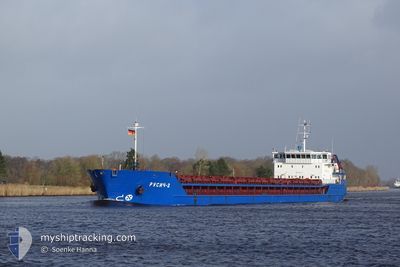
RUSICH-2
General Cargo
Current Trip
| Time Travelled | 2 days |
|---|---|
| Remaining Time | --- |
| Distance Travelled | 162.80 nm |
| Remaining Distance | --- |
| AVG Speed | 6.3 Knots |
| MAX Speed | 8.7 Knots |
| AVG Wind | 13.5 knots |
| MAX Wind | 24 knots |
| MIN Temp | 21°C / 69.8°F |
| MAX Temp | 25.7°C / 78.26°F |
| Draught | 3.4 m |
| Position Received | 1 d ago |
Current Position
| Longitude | 29.45485° |
|---|---|
| Latitude | 41.35585° |
| Status | Under way using engine |
| Speed | 7.6 Knots |
| Course | 60.9° |
| Area | Black Sea |
| Station | T-AIS |
| Position Received | 1 d ago |
Info
Information
The current position of RUSICH-2 is in Black Sea with coordinates 41.35585° / 29.45485° as reported on 2024-06-28 06:41 by AIS to our vessel tracker app. The vessel's current speed is 7.6 Knots and is heading at the port of AZOV. The estimated time of arrival as calculated by vessel tracking app is 2024-06-30 08:00 LT
The vessel RUSICH-2 (IMO: 9317016, MMSI: 273314430) is a General Cargo that was built in 2004 ( 20 years old ). It's sailing under the flag of [RU] Russia.
In this page you can find informations about the vessels current position, last detected port calls, and current voyage information. If the vessels is not in coverage by AIS you will find the latest position.
The current position of RUSICH-2 is detected by our AIS receivers and we are not responsible for the reliability of the data. The last position was recorded while the vessel was in Coverage by the Ais receivers of our vessel tracking app.
The current draught of RUSICH-2 as reported by AIS is 3.4 meters
Weather
| Temperature | 23.4°C / 74.12°F |
|---|---|
| Wind Speed | 21 knots |
| Direction | 49° NE |
| Pressure | 1010.3 hPa |
| Humidity | 78.1 % |
| Cloud Coverage | 12 % |
Featured Company
Most Visited Ports (Last year)
| Port | Arrivals | |
|---|---|---|
| 4 | ||
| 4 | ||
| 3 | ||
| 3 | ||
| 2 | ||
| 2 |
Last Trips
| Origin | Departure | Destination | Arrival | Distance | |
|---|---|---|---|---|---|
| 2024-05-25 16:28 | 2024-05-29 16:41 | 549.52 nm | |||
| 2024-05-19 15:11 | 2024-05-23 10:36 | 437.41 nm | |||
| 2024-04-27 11:04 | 2024-05-16 13:52 | 788.11 nm | |||
| 2024-04-16 17:14 | 2024-04-23 11:28 | 894.26 nm | |||
| 2024-03-18 09:17 | 2024-04-08 03:52 | 1562.48 nm |
Events
| Time | Event | Details | Position / Dest | Info |
|---|---|---|---|---|
| 2024-06-28 06:45 | Status Changed | Default Under way using engine |
41.36053 / 29.46590
RU AZO
|
Speed: 7.6 kn Course: 60.9° |
| 2024-06-28 06:41 | Status Changed | Under way using engine Default |
41.35585 / 29.45485
RU AZO
|
Speed: 7.3 kn Course: 63° |
| 2024-06-28 06:41 | OUT of Coverage |
41.35585 / 29.45485
Black Sea
RU AZO
|
Speed: 7.6 kn Course: 60.9° |
|
| 2024-06-28 05:59 | Status Changed | Default Under way using engine |
41.31875 / 29.35338
RU AZO
|
Speed: 7.2 kn Course: 58° |
| 2024-06-28 04:38 | Detected in Sea | Turkish part of the Black Sea |
41.23202 / 29.15150
Black Sea
RU AZO
|
Speed: 8.2 kn Course: 39.3° |
| 2024-06-28 01:30 | IN Coverage |
40.94400 / 28.99638
Sea of Marmara
RU AZO
|
Speed: 3.2 kn Course: 1.9° |
|
| 2024-06-27 16:21 | OUT of Coverage |
40.81018 / 28.97895
Sea of Marmara
RU AZO
|
Speed: 1 kn Course: 234.2° |
|
| 2024-06-27 10:40 | Status Changed | Under way using engine Default |
40.69277 / 28.88977
RU AZO
|
Speed: 6.5 kn Course: 56° |
| 2024-06-27 10:37 | Status Changed | Default Under way using engine |
40.69002 / 28.88450
RU AZO
|
Speed: 5.7 kn Course: 63.1° |
| 2024-06-27 10:28 | START Moving | 16.52 nm, South of YESILKOY |
40.68218 / 28.87213
RU AZO
|
Speed: 3.1 kn Course: 1° |