
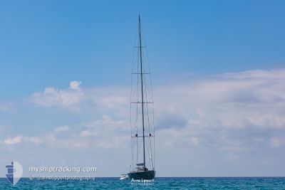
S/Y ESENSE
Sailing
Current Trip
| Trip Time | 3 days |
|---|---|
| Trip Distance | 455.78 nm |
| AVG Speed | 9.7 Knots |
| MAX Speed | 14 Knots |
| Draught | 6.3 m |
| AVG Wind | 9.9 knots |
| MAX Wind | 15.4 knots |
| MIN Temp | 18°C / 64.4°F |
| MAX Temp | 29.8°C / 85.64°F |
| Position Received | 1 m ago |
Current Position
| Longitude | 2.64255° |
|---|---|
| Latitude | 39.56632° |
| Status | Under way using engine |
| Speed | |
| Course | 321° |
| Area | Balearic Sea |
| Station | T-AIS |
| Position Received | 1 m ago |
Info
Information
The current position of S/Y ESENSE is in Balearic Sea with coordinates 39.56632° / 2.64255° as reported on 2024-06-06 16:36 by AIS to our vessel tracker app. The vessel's current speed is 0 Knots and is currently inside the port of PALMA DE MALLORCA.
The vessel S/Y ESENSE (MMSI: 235091911) is a Sailing It's sailing under the flag of [GB] United Kingdom.
In this page you can find informations about the vessels current position, last detected port calls, and current voyage information. If the vessels is not in coverage by AIS you will find the latest position.
The current position of S/Y ESENSE is detected by our AIS receivers and we are not responsible for the reliability of the data. The last position was recorded while the vessel was in Coverage by the Ais receivers of our vessel tracking app.
The current draught of S/Y ESENSE as reported by AIS is 6.3 meters
Weather
| Temperature | 28.8°C / 83.84°F |
|---|---|
| Wind Speed | 12 knots |
| Direction | 144° SE |
| Pressure | 1016.5 hPa |
| Humidity | 33.4 % |
| Cloud Coverage | 40 % |
Featured Company
Last Port Calls
| Port | Arrival | Departure | Time In Port |
|---|---|---|---|
| 2024-06-06 11:52 | |||
| 2024-06-03 04:12 | |||
| 2024-05-27 06:50 | 2024-05-28 10:19 | 1 d | |
| 2024-05-17 13:09 | 2024-05-20 09:09 | 2 d | |
| 2024-05-06 12:45 | 2024-05-17 11:48 | 10 d | |
| 2024-05-06 12:12 | 2024-05-06 12:44 | 31 m | |
| 2024-05-06 10:47 | 2024-05-06 10:53 | 5 m | |
| 2024-05-06 10:32 | 2024-05-06 10:45 | 13 m | |
| 2024-05-06 09:34 |
Most Visited Ports (Last year)
| Port | Arrivals | |
|---|---|---|
| 7 | ||
| 5 | ||
| 4 | ||
| 2 | ||
| 2 | ||
| 2 |
Last Trips
| Origin | Departure | Destination | Arrival | Distance | |
|---|---|---|---|---|---|
| 2024-06-03 06:12 | 2024-06-06 13:52 | 455.78 nm | |||
| 2024-05-20 11:09 | 2024-05-27 08:50 | 261.70 nm | |||
| 2024-05-17 13:48 | 2024-05-17 15:09 | 12.37 nm | |||
| 2024-05-06 14:44 | 2024-05-06 14:45 | 0.51 nm | |||
| 2024-05-06 12:53 | 2024-05-06 14:12 | 0.86 nm | |||
| 2024-05-06 12:45 | 2024-05-06 12:47 | 0.16 nm | |||
| 2024-05-06 11:34 | 2024-05-06 12:32 | 5.90 nm |
Events
| Time | Event | Details | Position / Dest | Info |
|---|---|---|---|---|
| 2024-06-06 12:11 | STOP Moving |
39.56634 / 2.64257
[ES] PALMA DE MALLORCA
|
Speed: 0.1 kn Course: 324° |
|
| 2024-06-06 11:52 | PORT ARRIVAL |
|
39.55546 / 2.64168
[ES] PALMA DE MALLORCA
|
Speed: 7.2 kn Course: 318.2° |
| 2024-06-06 10:42 | START Moving | 0.13 nm, North West of PORT ADRIANO |
39.49094 / 2.47586
PALMA DE MALLORCA
|
Speed: 3.8 kn Course: 337° |
| 2024-06-04 14:38 | STOP Moving | 0.1 nm, West of PORT ADRIANO |
39.48912 / 2.47587
PALMA DE MALLORCA
|
Speed: Course: 135° |
| 2024-06-04 12:16 | Change Sea Area | Spanish part of the Balearic Sea French part of the Mediterranean Sea - Western Basin |
39.24506 / 2.98371
Balearic Sea
|
Speed: 13.4 kn Course: 293.4° |
| 2024-06-04 12:14 | IN Coverage |
39.24506 / 2.98371
Balearic Sea
|
Speed: 13.4 kn Course: 293.4° |
|
| 2024-06-03 15:39 | OUT of Coverage |
42.00660 / 7.63482
Mediterranean Sea - Western Basin
|
Speed: 13.1 kn Course: 229° |
|
| 2024-06-03 08:26 | Change Sea Area | French part of the Mediterranean Sea - Western Basin French part of the Tyrrhenian Sea |
42.95548 / 9.23058
Mediterranean Sea - Western Basin
|
Speed: 12.6 kn Course: 228.7° |
| 2024-06-03 06:50 | Change Sea Area | French part of the Tyrrhenian Sea Italian part of the Tyrrhenian Sea |
42.98448 / 9.65184
Tyrrhenian Sea
|
Speed: 12.6 kn Course: 287.8° |
| 2024-06-03 06:02 | Destination Changed | PALMA DE MALLORCA ELBA |
42.93658 / 9.86809
PALMA DE MALLORCA
|
Speed: 12.2 kn Course: 286.6° |