
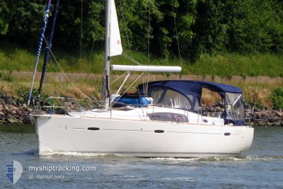
S/Y SELINA
Sailing
Current Trip
| Trip Time | 2 days |
|---|---|
| Trip Distance | 231.32 nm |
| AVG Speed | 5.7 Knots |
| MAX Speed | 8.1 Knots |
| Draught | --- |
| AVG Wind | 13.7 knots |
| MAX Wind | 16.3 knots |
| MIN Temp | 17.2°C / 62.96°F |
| MAX Temp | 20.4°C / 68.72°F |
| Position Received | 1 m ago |
Current Position
| Longitude | -6.28354° |
|---|---|
| Latitude | 36.54115° |
| Status | Default |
| Speed | |
| Course | --- |
| Area | North Atlantic Ocean |
| Station | T-AIS |
| Position Received | 1 m ago |
Info
Information
The current position of S/Y SELINA is in North Atlantic Ocean with coordinates 36.54115° / -6.28354° as reported on 2024-06-13 08:43 by AIS to our vessel tracker app. The vessel's current speed is 0 Knots and is currently inside the port of CADIZ.
The vessel S/Y SELINA (MMSI: 265061560) is a Sailing It's sailing under the flag of [SE] Sweden.
In this page you can find informations about the vessels current position, last detected port calls, and current voyage information. If the vessels is not in coverage by AIS you will find the latest position.
The current position of S/Y SELINA is detected by our AIS receivers and we are not responsible for the reliability of the data. The last position was recorded while the vessel was in Coverage by the Ais receivers of our vessel tracking app.
Weather
| Temperature | 21.4°C / 70.52°F |
|---|---|
| Wind Speed | 4 knots |
| Direction | 149° SSE |
| Pressure | 1019.2 hPa |
| Humidity | 68.8 % |
| Cloud Coverage | --- |
Featured Company
Last Port Calls
| Port | Arrival | Departure | Time In Port |
|---|---|---|---|
| 2024-06-12 22:15 | |||
| 2024-06-09 16:20 | 2024-06-10 15:51 | 23 h | |
| 2024-05-30 22:24 | 2024-06-01 14:00 | 1 d | |
| 2024-05-26 12:53 | 2024-05-30 07:56 | 3 d | |
| 2024-05-21 10:17 | 2024-05-24 08:57 | 2 d | |
| 2024-05-16 04:59 | 2024-05-18 06:21 | 2 d | |
| 2024-05-11 08:16 | 2024-05-11 08:59 | 42 m | |
| 2024-05-10 13:14 |
Most Visited Ports (Last year)
| Port | Arrivals | |
|---|---|---|
| 1 | ||
| 1 | ||
| 1 | ||
| 1 | ||
| 1 | ||
| 1 |
Last Trips
| Origin | Departure | Destination | Arrival | Distance | |
|---|---|---|---|---|---|
| 2024-06-10 16:51 | 2024-06-13 00:15 | 231.32 nm | |||
| 2024-06-01 16:00 | 2024-06-09 17:20 | 929.89 nm | |||
| 2024-05-30 09:56 | 2024-05-31 00:24 | 72.72 nm | |||
| 2024-05-24 10:57 | 2024-05-26 14:53 | 253.09 nm | |||
| 2024-05-18 08:21 | 2024-05-21 12:17 | 323.41 nm | |||
| 2024-05-11 10:59 | 2024-05-16 06:59 | 284.54 nm | |||
| 2024-05-10 15:14 | 2024-05-11 10:16 | 26.26 nm |
Events
| Time | Event | Details | Position / Dest | Info |
|---|---|---|---|---|
| 2024-06-12 22:15 | STOP Moving |
36.54119 / -6.28353
[ES] CADIZ
|
Speed: 0.1 kn Course: 511° |
|
| 2024-06-12 22:15 | PORT ARRIVAL |
|
36.54119 / -6.28353
[ES] CADIZ
|
Speed: 0.7 kn Course: 511° |
| 2024-06-12 21:04 | Change Sea Area | Spanish part of the North Atlantic Ocean Portuguese part of the North Atlantic Ocean |
36.59032 / -6.38107
North Atlantic Ocean
|
Speed: 5.7 kn Course: 120.2° |
| 2024-06-12 21:04 | IN Coverage |
36.59032 / -6.38107
North Atlantic Ocean
|
Speed: 5.7 kn Course: 120.2° |
|
| 2024-06-12 11:59 | OUT of Coverage |
36.90115 / -7.53814
North Atlantic Ocean
|
Speed: 6.7 kn Course: 103.6° |
|
| 2024-06-12 11:59 | IN Coverage |
36.90115 / -7.53814
North Atlantic Ocean
|
Speed: 6.7 kn Course: 103.6° |
|
| 2024-06-12 10:16 | OUT of Coverage |
36.93921 / -7.76934
North Atlantic Ocean
|
Speed: 6.8 kn Course: 71.5° |
|
| 2024-06-12 10:15 | IN Coverage |
36.93921 / -7.76934
North Atlantic Ocean
|
Speed: 6.8 kn Course: 71.5° |
|
| 2024-06-12 06:37 | OUT of Coverage |
36.91252 / -7.78427
North Atlantic Ocean
|
Speed: 0.7 kn Course: 302.4° |
|
| 2024-06-12 04:59 | IN Coverage |
36.91231 / -7.77380
North Atlantic Ocean
|
Speed: 0.2 kn Course: 511° |