
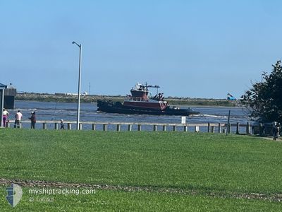
SABINE
Tug
Current Trip
US NSS
| Time Travelled | 6 h, 20 mins |
|---|---|
| Remaining Time | --- |
| Distance Travelled | 16.50 nm |
| Remaining Distance | --- |
| AVG Speed | 8.1 Knots |
| MAX Speed | 10.9 Knots |
| AVG Wind | 12.8 knots |
| MAX Wind | 19.2 knots |
| MIN Temp | 20.3°C / 68.54°F |
| MAX Temp | 29.1°C / 84.38°F |
| Draught | 4 m |
| Position Received | 1 m ago |
Current Position
| Longitude | -94.05037° |
|---|---|
| Latitude | 30.06892° |
| Status | Moored |
| Speed | 7.8 Knots |
| Course | 312.6° |
| Area | Gulf of Mexico |
| Station | T-AIS |
| Position Received | 1 m ago |
Info
Information
The current position of SABINE is in Gulf of Mexico with coordinates 30.06892° / -94.05037° as reported on 2024-05-29 02:50 by AIS to our vessel tracker app. The vessel's current speed is 7.8 Knots
The vessel SABINE (IMO: 9397391, MMSI: 367510870) is a Tug that was built in 2007 ( 17 years old ). It's sailing under the flag of [US] USA.
In this page you can find informations about the vessels current position, last detected port calls, and current voyage information. If the vessels is not in coverage by AIS you will find the latest position.
The current position of SABINE is detected by our AIS receivers and we are not responsible for the reliability of the data. The last position was recorded while the vessel was in Coverage by the Ais receivers of our vessel tracking app.
The current draught of SABINE as reported by AIS is 4 meters
Weather
| Temperature | 22.2°C / 71.96°F |
|---|---|
| Wind Speed | 8 knots |
| Direction | 65° ENE |
| Pressure | 1015.7 hPa |
| Humidity | 77.2 % |
| Cloud Coverage | 52 % |
Featured Company
Last Port Calls
| Port | Arrival | Departure | Time In Port |
|---|---|---|---|
| 2024-05-28 19:22 | 2024-05-28 20:31 | 1 h | |
| 2024-05-28 09:40 | 2024-05-28 15:59 | 6 h | |
| 2024-05-27 08:58 | 2024-05-28 06:47 | 21 h | |
| 2024-05-27 01:48 | 2024-05-27 08:26 | 6 h | |
| 2024-05-26 23:00 | 2024-05-26 23:51 | 51 m | |
| 2024-05-26 07:33 | 2024-05-26 19:36 | 12 h | |
| 2024-05-25 18:48 | 2024-05-26 06:45 | 11 h | |
| 2024-05-25 03:52 | 2024-05-25 15:09 | 11 h | |
| 2024-05-24 23:02 | 2024-05-25 00:09 | 1 h | |
| 2024-05-24 10:47 | 2024-05-24 21:34 | 10 h |
Most Visited Ports (Last year)
| Port | Arrivals | |
|---|---|---|
| 326 | ||
| 254 | ||
| 185 | ||
| 159 | ||
| 39 | ||
| 14 |
Last Trips
| Origin | Departure | Destination | Arrival | Distance | |
|---|---|---|---|---|---|
| 2024-05-28 10:59 | 2024-05-28 14:22 | 21.08 nm | |||
| 2024-05-28 01:47 | 2024-05-28 04:40 | 18.54 nm | |||
| 2024-05-27 03:26 | 2024-05-27 03:58 | 2.94 nm | |||
| 2024-05-26 18:51 | 2024-05-26 20:48 | 18.37 nm | |||
| 2024-05-26 14:36 | 2024-05-26 18:00 | 20.65 nm | |||
| 2024-05-26 01:45 | 2024-05-26 02:33 | 3.26 nm | |||
| 2024-05-25 10:09 | 2024-05-25 13:48 | 23.37 nm | |||
| 2024-05-24 19:09 | 2024-05-24 22:52 | 11.18 nm | |||
| 2024-05-24 16:34 | 2024-05-24 18:02 | 6.97 nm | |||
| 2024-05-24 01:07 | 2024-05-24 05:47 | 32.39 nm |
Events
| Time | Event | Details | Position / Dest | Info |
|---|---|---|---|---|
| 2024-05-29 02:34 | START Moving | 3.24 nm, North West of SUNOCO LOGISTICS |
30.04254 / -94.02960
US NSS
|
Speed: 6.9 kn Course: 15.6° |
| 2024-05-29 00:13 | STOP Moving | 3.16 nm, North West of SUNOCO LOGISTICS |
30.04071 / -94.02933
US NSS
|
Speed: Course: 195° |
| 2024-05-29 00:03 | START Moving | 3.07 nm, North West of SUNOCO LOGISTICS |
30.03358 / -94.03276
US NSS
|
Speed: 8.6 kn Course: 17.2° |
| 2024-05-28 23:49 | Status Changed | Moored Under way using engine |
30.03133 / -94.03355
US NSS
|
Speed: Course: 352° |
| 2024-05-28 23:48 | STOP Moving | 3.05 nm, North West of SUNOCO LOGISTICS |
30.03133 / -94.03354
US NSS
|
Speed: 0.3 kn Course: 350° |
| 2024-05-28 22:54 | START Moving | 1.42 nm, West of ATRECO |
29.98875 / -93.90727
US NSS
|
Speed: 6.2 kn Course: 144.5° |
| 2024-05-28 21:23 | STOP Moving | 1.53 nm, West of ATRECO |
29.98957 / -93.90926
US NSS
|
Speed: 0.3 kn Course: 28° |
| 2024-05-28 21:21 | START Moving | 1.49 nm, West of ATRECO |
29.98863 / -93.90875
US NSS
|
Speed: 5.1 kn Course: 336.4° |
| 2024-05-28 21:11 | STOP Moving | 1.39 nm, West of ATRECO |
29.98739 / -93.90719
US NSS
|
Speed: 0.3 kn Course: 301° |
| 2024-05-28 20:31 | PORT DEPARTURE |
|
29.93421 / -93.87050
US NSS
|
Speed: 9.1 kn Course: 38° |