
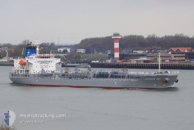
SAEHAN KOSTAR
Oil/Chemical Tanker
Current Trip
| Time Travelled | 3 h, 42 mins |
|---|---|
| Remaining Time | 1 day |
| Distance Travelled | 36.31 nm |
| Remaining Distance | 452.12 nm |
| AVG Speed | 11.7 Knots |
| MAX Speed | 12.1 Knots |
| AVG Wind | 13.3 knots |
| MAX Wind | 18.2 knots |
| MIN Temp | 20.7°C / 69.26°F |
| MAX Temp | 22°C / 71.6°F |
| Draught | 10.2 m |
| Position Received | 4 d ago |
Current Position
| Longitude | 118.76815° |
|---|---|
| Latitude | 38.78693° |
| Status | Under way using engine |
| Speed | 11.1 Knots |
| Course | 98° |
| Area | Yellow Sea |
| Station | T-AIS |
| Position Received | 4 d ago |
Info
Information
The current position of SAEHAN KOSTAR is in Yellow Sea with coordinates 38.78693° / 118.76815° as reported on 2024-06-07 16:19 by AIS to our vessel tracker app. The vessel's current speed is 11.1 Knots and is heading at the port of TIANJIN. The estimated time of arrival as calculated by vessel tracking app is 2024-06-14 02:53 LT
The vessel SAEHAN KOSTAR (IMO: 9423695, MMSI: 353608000) is a Oil/Chemical Tanker that was built in 2009 ( 15 years old ). It's sailing under the flag of [PA] Panama.
In this page you can find informations about the vessels current position, last detected port calls, and current voyage information. If the vessels is not in coverage by AIS you will find the latest position.
The current position of SAEHAN KOSTAR is detected by our AIS receivers and we are not responsible for the reliability of the data. The last position was recorded while the vessel was in Coverage by the Ais receivers of our vessel tracking app.
The current draught of SAEHAN KOSTAR as reported by AIS is 10.2 meters
Weather
| Temperature | 20.6°C / 69.08°F |
|---|---|
| Wind Speed | 8 knots |
| Direction | 136° SE |
| Pressure | 1004.2 hPa |
| Humidity | 93.6 % |
| Cloud Coverage | 38 % |
Featured Company
Last Port Calls
| Port | Arrival | Departure | Time In Port |
|---|---|---|---|
| 2024-06-10 14:03 | 2024-06-12 08:49 | 1 d | |
| 2024-06-05 01:47 | 2024-06-07 12:29 | 2 d | |
| 2024-05-14 08:31 | 2024-05-16 10:01 | 2 d | |
| 2024-04-29 17:41 | 2024-04-30 14:48 | 21 h | |
| 2024-04-21 02:17 | 2024-04-21 18:54 | 16 h | |
| 2024-04-12 23:04 | 2024-04-14 22:56 | 1 d |
Most Visited Ports (Last year)
| Port | Arrivals | |
|---|---|---|
| 5 | ||
| 3 | ||
| 3 | ||
| 2 | ||
| 2 | ||
| 2 |
Last Trips
| Origin | Departure | Destination | Arrival | Distance | |
|---|---|---|---|---|---|
| 2024-06-07 20:29 | 2024-06-10 22:03 | 551.55 nm | |||
| 2024-05-16 17:01 | 2024-06-05 09:47 | 4031.82 nm | |||
| 2024-04-30 20:18 | 2024-05-14 15:31 | 3080.95 nm | |||
| 2024-04-22 00:24 | 2024-04-29 23:11 | 2187.03 nm | |||
| 2024-04-15 01:56 | 2024-04-21 07:47 | 1237.19 nm | |||
| 2024-03-25 15:59 | 2024-04-13 02:04 | 1516.35 nm |
Events
| Time | Event | Details | Position / Dest | Info |
|---|---|---|---|---|
| 2024-06-12 08:49 | PORT DEPARTURE |
|
34.74730 / 119.53173
CN TXG
|
Speed: 11.8 kn Course: 66° |
| 2024-06-12 08:05 | START Moving |
34.75207 / 119.38565
[CN] LIANYUNGANG
|
Speed: 3.8 kn Course: 90° |
|
| 2024-06-10 14:03 | STOP Moving |
34.75070 / 119.38146
[CN] LIANYUNGANG
|
Speed: 0.1 kn Course: 282° |
|
| 2024-06-10 14:03 | PORT ARRIVAL |
|
34.75070 / 119.38146
[CN] LIANYUNGANG
|
Speed: 3.3 kn Course: 265° |
| 2024-06-10 10:41 | START Moving | 15.68 nm, East of LIANYUNGANG |
34.83177 / 119.78606
CN TXG
|
Speed: 7.5 kn Course: 304° |
| 2024-06-09 09:53 | STOP Moving | 15.91 nm, East of LIANYUNGANG |
34.82762 / 119.79277
CN TXG
|
Speed: 0.2 kn Course: 241° |
| 2024-06-07 16:21 | Status Changed | Default Under way using engine |
38.78617 / 118.77470
CN TXG
|
Speed: 11.1 kn Course: 98° |
| 2024-06-07 16:19 | OUT of Coverage |
38.78693 / 118.76815
Yellow Sea
|
Speed: 11.1 kn Course: 98° |
|
| 2024-06-07 15:46 | Status Changed | Under way using engine Default |
38.79997 / 118.63788
CN TXG
|
Speed: 11 kn Course: 96° |
| 2024-06-07 15:46 | IN Coverage |
38.79997 / 118.63788
Yellow Sea
|
Speed: 11.1 kn Course: 96° |