
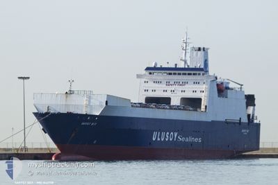
SAFFET BEY
Ro-Ro Cargo
Current Trip
| Time Travelled | 4 days |
|---|---|
| Remaining Time | 20 h, 43 mins |
| Distance Travelled | 1216.52 nm |
| Remaining Distance | 457.27 nm |
| AVG Speed | 11.4 Knots |
| MAX Speed | 15 Knots |
| AVG Wind | 6.9 knots |
| MAX Wind | 19 knots |
| MIN Temp | 11.9°C / 53.42°F |
| MAX Temp | 22.7°C / 72.86°F |
| Draught | 6 m |
| Position Received | 17 h, 35 m ago |
Current Position
| Longitude | 11.08037° |
|---|---|
| Latitude | 38.12528° |
| Status | Under way using engine |
| Speed | 11.8 Knots |
| Course | 297.7° |
| Area | Mediterranean Sea - Western Basin |
| Station | T-AIS |
| Position Received | 17 h, 35 m ago |
Info
Information
The current position of SAFFET BEY is in Mediterranean Sea - Western Basin with coordinates 38.12528° / 11.08037° as reported on 2024-05-31 11:45 by AIS to our vessel tracker app. The vessel's current speed is 11.8 Knots and is heading at the port of BARCELONA. The estimated time of arrival as calculated by vessel tracking app is 2024-06-02 02:04 LT
The vessel SAFFET BEY (IMO: 8417118, MMSI: 271000419) is a Ro-Ro Cargo that was built in 1987 ( 37 years old ). It's sailing under the flag of [TR] Turkey.
In this page you can find informations about the vessels current position, last detected port calls, and current voyage information. If the vessels is not in coverage by AIS you will find the latest position.
The current position of SAFFET BEY is detected by our AIS receivers and we are not responsible for the reliability of the data. The last position was recorded while the vessel was in Coverage by the Ais receivers of our vessel tracking app.
The current draught of SAFFET BEY as reported by AIS is 6 meters
Weather
| Temperature | 19.7°C / 67.46°F |
|---|---|
| Wind Speed | 13 knots |
| Direction | 351° N |
| Pressure | 1013.6 hPa |
| Humidity | 65.4 % |
| Cloud Coverage | 90 % |
Featured Company
Last Port Calls
| Port | Arrival | Departure | Time In Port |
|---|---|---|---|
| 2024-05-27 16:30 | 2024-05-27 20:05 | 3 h | |
| 2024-05-13 15:02 | 2024-05-14 08:09 | 17 h | |
| 2024-05-09 05:20 | 2024-05-09 14:57 | 9 h | |
| 2024-04-19 19:51 | 2024-04-21 07:05 | 1 d | |
| 2024-04-16 14:44 | 2024-04-17 08:32 | 17 h | |
| 2024-04-12 00:50 | 2024-04-12 16:43 | 15 h | |
| 2024-04-08 08:17 | 2024-04-08 19:33 | 11 h | |
| 2024-04-04 11:09 | 2024-04-04 20:21 | 9 h | |
| 2024-04-01 10:09 |
Most Visited Ports (Last year)
| Port | Arrivals | |
|---|---|---|
| 7 | ||
| 7 | ||
| 6 | ||
| 6 | ||
| 6 | ||
| 5 |
Last Trips
| Origin | Departure | Destination | Arrival | Distance | |
|---|---|---|---|---|---|
| 2024-05-14 11:09 | 2024-05-27 19:30 | 64.92 nm | |||
| 2024-05-09 16:57 | 2024-05-13 18:02 | 1184.29 nm | |||
| 2024-04-21 10:05 | 2024-05-09 07:20 | 1220.87 nm | |||
| 2024-04-17 11:32 | 2024-04-19 22:51 | 236.27 nm | |||
| 2024-04-12 19:43 | 2024-04-16 17:44 | 288.80 nm | |||
| 2024-04-08 22:33 | 2024-04-12 03:50 | 267.22 nm | |||
| 2024-04-04 23:21 | 2024-04-08 11:17 | 312.31 nm | |||
| 2024-04-01 13:09 | 2024-04-04 14:09 | 305.46 nm |
Events
| Time | Event | Details | Position / Dest | Info |
|---|---|---|---|---|
| 2024-05-31 11:50 | Status Changed | Default Under way using engine |
38.13160 / 11.06510
ESBCN
|
Speed: 11.8 kn Course: 297.7° |
| 2024-05-31 11:45 | OUT of Coverage |
38.12528 / 11.08037
Mediterranean Sea - Western Basin
ESBCN
|
Speed: 11.8 kn Course: 297.7° |
|
| 2024-05-31 11:44 | Status Changed | Under way using engine Default |
38.12351 / 11.08466
ESBCN
|
Speed: 12 kn Course: 300° |
| 2024-05-31 11:35 | IN Coverage |
38.12528 / 11.08037
Mediterranean Sea - Western Basin
ESBCN
|
Speed: 11.8 kn Course: 297.7° |
|
| 2024-05-31 08:52 | Status Changed | Default Under way using engine |
37.80833 / 11.68833
ESBCN
|
Speed: 11.4 kn Course: 300.7° |
| 2024-05-31 08:47 | OUT of Coverage |
37.80116 / 11.70535
Mediterranean Sea - Western Basin
ESBCN
|
Speed: 11.4 kn Course: 300.7° |
|
| 2024-05-31 08:29 | Status Changed | Under way using engine Default |
37.77101 / 11.76803
ESBCN
|
Speed: 11.3 kn Course: 302° |
| 2024-05-31 08:02 | Status Changed | Default Under way using engine |
37.72475 / 11.85935
ESBCN
|
Speed: 11.4 kn Course: 302° |
| 2024-05-31 07:02 | Change Sea Area | Italian part of the Mediterranean Sea - Western Basin Italian part of the Mediterranean Sea - Eastern Basin |
37.63670 / 12.07442
Mediterranean Sea - Western Basin
ESBCN
|
Speed: 12 kn Course: 294.2° |
| 2024-05-31 05:31 | Status Changed | Under way using engine Default |
37.49359 / 12.39477
ESBCN
|
Speed: 11.3 kn Course: 292° |