
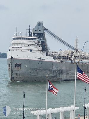
SAGINAW
Self Discharging Bulk Carrier
Current Trip
SAULT STE MARIE
| Time Travelled | 13 h, 9 mins |
|---|---|
| Remaining Time | --- |
| Distance Travelled | 172.81 nm |
| Remaining Distance | --- |
| AVG Speed | 13.4 Knots |
| MAX Speed | 13.8 Knots |
| AVG Wind | 14.5 knots |
| MAX Wind | 18 knots |
| MIN Temp | 7.1°C / 44.78°F |
| MAX Temp | 11.9°C / 53.42°F |
| Draught | 6.8 m |
| Position Received | 2 d ago |
Current Position
| Longitude | -91.66987° |
|---|---|
| Latitude | 46.84546° |
| Status | Under way using engine |
| Speed | 13.3 Knots |
| Course | 60.5° |
| Area | Gulf of St-Lawrence |
| Station | T-AIS |
| Position Received | 2 d ago |
Info
Information
The current position of SAGINAW is in Gulf of St-Lawrence with coordinates 46.84546° / -91.66987° as reported on 2024-06-25 03:49 by AIS to our vessel tracker app. The vessel's current speed is 13.3 Knots
The vessel SAGINAW (IMO: 5173876, MMSI: 316004950) is a Self Discharging Bulk Carrier that was built in 1953 ( 71 years old ). It's sailing under the flag of [CA] Canada.
In this page you can find informations about the vessels current position, last detected port calls, and current voyage information. If the vessels is not in coverage by AIS you will find the latest position.
The current position of SAGINAW is detected by our AIS receivers and we are not responsible for the reliability of the data. The last position was recorded while the vessel was in Coverage by the Ais receivers of our vessel tracking app.
The current draught of SAGINAW as reported by AIS is 6.8 meters
Weather
| Temperature | 7.8°C / 46.04°F |
|---|---|
| Wind Speed | 9 knots |
| Direction | 248° WSW |
| Pressure | 1015.5 hPa |
| Humidity | 95.2 % |
| Cloud Coverage | 100 % |
Featured Company
Last Port Calls
| Port | Arrival | Departure | Time In Port |
|---|---|---|---|
| 2024-06-26 04:11 | 2024-06-26 18:36 | 14 h | |
| 2024-06-24 20:04 | 2024-06-25 02:33 | 6 h | |
| 2024-06-23 12:43 | 2024-06-23 19:16 | 6 h | |
| 2024-06-22 17:03 | 2024-06-23 01:15 | 8 h | |
| 2024-06-21 23:17 | 2024-06-22 06:05 | 6 h | |
| 2024-06-19 22:29 | 2024-06-20 20:32 | 22 h | |
| 2024-06-18 04:59 | 2024-06-18 14:06 | 9 h | |
| 2024-06-16 16:54 | 2024-06-17 03:15 | 10 h | |
| 2024-06-15 01:57 | 2024-06-15 15:55 | 13 h | |
| 2024-06-14 18:47 | 2024-06-14 21:09 | 2 h |
Most Visited Ports (Last year)
| Port | Arrivals | |
|---|---|---|
| 68 | ||
| 29 | ||
| 17 | ||
| 15 | ||
| 11 | ||
| 10 |
Last Trips
| Origin | Departure | Destination | Arrival | Distance | |
|---|---|---|---|---|---|
| 2024-06-24 21:33 | 2024-06-26 00:11 | 340.04 nm | |||
| 2024-06-23 15:16 | 2024-06-24 15:04 | 332.54 nm | |||
| 2024-06-22 21:15 | 2024-06-23 08:43 | 136.48 nm | |||
| 2024-06-22 02:05 | 2024-06-22 13:03 | 130.86 nm | |||
| 2024-06-20 15:32 | 2024-06-21 19:17 | 343.00 nm | |||
| 2024-06-18 10:06 | 2024-06-19 17:29 | 344.07 nm | |||
| 2024-06-16 22:15 | 2024-06-18 00:59 | 338.91 nm | |||
| 2024-06-15 11:55 | 2024-06-16 11:54 | 337.75 nm | |||
| 2024-06-14 17:09 | 2024-06-14 21:57 | 0.28 nm | |||
| 2024-06-13 06:03 | 2024-06-14 14:47 | 300.91 nm |
Events
| Time | Event | Details | Position / Dest | Info |
|---|---|---|---|---|
| 2024-06-26 18:36 | PORT DEPARTURE |
|
46.49584 / -84.41736
SAULT STE MARIE
|
Speed: 7.1 kn Course: 254° |
| 2024-06-26 18:15 | START Moving |
46.51448 / -84.37690
[CA] SAULT STE MARIE
|
Speed: 3.2 kn Course: 192° |
|
| 2024-06-26 04:40 | STOP Moving |
46.51676 / -84.37550
[CA] SAULT STE MARIE
|
Speed: Course: 146° |
|
| 2024-06-26 04:11 | PORT ARRIVAL |
|
46.50743 / -84.38500
[CA] SAULT STE MARIE
|
Speed: 5.8 kn Course: 67° |
| 2024-06-25 03:58 | Status Changed | Default Under way using engine |
46.86229 / -91.62624
SAULT STE MARIE
|
Speed: 13.3 kn Course: 60.5° |
| 2024-06-25 03:49 | OUT of Coverage |
46.84546 / -91.66987
Gulf of St-Lawrence
SAULT STE MARIE
|
Speed: 13.3 kn Course: 60.5° |
|
| 2024-06-25 02:33 | PORT DEPARTURE |
|
46.70685 / -92.01572
SAULT STE MARIE
|
Speed: 7.2 kn Course: 54° |
| 2024-06-25 02:31 | START Moving |
46.70525 / -92.01965
[US] DULUTH SUPERIOR
|
Speed: 3.2 kn Course: 65° |
|
| 2024-06-24 20:23 | STOP Moving |
46.70000 / -92.01857
[US] DULUTH SUPERIOR
|
Speed: 0.3 kn Course: 173° |
|
| 2024-06-24 20:15 | Destination Changed | SAULT STE MARIE SUPERIOR |
46.70179 / -92.01896
[US] DULUTH SUPERIOR
|
Speed: 0.7 kn Course: 176° |