
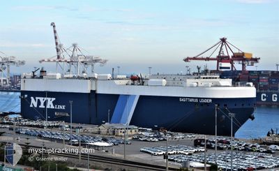
SAGITTARIUS LEADER
Vehicles Carrier
Current Trip
| Time Travelled | 5 days |
|---|---|
| Remaining Time | 1 day |
| Distance Travelled | 1836.55 nm |
| Remaining Distance | 540.63 nm |
| AVG Speed | 14.4 Knots |
| MAX Speed | 18.1 Knots |
| AVG Wind | 14.4 knots |
| MAX Wind | 33 knots |
| MIN Temp | 14.1°C / 57.38°F |
| MAX Temp | 21.5°C / 70.7°F |
| Draught | 8.3 m |
| Position Received | 20 h, 35 m ago |
Current Position
| Longitude | -9.22913° |
|---|---|
| Latitude | 43.99616° |
| Status | Under way using engine |
| Speed | 13.5 Knots |
| Course | 27° |
| Area | North Atlantic Ocean |
| Station | T-AIS |
| Position Received | 20 h, 35 m ago |
Info
Information
The current position of SAGITTARIUS LEADER is in North Atlantic Ocean with coordinates 43.99616° / -9.22913° as reported on 2024-05-31 06:26 by AIS to our vessel tracker app. The vessel's current speed is 13.5 Knots and is heading at the port of ZEEBRUGGE. The estimated time of arrival as calculated by vessel tracking app is 2024-06-02 16:28 LT
The vessel SAGITTARIUS LEADER (IMO: 9283887, MMSI: 431912000) is a Vehicles Carrier that was built in 2005 ( 19 years old ). It's sailing under the flag of [JP] Japan.
In this page you can find informations about the vessels current position, last detected port calls, and current voyage information. If the vessels is not in coverage by AIS you will find the latest position.
The current position of SAGITTARIUS LEADER is detected by our AIS receivers and we are not responsible for the reliability of the data. The last position was recorded while the vessel was in Coverage by the Ais receivers of our vessel tracking app.
The current draught of SAGITTARIUS LEADER as reported by AIS is 8.3 meters
Weather
| Temperature | 13.7°C / 56.66°F |
|---|---|
| Wind Speed | 20 knots |
| Direction | 31° NNE |
| Pressure | 1024.4 hPa |
| Humidity | 79.5 % |
| Cloud Coverage | 5 % |
Featured Company
Last Port Calls
| Port | Arrival | Departure | Time In Port |
|---|---|---|---|
| 2024-05-26 01:04 | 2024-05-26 11:32 | 10 h | |
| 2024-05-22 21:38 | 2024-05-23 16:45 | 19 h | |
| 2024-05-21 09:31 | 2024-05-22 20:52 | 1 d | |
| 2024-05-18 07:36 | 2024-05-18 15:34 | 7 h | |
| 2024-04-13 22:34 | 2024-04-14 09:43 | 11 h | |
| 2024-04-05 21:06 | 2024-04-06 07:11 | 10 h | |
| 2024-04-04 21:12 | 2024-04-05 08:43 | 11 h | |
| 2024-04-01 21:04 |
Last Trips
| Origin | Departure | Destination | Arrival | Distance | |
|---|---|---|---|---|---|
| 2024-05-23 19:45 | 2024-05-26 03:04 | 889.29 nm | |||
| 2024-05-22 23:52 | 2024-05-23 00:38 | 5.19 nm | |||
| 2024-05-18 18:34 | 2024-05-21 12:31 | 904.22 nm | |||
| 2024-04-14 16:43 | 2024-05-18 10:36 | 13662.06 nm | |||
| 2024-04-06 16:11 | 2024-04-14 05:34 | 2945.94 nm | |||
| 2024-04-05 17:43 | 2024-04-06 06:06 | 11.49 nm | |||
| 2024-04-02 06:04 | 2024-04-05 06:12 | 18.67 nm |
Events
| Time | Event | Details | Position / Dest | Info |
|---|---|---|---|---|
| 2024-05-31 06:33 | Status Changed | Default Under way using engine |
44.02188 / -9.21049
BE ZEE
|
Speed: 13.5 kn Course: 27° |
| 2024-05-31 06:26 | Status Changed | Under way using engine Default |
43.99616 / -9.22913
BE ZEE
|
Speed: 13.1 kn Course: 29° |
| 2024-05-31 06:26 | OUT of Coverage |
43.99616 / -9.22913
North Atlantic Ocean
BE ZEE
|
Speed: 13.5 kn Course: 27° |
|
| 2024-05-31 05:57 | Status Changed | Default Under way using engine |
43.90210 / -9.29906
BE ZEE
|
Speed: 13.4 kn Course: 27.4° |
| 2024-05-31 05:47 | Status Changed | Under way using engine Default |
43.86803 / -9.32375
BE ZEE
|
Speed: 13.3 kn Course: 25° |
| 2024-05-31 05:23 | Status Changed | Default Under way using engine |
43.78682 / -9.37889
BE ZEE
|
Speed: 13.1 kn Course: 27.5° |
| 2024-05-31 02:04 | Status Changed | Under way using engine Default |
43.14034 / -9.82104
BE ZEE
|
Speed: 13.2 kn Course: 359° |
| 2024-05-31 01:49 | Status Changed | Default Under way using engine |
43.08248 / -9.82185
BE ZEE
|
Speed: 13 kn Course: 359.6° |
| 2024-05-31 01:47 | Status Changed | Under way using engine Default |
43.07697 / -9.82183
BE ZEE
|
Speed: 12.9 kn Course: 359° |
| 2024-05-31 01:28 | IN Coverage |
43.07697 / -9.82183
North Atlantic Ocean
BE ZEE
|
Speed: 13 kn Course: 359.6° |