
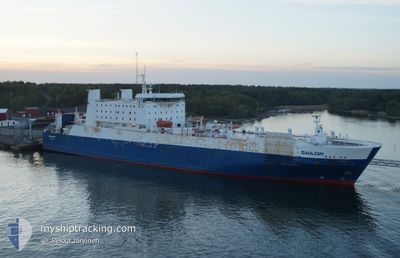
SAILOR
Ro-Ro/Passenger Ship
Current Trip
| Trip Time | 10 h, 51 mins |
|---|---|
| Trip Distance | 158.52 nm |
| AVG Speed | 14.1 Knots |
| MAX Speed | 15.8 Knots |
| Draught | 6.7 m |
| AVG Wind | 7 knots |
| MAX Wind | 9.1 knots |
| MIN Temp | 10.9°C / 51.62°F |
| MAX Temp | 19.1°C / 66.38°F |
| Position Received | 2 m ago |
Current Position
| Longitude | 24.07760° |
|---|---|
| Latitude | 59.33423° |
| Status | Moored |
| Speed | |
| Course | 182° |
| Area | Gulf of Finland |
| Station | T-AIS |
| Position Received | 2 m ago |
Info
Information
The current position of SAILOR is in Gulf of Finland with coordinates 59.33423° / 24.07760° as reported on 2024-06-01 17:17 by AIS to our vessel tracker app. The vessel's current speed is 0 Knots and is currently inside the port of PALDISKI.
The vessel SAILOR (IMO: 8401444, MMSI: 276817000) is a Ro-Ro/Passenger Ship that was built in 1987 ( 37 years old ). It's sailing under the flag of [EE] Estonia.
In this page you can find informations about the vessels current position, last detected port calls, and current voyage information. If the vessels is not in coverage by AIS you will find the latest position.
The current position of SAILOR is detected by our AIS receivers and we are not responsible for the reliability of the data. The last position was recorded while the vessel was in Coverage by the Ais receivers of our vessel tracking app.
The current draught of SAILOR as reported by AIS is 6.7 meters
Weather
| Temperature | 14.7°C / 58.46°F |
|---|---|
| Wind Speed | 6 knots |
| Direction | 351° N |
| Pressure | 1012.5 hPa |
| Humidity | 96.4 % |
| Cloud Coverage | 90 % |
Featured Company
Last Port Calls
| Port | Arrival | Departure | Time In Port |
|---|---|---|---|
| 2024-05-31 05:44 | |||
| 2024-05-30 05:51 | 2024-05-30 18:53 | 13 h | |
| 2024-05-29 05:43 | 2024-05-29 18:16 | 12 h | |
| 2024-05-28 05:50 | 2024-05-28 19:05 | 13 h | |
| 2024-05-27 05:45 | 2024-05-27 18:07 | 12 h | |
| 2024-05-26 05:47 | 2024-05-26 17:38 | 11 h | |
| 2024-05-24 05:45 | 2024-05-25 18:48 | 1 d | |
| 2024-05-23 05:47 | 2024-05-23 18:22 | 12 h | |
| 2024-05-22 05:44 | 2024-05-22 18:26 | 12 h | |
| 2024-05-21 05:47 | 2024-05-21 18:28 | 12 h |
Most Visited Ports (Last year)
| Port | Arrivals | |
|---|---|---|
| 154 | ||
| 149 | ||
| 1 |
Last Trips
| Origin | Departure | Destination | Arrival | Distance | |
|---|---|---|---|---|---|
| 2024-05-30 20:53 | 2024-05-31 08:44 | 158.52 nm | |||
| 2024-05-29 21:16 | 2024-05-30 07:51 | 157.63 nm | |||
| 2024-05-28 21:05 | 2024-05-29 08:43 | 157.46 nm | |||
| 2024-05-27 21:07 | 2024-05-28 07:50 | 157.09 nm | |||
| 2024-05-26 19:38 | 2024-05-27 08:45 | 158.33 nm | |||
| 2024-05-25 21:48 | 2024-05-26 07:47 | 158.03 nm | |||
| 2024-05-23 20:22 | 2024-05-24 08:45 | 159.79 nm | |||
| 2024-05-22 21:26 | 2024-05-23 07:47 | 157.59 nm | |||
| 2024-05-21 20:28 | 2024-05-22 08:44 | 158.11 nm | |||
| 2024-05-20 21:41 | 2024-05-21 07:47 | 157.97 nm |
Events
| Time | Event | Details | Position / Dest | Info |
|---|---|---|---|---|
| 2024-06-01 00:03 | ETA Changed | 2025/05/31 06:00 2024/05/31 06:00 |
59.33423 / 24.07760
[EE] PALDISKI
|
Speed: 0.1 kn Course: 182° |
| 2024-05-31 09:26 | Status Changed | Moored Under way using engine |
59.33423 / 24.07758
[EE] PALDISKI
|
Speed: Course: 182° |
| 2024-05-31 05:57 | STOP Moving |
59.33415 / 24.07762
[EE] PALDISKI
|
Speed: 0.2 kn Course: 183° |
|
| 2024-05-31 05:44 | PORT ARRIVAL |
|
59.33038 / 24.07875
[EE] PALDISKI
|
Speed: 3.4 kn Course: 73° |
| 2024-05-31 04:02 | Detected in Sea | Estonian part of the Gulf of Finland |
59.38262 / 23.31975
Gulf of Finland
EEPLSSEKPS
|
Speed: 14.8 kn Course: 91° |
| 2024-05-31 02:26 | Change Sea Area | Estonian part of the Baltic Sea Finnish part of the Baltic Sea |
59.38960 / 22.54353
Baltic Sea
EEPLSSEKPS
|
Speed: 15.3 kn Course: 91° |
| 2024-05-31 02:24 | Status Changed | Under way using engine Default |
59.38970 / 22.53020
EEPLSSEKPS
|
Speed: 15.6 kn Course: 102° |
| 2024-05-31 01:51 | Status Changed | Default Under way using engine |
59.41483 / 22.25532
EEPLSSEKPS
|
Speed: 15.4 kn Course: 106° |
| 2024-05-30 22:45 | Status Changed | Under way using engine Default |
59.64268 / 20.79142
EEPLSSEKPS
|
Speed: 15.1 kn Course: 108° |
| 2024-05-30 22:34 | Status Changed | Default Under way using engine |
59.65612 / 20.70857
EEPLSSEKPS
|
Speed: 14.9 kn Course: 109° |