
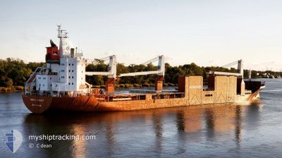
SAIMAAGRACHT
General Cargo
Current Trip
| Time Travelled | 10 days |
|---|---|
| Remaining Time | 7 h, 52 mins |
| Distance Travelled | 3190.67 nm |
| Remaining Distance | 128.08 nm |
| AVG Speed | 13.4 Knots |
| MAX Speed | 17.4 Knots |
| AVG Wind | 12 knots |
| MAX Wind | 25.3 knots |
| MIN Temp | 8.8°C / 47.84°F |
| MAX Temp | 24.6°C / 76.28°F |
| Draught | 10.2 m |
| Position Received | 1 m ago |
Current Position
| Longitude | -76.14630° |
|---|---|
| Latitude | 37.20878° |
| Status | Under way using engine |
| Speed | 15.5 Knots |
| Course | 16.9° |
| Area | North Atlantic Ocean |
| Station | T-AIS |
| Position Received | 1 m ago |
Info
Information
The current position of SAIMAAGRACHT is in North Atlantic Ocean with coordinates 37.20878° / -76.14630° as reported on 2024-06-09 13:02 by AIS to our vessel tracker app. The vessel's current speed is 15.5 Knots and is heading at the port of BALTIMORE. The estimated time of arrival as calculated by vessel tracking app is 2024-06-09 20:55 LT
The vessel SAIMAAGRACHT (IMO: 9288069, MMSI: 246293000) is a General Cargo that was built in 2005 ( 19 years old ). It's sailing under the flag of [NL] Netherlands.
In this page you can find informations about the vessels current position, last detected port calls, and current voyage information. If the vessels is not in coverage by AIS you will find the latest position.
The current position of SAIMAAGRACHT is detected by our AIS receivers and we are not responsible for the reliability of the data. The last position was recorded while the vessel was in Coverage by the Ais receivers of our vessel tracking app.
The current draught of SAIMAAGRACHT as reported by AIS is 10.2 meters
Weather
| Temperature | 23.8°C / 74.84°F |
|---|---|
| Wind Speed | 15 knots |
| Direction | 226° SW |
| Pressure | 1007.5 hPa |
| Humidity | 61.3 % |
| Cloud Coverage | 90 % |
Featured Company
Most Visited Ports (Last year)
| Port | Arrivals | |
|---|---|---|
| 3 | ||
| 3 | ||
| 3 | ||
| 3 | ||
| 2 | ||
| 2 |
Last Trips
| Origin | Departure | Destination | Arrival | Distance | |
|---|---|---|---|---|---|
| 2024-05-23 09:16 | 2024-05-28 11:58 | 1683.02 nm | |||
| 2024-05-14 08:28 | 2024-05-19 15:34 | 1681.70 nm | |||
| 2024-05-04 15:27 | 2024-05-12 18:33 | 3096.59 nm | |||
| 2024-04-25 11:19 | 2024-05-02 15:21 | 1570.01 nm |
Events
| Time | Event | Details | Position / Dest | Info |
|---|---|---|---|---|
| 2024-06-09 12:03 | Draught Changed | 10.2 10.3 |
36.99193 / -76.01341
BALTIMORE
|
Speed: 14.9 kn Course: 314.7° |
| 2024-06-09 11:49 | Status Changed | Under way using engine Default |
36.94592 / -75.97094
BALTIMORE
|
Speed: 14.6 kn Course: 295° |
| 2024-06-09 11:43 | Status Changed | Default Under way using engine |
36.93542 / -75.94359
BALTIMORE
|
Speed: 9.4 kn Course: 300.5° |
| 2024-06-09 11:38 | Status Changed | Under way using engine Default |
36.92738 / -75.92432
BALTIMORE
|
Speed: 8.5 kn Course: 317° |
| 2024-06-09 11:35 | Status Changed | Default Under way using engine |
36.92381 / -75.91787
BALTIMORE
|
Speed: 8.8 kn Course: 317.5° |
| 2024-06-09 11:12 | Status Changed | Under way using engine Default |
36.88076 / -75.86951
BALTIMORE
|
Speed: 9.3 kn Course: 322° |
| 2024-06-09 11:11 | Status Changed | Default Under way using engine |
36.87911 / -75.86774
BALTIMORE
|
Speed: 9.3 kn Course: 319.3° |
| 2024-06-09 10:37 | Status Changed | Under way using engine Default |
36.82963 / -75.76968
BALTIMORE
|
Speed: 10.4 kn Course: 300° |
| 2024-06-09 10:35 | Status Changed | Default Under way using engine |
36.82680 / -75.76359
BALTIMORE
|
Speed: 10.9 kn Course: 289.1° |
| 2024-06-09 09:57 | Draught Changed | 10.3 10.2 |
36.78972 / -75.60834
BALTIMORE
|
Speed: 14 kn Course: 271° |