
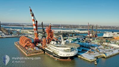
SAIPEM CONSTELLATION
Pipelay Crane Vessel
Current Trip
| Time Travelled | 1 day |
|---|---|
| Remaining Time | 3 days |
| Distance Travelled | 67.46 nm |
| Remaining Distance | 797.00 nm |
| AVG Speed | 10.4 Knots |
| MAX Speed | 12 Knots |
| AVG Wind | 15 knots |
| MAX Wind | 21 knots |
| MIN Temp | 14.1°C / 57.38°F |
| MAX Temp | 20.6°C / 69.08°F |
| Draught | 9.5 m |
| Position Received | 7 h, 45 m ago |
Current Position
| Longitude | -15.97599° |
|---|---|
| Latitude | 27.40377° |
| Status | Under way using engine |
| Speed | 3.6 Knots |
| Course | 227° |
| Area | North Atlantic Ocean |
| Station | T-AIS |
| Position Received | 7 h, 45 m ago |
Info
Information
The current position of SAIPEM CONSTELLATION is in North Atlantic Ocean with coordinates 27.40377° / -15.97599° as reported on 2024-05-29 16:51 by AIS to our vessel tracker app. The vessel's current speed is 3.6 Knots and is heading at the port of DAKAR. The estimated time of arrival as calculated by vessel tracking app is 2024-06-02 03:16 LT
The vessel SAIPEM CONSTELLATION (IMO: 9629756, MMSI: 311000806) is a Pipelay Crane Vessel that was built in 2014 ( 10 years old ). It's sailing under the flag of [BS] Bahamas.
In this page you can find informations about the vessels current position, last detected port calls, and current voyage information. If the vessels is not in coverage by AIS you will find the latest position.
The current position of SAIPEM CONSTELLATION is detected by our AIS receivers and we are not responsible for the reliability of the data. The last position was recorded while the vessel was in Coverage by the Ais receivers of our vessel tracking app.
The current draught of SAIPEM CONSTELLATION as reported by AIS is 9.5 meters
Weather
| Temperature | 20.5°C / 68.9°F |
|---|---|
| Wind Speed | 16 knots |
| Direction | 351° N |
| Pressure | 1016 hPa |
| Humidity | 76.3 % |
| Cloud Coverage | --- |
Featured Company
Last Port Calls
| Port | Arrival | Departure | Time In Port |
|---|---|---|---|
| 2024-05-28 03:33 | 2024-05-28 05:11 | 1 h | |
| 2024-05-25 22:49 | 2024-05-27 22:41 | 1 d | |
| 2024-05-23 06:39 | 2024-05-25 22:32 | 2 d | |
| 2024-05-09 07:11 | 2024-05-17 06:27 | 7 d | |
| 2024-05-01 04:39 |
Most Visited Ports (Last year)
| Port | Arrivals | |
|---|---|---|
| 3 | ||
| 2 |
Last Trips
| Origin | Departure | Destination | Arrival | Distance | |
|---|---|---|---|---|---|
| 2024-05-27 23:41 | 2024-05-28 04:33 | 45.55 nm | |||
| 2024-05-25 23:32 | 2024-05-25 23:49 | 1.08 nm | |||
| 2024-05-17 08:27 | 2024-05-23 07:39 | 1405.74 nm | |||
| 2024-05-01 06:39 | 2024-05-09 09:11 | 79.85 nm |
Events
| Time | Event | Details | Position / Dest | Info |
|---|---|---|---|---|
| 2024-05-29 16:51 | OUT of Coverage |
27.40377 / -15.97599
North Atlantic Ocean
DAKAR TORTUE PROJECT
|
Speed: 3.6 kn Course: 241.2° |
|
| 2024-05-29 16:51 | IN Coverage |
27.40377 / -15.97599
North Atlantic Ocean
DAKAR TORTUE PROJECT
|
Speed: 3.6 kn Course: 241.2° |
|
| 2024-05-29 14:12 | OUT of Coverage |
27.40523 / -15.97404
North Atlantic Ocean
DAKAR TORTUE PROJECT
|
Speed: 0.1 kn Course: 86.2° |
|
| 2024-05-29 12:16 | IN Coverage |
27.40537 / -15.97410
North Atlantic Ocean
DAKAR TORTUE PROJECT
|
Speed: Course: 246° |
|
| 2024-05-29 11:04 | OUT of Coverage |
27.40534 / -15.97411
North Atlantic Ocean
DAKAR TORTUE PROJECT
|
Speed: Course: 253.8° |
|
| 2024-05-28 19:12 | Draught Changed | 9.5 9.2 |
27.40529 / -15.97402
DAKAR TORTUE PROJECT
|
Speed: 0.1 kn Course: 79° |
| 2024-05-28 15:50 | IN Coverage |
27.40531 / -15.97405
North Atlantic Ocean
DAKAR TORTUE PROJECT
|
Speed: 0.1 kn Course: 331.4° |
|
| 2024-05-28 14:45 | OUT of Coverage |
27.40491 / -15.97400
North Atlantic Ocean
DAKAR TORTUE PROJECT
|
Speed: 0.1 kn Course: 329° |
|
| 2024-05-28 11:47 | Status Changed | Restricted manoeuverability Under way sailing |
27.40470 / -15.97403
DAKAR TORTUE PROJECT
|
Speed: 0.1 kn Course: 129° |
| 2024-05-28 11:38 | STOP Moving |
27.40503 / -15.97406
DAKAR TORTUE PROJECT
|
Speed: 0.3 kn Course: 78° |