
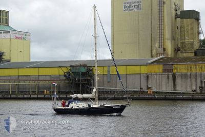
SAMAR
Sailing
Current Trip
| Trip Time | 4 days |
|---|---|
| Trip Distance | 129.34 nm |
| AVG Speed | 5.4 Knots |
| MAX Speed | 8.4 Knots |
| Draught | --- |
| AVG Wind | 7.6 knots |
| MAX Wind | 13.3 knots |
| MIN Temp | 13.3°C / 55.94°F |
| MAX Temp | 22.4°C / 72.32°F |
| Position Received | 1 m ago |
Current Position
| Longitude | 10.23893° |
|---|---|
| Latitude | 55.09444° |
| Status | Default |
| Speed | |
| Course | --- |
| Area | Kattegat |
| Station | T-AIS |
| Position Received | 1 m ago |
Info
Information
The current position of SAMAR is in Kattegat with coordinates 55.09444° / 10.23893° as reported on 2024-06-28 17:50 by AIS to our vessel tracker app. The vessel's current speed is 0 Knots and is currently inside the port of FAABORG.
The vessel SAMAR (MMSI: 244740071) is a Sailing It's sailing under the flag of [NL] Netherlands.
In this page you can find informations about the vessels current position, last detected port calls, and current voyage information. If the vessels is not in coverage by AIS you will find the latest position.
The current position of SAMAR is detected by our AIS receivers and we are not responsible for the reliability of the data. The last position was recorded while the vessel was in Coverage by the Ais receivers of our vessel tracking app.
Weather
| Temperature | 17.3°C / 63.14°F |
|---|---|
| Wind Speed | 17 knots |
| Direction | 264° W |
| Pressure | 1013.4 hPa |
| Humidity | 75.5 % |
| Cloud Coverage | --- |
Featured Company
Last Port Calls
| Port | Arrival | Departure | Time In Port |
|---|---|---|---|
| 2024-06-28 08:11 | |||
| 2024-06-23 09:42 | 2024-06-23 09:44 | 2 m | |
| 2024-06-18 13:13 | 2024-06-22 09:20 | 3 d | |
| 2024-06-10 10:39 | 2024-06-18 07:52 | 7 d | |
| 2024-06-08 09:10 | 2024-06-08 16:29 | 7 h | |
| 2024-06-02 17:20 | 2024-06-07 11:59 | 4 d | |
| 2024-05-26 14:33 | 2024-05-31 11:34 | 4 d | |
| 2024-05-22 07:02 | 2024-05-24 11:04 | 2 d | |
| 2024-05-12 08:29 | 2024-05-17 11:02 | 5 d | |
| 2024-05-09 13:17 | 2024-05-09 16:22 | 3 h |
Most Visited Ports (Last year)
| Port | Arrivals | |
|---|---|---|
| 10 | ||
| 2 | ||
| 1 | ||
| 1 | ||
| 1 | ||
| 1 |
Last Trips
| Origin | Departure | Destination | Arrival | Distance | |
|---|---|---|---|---|---|
| 2024-06-23 11:44 | 2024-06-28 10:11 | 129.34 nm | |||
| 2024-06-22 11:20 | 2024-06-23 11:42 | 112.52 nm | |||
| 2024-06-18 09:52 | 2024-06-18 15:13 | 7.53 nm | |||
| 2024-06-08 18:29 | 2024-06-10 12:39 | 3.16 nm | |||
| 2024-06-07 13:59 | 2024-06-08 11:10 | 3.47 nm | |||
| 2024-05-31 13:34 | 2024-06-02 19:20 | 6.59 nm | |||
| 2024-05-24 13:04 | 2024-05-26 16:33 | 20.53 nm | |||
| 2024-05-17 13:02 | 2024-05-22 09:02 | 17.89 nm | |||
| 2024-05-09 18:22 | 2024-05-12 10:29 | 8.10 nm | |||
| 2024-05-09 13:54 | 2024-05-09 15:17 | 2.50 nm |
Events
| Time | Event | Details | Position / Dest | Info |
|---|---|---|---|---|
| 2024-06-28 08:21 | STOP Moving |
55.09441 / 10.23883
[DK] FAABORG
|
Speed: 0.3 kn Course: 511° |
|
| 2024-06-28 08:11 | PORT ARRIVAL |
|
55.08688 / 10.24183
[DK] FAABORG
|
Speed: 5.1 kn Course: 318.2° |
| 2024-06-28 05:22 | START Moving | 0.89 nm, North West of AEROSKOBING |
54.90279 / 10.39536
|
Speed: 3.3 kn Course: 322.4° |
| 2024-06-25 19:48 | STOP Moving | 0.76 nm, North West of AEROSKOBING |
54.90075 / 10.39731
|
Speed: 0.3 kn Course: 511° |
| 2024-06-25 16:29 | Change Sea Area | Danish part of the Kattegat Danish part of the Baltic Sea |
54.80909 / 10.25171
Kattegat
|
Speed: 5.9 kn Course: 346.4° |
| 2024-06-25 15:20 | Change Sea Area | Danish part of the Baltic Sea German part of the Baltic Sea |
54.70068 / 10.28481
Baltic Sea
|
Speed: 5.4 kn Course: 350.9° |
| 2024-06-25 12:37 | Change Sea Area | German part of the Baltic Sea German part of the North Sea |
54.47110 / 10.26380
Baltic Sea
|
Speed: 4.7 kn Course: 16.4° |
| 2024-06-25 10:50 | START Moving | 1.34 nm, South West of STICKENHΟRN SPORT |
54.36501 / 10.14527
|
Speed: 4.5 kn Course: 110.6° |
| 2024-06-25 10:31 | STOP Moving | 1.38 nm, South West of STICKENHΟRN SPORT |
54.36573 / 10.14187
|
Speed: 0.1 kn Course: 511° |
| 2024-06-25 02:57 | IN Coverage |
54.04662 / 9.30618
North Sea
|
Speed: 5.3 kn Course: 5.2° |