
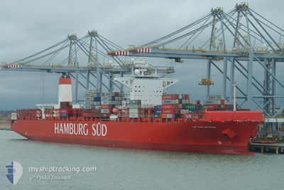
SAN ANTONIO MAERSK
Container Ship
Current Trip
BRSSZ > MAPTM2
| Time Travelled | 9 days |
|---|---|
| Remaining Time | --- |
| Distance Travelled | 3763.07 nm |
| Remaining Distance | --- |
| AVG Speed | 16.7 Knots |
| MAX Speed | 18.7 Knots |
| AVG Wind | 11.3 knots |
| MAX Wind | 19.4 knots |
| MIN Temp | 19.7°C / 67.46°F |
| MAX Temp | 28.5°C / 83.3°F |
| Draught | 14.5 m |
| Position Received | Now |
Current Position
| Longitude | -14.84259° |
|---|---|
| Latitude | 28.24619° |
| Status | Under way using engine |
| Speed | 17.6 Knots |
| Course | 21.2° |
| Area | North Atlantic Ocean |
| Station | T-AIS |
| Position Received | Now |
Info
Information
The current position of SAN ANTONIO MAERSK is in North Atlantic Ocean with coordinates 28.24619° / -14.84259° as reported on 2024-06-06 14:16 by AIS to our vessel tracker app. The vessel's current speed is 17.6 Knots
The vessel SAN ANTONIO MAERSK (IMO: 9622241, MMSI: 219095000) is a Container Ship that was built in 2014 ( 10 years old ). It's sailing under the flag of [DK] Denmark.
In this page you can find informations about the vessels current position, last detected port calls, and current voyage information. If the vessels is not in coverage by AIS you will find the latest position.
The current position of SAN ANTONIO MAERSK is detected by our AIS receivers and we are not responsible for the reliability of the data. The last position was recorded while the vessel was in Coverage by the Ais receivers of our vessel tracking app.
The current draught of SAN ANTONIO MAERSK as reported by AIS is 14.5 meters
Weather
| Temperature | 20.3°C / 68.54°F |
|---|---|
| Wind Speed | 1 knots |
| Direction | 341° NNW |
| Pressure | 1016.8 hPa |
| Humidity | 69.1 % |
| Cloud Coverage | 100 % |
Featured Company
Last Port Calls
| Port | Arrival | Departure | Time In Port |
|---|---|---|---|
| 2024-05-26 13:04 | 2024-05-28 07:36 | 1 d | |
| 2024-05-25 05:01 | 2024-05-25 18:57 | 13 h | |
| 2024-05-19 06:57 | 2024-05-20 12:21 | 1 d | |
| 2024-05-17 10:21 | 2024-05-18 17:19 | 1 d | |
| 2024-05-14 01:09 | 2024-05-14 17:21 | 16 h | |
| 2024-05-11 06:35 | 2024-05-12 15:04 | 1 d | |
| 2024-04-28 11:44 | 2024-04-29 03:07 | 15 h | |
| 2024-04-24 00:55 | 2024-04-24 22:48 | 21 h | |
| 2024-04-19 11:40 | 2024-04-20 18:10 | 1 d | |
| 2024-04-18 04:14 | 2024-04-19 00:53 | 20 h |
Last Trips
| Origin | Departure | Destination | Arrival | Distance | |
|---|---|---|---|---|---|
| 2024-05-25 15:57 | 2024-05-26 10:04 | 180.41 nm | |||
| 2024-05-20 09:21 | 2024-05-25 02:01 | 890.98 nm | |||
| 2024-05-18 14:19 | 2024-05-19 03:57 | 148.37 nm | |||
| 2024-05-14 14:21 | 2024-05-17 07:21 | 933.97 nm | |||
| 2024-05-12 12:04 | 2024-05-13 22:09 | 192.76 nm | |||
| 2024-04-29 04:07 | 2024-05-11 03:35 | 4438.22 nm | |||
| 2024-04-25 00:48 | 2024-04-28 12:44 | 1424.57 nm | |||
| 2024-04-20 20:10 | 2024-04-24 02:55 | 457.17 nm | |||
| 2024-04-19 02:53 | 2024-04-19 13:40 | 127.75 nm | |||
| 2024-04-17 00:43 | 2024-04-18 06:14 | 387.03 nm |
Events
| Time | Event | Details | Position / Dest | Info |
|---|---|---|---|---|
| 2024-06-06 11:20 | Status Changed | Under way using engine Default |
27.42033 / -15.17185
BRSSZ > MAPTM2
|
Speed: 17.6 kn Course: 15° |
| 2024-06-06 11:15 | Status Changed | Default Under way using engine |
27.39978 / -15.17804
BRSSZ > MAPTM2
|
Speed: 17.5 kn Course: 12.3° |
| 2024-06-06 11:07 | Change Sea Area | Spanish (Canary Islands) part of the North Atlantic Ocean Brazilian part of the South Atlantic Ocean |
27.35828 / -15.18891
North Atlantic Ocean
BRSSZ > MAPTM2
|
Speed: 17.5 kn Course: 12.3° |
| 2024-06-06 11:07 | Status Changed | Under way using engine Default |
27.35828 / -15.18891
BRSSZ > MAPTM2
|
Speed: 17.5 kn Course: 12° |
| 2024-06-06 10:51 | IN Coverage |
27.35828 / -15.18891
North Atlantic Ocean
BRSSZ > MAPTM2
|
Speed: 17.5 kn Course: 12.3° |
|
| 2024-06-03 09:03 | START Moving |
8.43500 / -24.73667
BRSSZ > MAPTM2
|
Speed: 8 kn Course: 20° |
|
| 2024-06-03 08:24 | STOP Moving |
8.42333 / -24.74500
BRSSZ > MAPTM2
|
Speed: Course: -1° |
|
| 2024-05-30 18:26 | START Moving |
-13.86820 / -34.99384
BRSSZ > MAPTM2
|
Speed: 4.9 kn Course: 24° |
|
| 2024-05-30 17:54 | STOP Moving |
-13.87167 / -34.99833
BRSSZ > MAPTM2
|
Speed: Course: -1° |
|
| 2024-05-29 06:07 | OUT of Coverage |
-22.29187 / -40.64710
South Atlantic Ocean
BRSSZ > MAPTM2
|
Speed: 17 kn Course: 42.1° |