
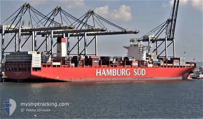
SAN AUGUSTIN MAERSK
Container Ship
Current Trip
| Time Travelled | 9 days |
|---|---|
| Remaining Time | --- |
| Distance Travelled | 3377.44 nm |
| Remaining Distance | 1049.59 nm |
| AVG Speed | 14.9 Knots |
| MAX Speed | 18 Knots |
| AVG Wind | 13.1 knots |
| MAX Wind | 25 knots |
| MIN Temp | 17.4°C / 63.32°F |
| MAX Temp | 28.6°C / 83.48°F |
| Draught | 11.4 m |
| Position Received | 7 d ago |
Current Position
| Longitude | -15.52752° |
|---|---|
| Latitude | 27.15415° |
| Status | Under way using engine |
| Speed | 16.1 Knots |
| Course | 208.2° |
| Area | North Atlantic Ocean |
| Station | T-AIS |
| Position Received | 7 d ago |
Info
Information
The current position of SAN AUGUSTIN MAERSK is in North Atlantic Ocean with coordinates 27.15415° / -15.52752° as reported on 2024-06-04 23:41 by AIS to our vessel tracker app. The vessel's current speed is 16.1 Knots and is heading at the port of SANTOS. The estimated time of arrival as calculated by vessel tracking app is 2024-06-15 02:00 LT
The vessel SAN AUGUSTIN MAERSK (IMO: 9622239, MMSI: 219100000) is a Container Ship that was built in 2013 ( 11 years old ). It's sailing under the flag of [DK] Denmark.
In this page you can find informations about the vessels current position, last detected port calls, and current voyage information. If the vessels is not in coverage by AIS you will find the latest position.
The current position of SAN AUGUSTIN MAERSK is detected by our AIS receivers and we are not responsible for the reliability of the data. The last position was recorded while the vessel was in Coverage by the Ais receivers of our vessel tracking app.
The current draught of SAN AUGUSTIN MAERSK as reported by AIS is 11.4 meters
Weather
| Temperature | 26.5°C / 79.7°F |
|---|---|
| Wind Speed | 18 knots |
| Direction | 118° ESE |
| Pressure | 1016.2 hPa |
| Humidity | 66.8 % |
| Cloud Coverage | 85 % |
Featured Company
Last Port Calls
| Port | Arrival | Departure | Time In Port |
|---|---|---|---|
| 2024-06-02 06:27 | 2024-06-02 22:39 | 16 h | |
| 2024-05-27 02:29 | 2024-05-28 03:35 | 1 d | |
| 2024-05-25 10:31 | 2024-05-26 04:23 | 17 h | |
| 2024-05-22 19:47 | 2024-05-24 06:00 | 1 d | |
| 2024-05-20 20:03 | 2024-05-21 19:15 | 23 h | |
| 2024-05-04 05:52 | 2024-05-06 05:37 | 1 d | |
| 2024-05-01 20:37 | 2024-05-02 20:01 | 23 h | |
| 2024-04-21 04:48 | 2024-04-22 19:29 | 1 d | |
| 2024-04-16 14:36 | 2024-04-18 09:03 | 1 d | |
| 2024-04-05 14:24 | 2024-04-06 12:44 | 22 h |
Most Visited Ports (Last year)
| Port | Arrivals | |
|---|---|---|
| 10 | ||
| 9 | ||
| 6 | ||
| 6 | ||
| 5 | ||
| 5 |
Last Trips
| Origin | Departure | Destination | Arrival | Distance | |
|---|---|---|---|---|---|
| 2024-05-28 05:35 | 2024-06-02 07:27 | 1500.42 nm | |||
| 2024-05-26 06:23 | 2024-05-27 04:29 | 379.20 nm | |||
| 2024-05-24 08:00 | 2024-05-25 12:31 | 232.65 nm | |||
| 2024-05-21 21:15 | 2024-05-22 21:47 | 324.40 nm | |||
| 2024-05-06 02:37 | 2024-05-20 22:03 | 5803.46 nm | |||
| 2024-05-02 17:01 | 2024-05-04 02:52 | 209.50 nm | |||
| 2024-04-22 16:29 | 2024-05-01 17:37 | 1184.36 nm | |||
| 2024-04-18 06:03 | 2024-04-21 01:48 | 1002.17 nm | |||
| 2024-04-06 12:44 | 2024-04-16 11:36 | 4435.28 nm | |||
| 2024-03-28 22:19 | 2024-04-05 14:24 | 1464.97 nm |
Events
| Time | Event | Details | Position / Dest | Info |
|---|---|---|---|---|
| 2024-06-04 23:43 | Status Changed | Default Under way using engine |
27.14542 / -15.53275
MAPTM 1>BRSSZ
|
Speed: 16.1 kn Course: 208.2° |
| 2024-06-04 23:41 | Status Changed | Under way using engine Default |
27.15415 / -15.52752
MAPTM 1>BRSSZ
|
Speed: 16 kn Course: 207° |
| 2024-06-04 23:41 | OUT of Coverage |
27.15415 / -15.52752
North Atlantic Ocean
MAPTM 1>BRSSZ
|
Speed: 16.1 kn Course: 208.2° |
|
| 2024-06-04 23:33 | Status Changed | Default Under way using engine |
27.18656 / -15.50811
MAPTM 1>BRSSZ
|
Speed: 16.3 kn Course: 207.4° |
| 2024-06-04 23:28 | Status Changed | Under way using engine Default |
27.20550 / -15.49692
MAPTM 1>BRSSZ
|
Speed: 16 kn Course: 206° |
| 2024-06-04 23:17 | Status Changed | Default Under way using engine |
27.24879 / -15.47248
MAPTM 1>BRSSZ
|
Speed: 16.3 kn Course: 206.6° |
| 2024-06-04 23:01 | Status Changed | Under way using engine Default |
27.31363 / -15.43601
MAPTM 1>BRSSZ
|
Speed: 16.3 kn Course: 207° |
| 2024-06-04 22:53 | IN Coverage |
27.31363 / -15.43601
North Atlantic Ocean
MAPTM 1>BRSSZ
|
Speed: 16.4 kn Course: 207.1° |
|
| 2024-06-04 21:54 | Status Changed | Default Under way using engine |
27.59043 / -15.27186
MAPTM 1>BRSSZ
|
Speed: 16.2 kn Course: 207° |
| 2024-06-04 21:46 | OUT of Coverage |
27.62253 / -15.25356
North Atlantic Ocean
MAPTM 1>BRSSZ
|
Speed: 16.2 kn Course: 207° |