
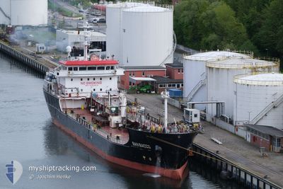
SAN BACCO
Tanker
Current Trip
| Time Travelled | 18 h, 41 mins |
|---|---|
| Remaining Time | 5 h, 20 mins |
| Distance Travelled | 159.88 nm |
| Remaining Distance | 73.36 nm |
| AVG Speed | 8.8 Knots |
| MAX Speed | 14.4 Knots |
| AVG Wind | 9.7 knots |
| MAX Wind | 17 knots |
| MIN Temp | 10.6°C / 51.08°F |
| MAX Temp | 20.8°C / 69.44°F |
| Draught | 6.3 m |
| Position Received | 1 m ago |
Current Position
| Longitude | 10.96072° |
|---|---|
| Latitude | 55.91948° |
| Status | Under way using engine |
| Speed | 13.5 Knots |
| Course | 38.9° |
| Area | Kattegat |
| Station | T-AIS |
| Position Received | 1 m ago |
Info
Information
The current position of SAN BACCO is in Kattegat with coordinates 55.91948° / 10.96072° as reported on 2024-05-18 10:10 by AIS to our vessel tracker app. The vessel's current speed is 13.5 Knots and is heading at the port of HELSINGBORG. The estimated time of arrival as calculated by vessel tracking app is 2024-05-18 15:32 LT
The vessel SAN BACCO (IMO: 9753818, MMSI: 256831000) is a Tanker It's sailing under the flag of [MT] Malta.
In this page you can find informations about the vessels current position, last detected port calls, and current voyage information. If the vessels is not in coverage by AIS you will find the latest position.
The current position of SAN BACCO is detected by our AIS receivers and we are not responsible for the reliability of the data. The last position was recorded while the vessel was in Coverage by the Ais receivers of our vessel tracking app.
The current draught of SAN BACCO as reported by AIS is 6.3 meters
Weather
| Temperature | 14°C / 57.2°F |
|---|---|
| Wind Speed | 12 knots |
| Direction | 71° ENE |
| Pressure | 1015.4 hPa |
| Humidity | 81.8 % |
| Cloud Coverage | 4 % |
Featured Company
Last Port Calls
| Port | Arrival | Departure | Time In Port |
|---|---|---|---|
| 2024-05-16 16:29 | 2024-05-17 15:31 | 23 h | |
| 2024-05-12 06:07 | 2024-05-13 16:17 | 1 d | |
| 2024-05-10 09:52 | 2024-05-10 21:56 | 12 h | |
| 2024-05-05 22:11 | 2024-05-08 11:11 | 2 d | |
| 2024-05-04 00:07 | 2024-05-04 07:19 | 7 h | |
| 2024-05-03 09:35 | 2024-05-03 21:52 | 12 h | |
| 2024-04-28 06:06 | 2024-04-29 06:26 | 1 d | |
| 2024-04-21 10:54 | 2024-04-23 01:41 | 1 d | |
| 2024-04-18 16:20 | 2024-04-19 21:16 | 1 d | |
| 2024-04-16 11:56 | 2024-04-17 06:30 | 18 h |
Most Visited Ports (Last year)
| Port | Arrivals | |
|---|---|---|
| 37 | ||
| 15 | ||
| 10 | ||
| 9 | ||
| 8 | ||
| 7 |
Last Trips
| Origin | Departure | Destination | Arrival | Distance | |
|---|---|---|---|---|---|
| 2024-05-13 18:17 | 2024-05-16 18:29 | 823.53 nm | |||
| 2024-05-10 23:56 | 2024-05-12 08:07 | 404.30 nm | |||
| 2024-05-08 13:11 | 2024-05-10 11:52 | 515.20 nm | |||
| 2024-05-04 09:19 | 2024-05-06 00:11 | 238.43 nm | |||
| 2024-05-03 23:52 | 2024-05-04 02:07 | 25.93 nm | |||
| 2024-04-29 08:26 | 2024-05-03 11:35 | 1111.53 nm | |||
| 2024-04-23 02:41 | 2024-04-28 08:06 | 882.27 nm | |||
| 2024-04-19 23:16 | 2024-04-21 11:54 | 393.72 nm | |||
| 2024-04-17 07:30 | 2024-04-18 18:20 | 400.38 nm | |||
| 2024-04-12 20:18 | 2024-04-16 12:56 | 401.33 nm |
Events
| Time | Event | Details | Position / Dest | Info |
|---|---|---|---|---|
| 2024-05-18 04:23 | Change Sea Area | Danish part of the Kattegat Danish part of the Baltic Sea |
54.75147 / 10.87862
Kattegat
SEHEL
|
Speed: 13 kn Course: 357° |
| 2024-05-18 04:13 | Draught Changed | 6.3 6 |
54.71744 / 10.88283
SEHEL
|
Speed: 8.8 kn Course: 354.4° |
| 2024-05-18 04:13 | ETA Changed | 2024/05/18 17:00 |
54.71744 / 10.88283
SEHEL
|
Speed: 8.8 kn Course: 354.4° |
| 2024-05-18 04:07 | Draught Changed | 6 6.3 |
54.70093 / 10.88560
SEHEL
|
Speed: 11.3 kn Course: 356.9° |
| 2024-05-18 03:02 | Change Sea Area | Danish part of the Baltic Sea German part of the Baltic Sea |
54.56320 / 10.59121
Baltic Sea
SEHEL
|
Speed: 12.1 kn Course: 53.5° |
| 2024-05-18 01:09 | START Moving | 1.29 nm, South West of STICKENHΟRN SPORT |
54.36558 / 10.14600
SEHEL
|
Speed: 3.7 kn Course: 102° |
| 2024-05-18 00:33 | STOP Moving | 1.35 nm, South West of STICKENHΟRN SPORT |
54.36595 / 10.14281
SEHEL
|
Speed: 0.3 kn Course: 103° |
| 2024-05-18 00:19 | Draught Changed | 6.3 6 |
54.36775 / 10.13084
SEHEL
|
Speed: 3.6 kn Course: 103° |
| 2024-05-18 00:19 | ETA Changed | 2024/05/18 17:00 |
54.36775 / 10.13084
SEHEL
|
Speed: 3.6 kn Course: 103° |
| 2024-05-18 00:13 | Draught Changed | 6 6.3 |
54.36915 / 10.11780
SEHEL
|
Speed: 5.1 kn Course: 106.2° |