
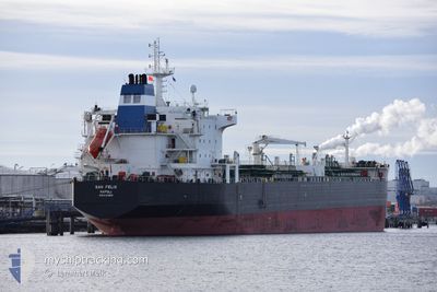
SAN FELIX
Oil/Chemical Tanker
Current Trip
| Time Travelled | 1 day |
|---|---|
| Remaining Time | --- |
| Distance Travelled | 6.12 nm |
| Remaining Distance | --- |
| AVG Speed | 5 Knots |
| MAX Speed | 6.5 Knots |
| AVG Wind | 5.1 knots |
| MAX Wind | 9.3 knots |
| MIN Temp | 13.8°C / 56.84°F |
| MAX Temp | 18.8°C / 65.84°F |
| Draught | 7 m |
| Position Received | 3 m ago |
Current Position
| Longitude | 14.50305° |
|---|---|
| Latitude | 45.27334° |
| Status | At anchor |
| Speed | 0.2 Knots |
| Course | 81° |
| Area | Adriatic Sea |
| Station | T-AIS |
| Position Received | 3 m ago |
Info
Information
The current position of SAN FELIX is in Adriatic Sea with coordinates 45.27334° / 14.50305° as reported on 2024-05-17 09:27 by AIS to our vessel tracker app. The vessel's current speed is 0.2 Knots
The vessel SAN FELIX (IMO: 9314868, MMSI: 247391400) is a Oil/Chemical Tanker that was built in 2007 ( 17 years old ). It's sailing under the flag of [IT] Italy.
In this page you can find informations about the vessels current position, last detected port calls, and current voyage information. If the vessels is not in coverage by AIS you will find the latest position.
The current position of SAN FELIX is detected by our AIS receivers and we are not responsible for the reliability of the data. The last position was recorded while the vessel was in Coverage by the Ais receivers of our vessel tracking app.
The current draught of SAN FELIX as reported by AIS is 7 meters
Weather
| Temperature | 16.9°C / 62.42°F |
|---|---|
| Wind Speed | 9 knots |
| Direction | 206° SSW |
| Pressure | 1011.6 hPa |
| Humidity | 70.3 % |
| Cloud Coverage | --- |
Featured Company
Most Visited Ports (Last year)
| Port | Arrivals | |
|---|---|---|
| 3 | ||
| 3 | ||
| 2 | ||
| 2 | ||
| 2 | ||
| 2 |
Last Trips
| Origin | Departure | Destination | Arrival | Distance | |
|---|---|---|---|---|---|
| 2024-04-17 20:32 | 2024-05-13 19:39 | 4537.01 nm | |||
| 2024-04-03 13:30 | 2024-04-16 08:03 | 1286.33 nm | |||
| 2024-03-30 23:11 | 2024-04-01 10:10 | 408.06 nm | |||
| 2024-03-09 08:02 | 2024-03-29 03:04 | 487.81 nm | |||
| 2024-02-16 21:28 | 2024-03-05 19:47 | 1176.26 nm |
Events
| Time | Event | Details | Position / Dest | Info |
|---|---|---|---|---|
| 2024-05-17 08:32 | Status Changed | At anchor Default |
45.27237 / 14.50634
HRRJK
|
Speed: 0.1 kn Course: 307° |
| 2024-05-17 08:27 | Status Changed | Default At anchor |
45.27245 / 14.50653
HRRJK
|
Speed: 0.1 kn Course: 291° |
| 2024-05-17 08:23 | Status Changed | At anchor Default |
45.27284 / 14.50676
HRRJK
|
Speed: 0.1 kn Course: 284° |
| 2024-05-17 08:18 | Status Changed | Default At anchor |
45.27292 / 14.50688
HRRJK
|
Speed: 0.1 kn Course: 278° |
| 2024-05-17 07:17 | Status Changed | At anchor Default |
45.27387 / 14.50695
HRRJK
|
Speed: Course: 250° |
| 2024-05-17 07:12 | Status Changed | Default At anchor |
45.27387 / 14.50695
HRRJK
|
Speed: Course: 247° |
| 2024-05-17 00:42 | Status Changed | At anchor Default |
45.27511 / 14.50528
HRRJK
|
Speed: Course: 187° |
| 2024-05-17 00:39 | Status Changed | Default At anchor |
45.27509 / 14.50529
HRRJK
|
Speed: Course: 188° |
| 2024-05-16 22:30 | Status Changed | At anchor Default |
45.27460 / 14.50341
HRRJK
|
Speed: Course: 158° |
| 2024-05-16 22:06 | Status Changed | Default At anchor |
45.27431 / 14.50442
HRRJK
|
Speed: 0.1 kn Course: 190° |