
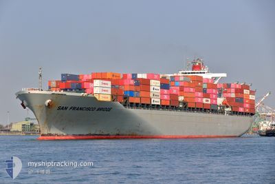
SAN FRANCISCO BRIDGE
Container Ship
Current Trip
| Trip Time | 2 days |
|---|---|
| Trip Distance | 812.10 nm |
| AVG Speed | 14.6 Knots |
| MAX Speed | 20.6 Knots |
| Draught | 10.1 m |
| AVG Wind | 5.7 knots |
| MAX Wind | 11.1 knots |
| MIN Temp | 29.2°C / 84.56°F |
| MAX Temp | 31.2°C / 88.16°F |
| Position Received | 2 d ago |
Current Position
| Longitude | 104.41223° |
|---|---|
| Latitude | 1.35245° |
| Status | Under way using engine |
| Speed | 15.9 Knots |
| Course | 52° |
| Area | South China Sea |
| Station | T-AIS |
| Position Received | 2 d ago |
Info
Information
The current position of SAN FRANCISCO BRIDGE is in South China Sea with coordinates 1.35245° / 104.41223° as reported on 2024-05-14 10:39 by AIS to our vessel tracker app. The vessel's current speed is 15.9 Knots and is currently inside the port of LAEM CHABANG.
The vessel SAN FRANCISCO BRIDGE (IMO: 9560364, MMSI: 355400000) is a Container Ship that was built in 2010 ( 14 years old ). It's sailing under the flag of [PA] Panama.
In this page you can find informations about the vessels current position, last detected port calls, and current voyage information. If the vessels is not in coverage by AIS you will find the latest position.
The current position of SAN FRANCISCO BRIDGE is detected by our AIS receivers and we are not responsible for the reliability of the data. The last position was recorded while the vessel was in Coverage by the Ais receivers of our vessel tracking app.
The current draught of SAN FRANCISCO BRIDGE as reported by AIS is 10.1 meters
Weather
| Temperature | 29.1°C / 84.38°F |
|---|---|
| Wind Speed | 4 knots |
| Direction | 155° SSE |
| Pressure | 1010 hPa |
| Humidity | 77.2 % |
| Cloud Coverage | 100 % |
Featured Company
Last Port Calls
| Port | Arrival | Departure | Time In Port |
|---|---|---|---|
| 2024-05-16 13:08 | |||
| 2024-05-13 10:47 | 2024-05-14 07:37 | 20 h | |
| 2024-05-09 01:32 | 2024-05-09 19:40 | 18 h | |
| 2024-05-03 00:36 | 2024-05-03 19:34 | 18 h | |
| 2024-04-28 07:08 | 2024-04-29 07:36 | 1 d | |
| 2024-04-24 12:24 | 2024-04-25 01:39 | 13 h | |
| 2024-04-22 11:14 | 2024-04-22 22:46 | 11 h | |
| 2024-04-15 09:28 | 2024-04-16 06:11 | 20 h | |
| 2024-04-13 06:30 | 2024-04-13 19:26 | 12 h | |
| 2024-04-10 07:22 | 2024-04-11 18:08 | 1 d |
Most Visited Ports (Last year)
| Port | Arrivals | |
|---|---|---|
| 11 | ||
| 9 | ||
| 7 | ||
| 7 | ||
| 5 | ||
| 5 |
Last Trips
| Origin | Departure | Destination | Arrival | Distance | |
|---|---|---|---|---|---|
| 2024-05-14 15:37 | 2024-05-16 20:08 | 812.10 nm | |||
| 2024-05-10 03:40 | 2024-05-13 18:47 | 223.52 nm | |||
| 2024-05-04 01:04 | 2024-05-09 09:32 | 1441.27 nm | |||
| 2024-04-29 13:06 | 2024-05-03 06:06 | 939.29 nm | |||
| 2024-04-25 06:39 | 2024-04-28 12:38 | 598.18 nm | |||
| 2024-04-23 04:16 | 2024-04-24 17:24 | 431.19 nm | |||
| 2024-04-16 14:11 | 2024-04-22 16:44 | 2446.78 nm | |||
| 2024-04-14 03:26 | 2024-04-15 17:28 | 20.64 nm | |||
| 2024-04-12 02:08 | 2024-04-13 14:30 | 200.47 nm | |||
| 2024-04-08 11:21 | 2024-04-10 15:22 | 809.41 nm |
Events
| Time | Event | Details | Position / Dest | Info |
|---|---|---|---|---|
| 2024-05-16 13:42 | STOP Moving |
13.05323 / 100.89455
[TH] LAEM CHABANG
|
Speed: 0.1 kn Course: 74° |
|
| 2024-05-16 13:08 | PORT ARRIVAL |
|
13.06662 / 100.87480
[TH] LAEM CHABANG
|
Speed: 7.9 kn Course: 117° |
| 2024-05-14 10:45 | Status Changed | Default Under way using engine |
1.36618 / 104.43030
THLCH
|
Speed: 15.9 kn Course: 52° |
| 2024-05-14 10:39 | OUT of Coverage |
1.35245 / 104.41223
South China Sea
THLCH
|
Speed: 15.9 kn Course: 52° |
|
| 2024-05-14 10:37 | Status Changed | Under way using engine Default |
1.34682 / 104.40478
THLCH
|
Speed: 15.9 kn Course: 52° |
| 2024-05-14 10:37 | Status Changed | Default Under way using engine |
1.34490 / 104.40231
THLCH
|
Speed: 15.7 kn Course: 52° |
| 2024-05-14 10:25 | Change Sea Area | Malaysian part of the South China Sea Malaysian part of the Singapore Strait |
1.31237 / 104.36115
South China Sea
THLCH
|
Speed: 15.5 kn Course: 50° |
| 2024-05-14 10:14 | Status Changed | Under way using engine Default |
1.28800 / 104.32250
THLCH
|
Speed: 15.6 kn Course: 75° |
| 2024-05-14 10:00 | Status Changed | Default Under way using engine |
1.27667 / 104.26630
THLCH
|
Speed: 15.8 kn Course: 78° |
| 2024-05-14 09:34 | Change Sea Area | Malaysian part of the Singapore Strait Indonesian part of the Singapore Strait |
1.25872 / 104.15317
Singapore Strait
THLCH
|
Speed: 16.2 kn Course: 83° |