
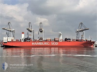
SAN LORENZO MAERSK
Container Ship
Current Trip
| Time Travelled | 12 days |
|---|---|
| Remaining Time | 16 h, 36 mins |
| Distance Travelled | 4194.66 nm |
| Remaining Distance | 209.68 nm |
| AVG Speed | 13.6 Knots |
| MAX Speed | 15.3 Knots |
| AVG Wind | 11.8 knots |
| MAX Wind | 23.8 knots |
| MIN Temp | 17.7°C / 63.86°F |
| MAX Temp | 28.9°C / 84.02°F |
| Draught | 12.4 m |
| Position Received | 41 m ago |
Current Position
| Longitude | -42.54553° |
|---|---|
| Latitude | -23.71002° |
| Status | Under way using engine |
| Speed | 12.6 Knots |
| Course | 235.4° |
| Area | South Atlantic Ocean |
| Station | T-AIS |
| Position Received | 41 m ago |
Info
Information
The current position of SAN LORENZO MAERSK is in South Atlantic Ocean with coordinates -23.71002° / -42.54553° as reported on 2024-05-17 06:15 by AIS to our vessel tracker app. The vessel's current speed is 12.6 Knots and is heading at the port of SANTOS. The estimated time of arrival as calculated by vessel tracking app is 2024-05-17 23:33 LT
The vessel SAN LORENZO MAERSK (IMO: 9622227, MMSI: 219096000) is a Container Ship that was built in 2013 ( 11 years old ). It's sailing under the flag of [DK] Denmark.
In this page you can find informations about the vessels current position, last detected port calls, and current voyage information. If the vessels is not in coverage by AIS you will find the latest position.
The current position of SAN LORENZO MAERSK is detected by our AIS receivers and we are not responsible for the reliability of the data. The last position was recorded while the vessel was in Coverage by the Ais receivers of our vessel tracking app.
The current draught of SAN LORENZO MAERSK as reported by AIS is 12.4 meters
Weather
| Temperature | 24.4°C / 75.92°F |
|---|---|
| Wind Speed | 17 knots |
| Direction | 37° NE |
| Pressure | 1014.3 hPa |
| Humidity | 88.2 % |
| Cloud Coverage | 93 % |
Featured Company
Last Port Calls
| Port | Arrival | Departure | Time In Port |
|---|---|---|---|
| 2024-05-03 22:04 | 2024-05-04 16:32 | 18 h | |
| 2024-04-27 18:09 | 2024-04-28 21:42 | 1 d | |
| 2024-04-25 17:01 | 2024-04-26 18:50 | 1 d | |
| 2024-04-24 00:42 | 2024-04-25 04:43 | 1 d | |
| 2024-04-22 01:55 | 2024-04-22 19:22 | 17 h | |
| 2024-04-19 20:14 | 2024-04-20 22:29 | 1 d | |
| 2024-03-30 23:35 | 2024-04-01 09:17 | 1 d | |
| 2024-03-29 10:30 | 2024-03-30 08:50 | 22 h | |
| 2024-03-24 10:02 | 2024-03-25 12:13 | 1 d | |
| 2024-03-18 21:51 | 2024-03-19 13:50 | 15 h |
Most Visited Ports (Last year)
| Port | Arrivals | |
|---|---|---|
| 9 | ||
| 9 | ||
| 6 | ||
| 5 | ||
| 4 | ||
| 4 |
Last Trips
| Origin | Departure | Destination | Arrival | Distance | |
|---|---|---|---|---|---|
| 2024-04-28 23:42 | 2024-05-03 23:04 | 1427.47 nm | |||
| 2024-04-26 20:50 | 2024-04-27 20:09 | 378.94 nm | |||
| 2024-04-25 06:43 | 2024-04-25 19:01 | 133.72 nm | |||
| 2024-04-22 20:22 | 2024-04-24 02:42 | 436.58 nm | |||
| 2024-04-21 00:29 | 2024-04-22 02:55 | 260.57 nm | |||
| 2024-04-01 06:17 | 2024-04-19 22:14 | 5862.80 nm | |||
| 2024-03-30 05:50 | 2024-03-30 20:35 | 174.95 nm | |||
| 2024-03-25 09:13 | 2024-03-29 07:30 | 851.56 nm | |||
| 2024-03-19 10:50 | 2024-03-24 07:02 | 1021.75 nm | |||
| 2024-03-03 09:20 | 2024-03-15 22:08 | 4459.16 nm |
Events
| Time | Event | Details | Position / Dest | Info |
|---|---|---|---|---|
| 2024-05-17 06:18 | Status Changed | Default Under way using engine |
-23.71655 / -42.55462
MA PTM > BR SSZ
|
Speed: 12.6 kn Course: 235.4° |
| 2024-05-17 06:15 | Status Changed | Under way using engine Default |
-23.71002 / -42.54553
MA PTM > BR SSZ
|
Speed: 12.3 kn Course: 234° |
| 2024-05-17 05:38 | Status Changed | Default Under way using engine |
-23.62836 / -42.43620
MA PTM > BR SSZ
|
Speed: 12.1 kn Course: 232.8° |
| 2024-05-17 05:35 | Status Changed | Under way using engine Default |
-23.62181 / -42.42749
MA PTM > BR SSZ
|
Speed: 12 kn Course: 228° |
| 2024-05-17 05:18 | Status Changed | Default Under way using engine |
-23.58607 / -42.38015
MA PTM > BR SSZ
|
Speed: 12 kn Course: 228.8° |
| 2024-05-17 05:14 | Status Changed | Under way using engine Default |
-23.57655 / -42.36776
MA PTM > BR SSZ
|
Speed: 12 kn Course: 231° |
| 2024-05-17 05:12 | IN Coverage |
-23.57655 / -42.36776
South Atlantic Ocean
|
Speed: 12 kn Course: 228.8° |
|
| 2024-05-17 01:52 | Status Changed | Default Under way using engine |
-23.13833 / -41.78333
MA PTM > BR SSZ
|
Speed: 10.9 kn Course: 225.7° |
| 2024-05-17 01:48 | Detected in Sea | Brazilian part of the South Atlantic Ocean |
-23.13154 / -41.77562
South Atlantic Ocean
|
Speed: 10.9 kn Course: 225.7° |
| 2024-05-17 01:48 | OUT of Coverage |
-23.13154 / -41.77562
South Atlantic Ocean
|
Speed: 10.9 kn Course: 225.7° |