
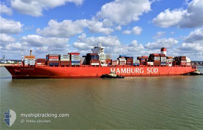
SAN RAPHAEL MAERSK
Container Ship
Current Trip
| Time Travelled | 6 h, 50 mins |
|---|---|
| Remaining Time | 11 days |
| Distance Travelled | 96.13 nm |
| Remaining Distance | 4287.17 nm |
| AVG Speed | 11.8 Knots |
| MAX Speed | 16.3 Knots |
| AVG Wind | 15.1 knots |
| MAX Wind | 22.2 knots |
| MIN Temp | 20.1°C / 68.18°F |
| MAX Temp | 25.8°C / 78.44°F |
| Draught | 12 m |
| Position Received | 1 m ago |
Current Position
| Longitude | -7.07327° |
|---|---|
| Latitude | 35.06462° |
| Status | Under way using engine |
| Speed | 14.7 Knots |
| Course | 228.2° |
| Area | North Atlantic Ocean |
| Station | T-AIS |
| Position Received | 1 m ago |
Info
Information
The current position of SAN RAPHAEL MAERSK is in North Atlantic Ocean with coordinates 35.06462° / -7.07327° as reported on 2024-06-24 13:53 by AIS to our vessel tracker app. The vessel's current speed is 14.7 Knots and is heading at the port of SANTOS. The estimated time of arrival as calculated by vessel tracking app is 2024-07-06 06:19 LT
The vessel SAN RAPHAEL MAERSK (IMO: 9622253, MMSI: 219107000) is a Container Ship that was built in 2014 ( 10 years old ). It's sailing under the flag of [DK] Denmark.
In this page you can find informations about the vessels current position, last detected port calls, and current voyage information. If the vessels is not in coverage by AIS you will find the latest position.
The current position of SAN RAPHAEL MAERSK is detected by our AIS receivers and we are not responsible for the reliability of the data. The last position was recorded while the vessel was in Coverage by the Ais receivers of our vessel tracking app.
The current draught of SAN RAPHAEL MAERSK as reported by AIS is 12 meters
Weather
| Temperature | 22.5°C / 72.5°F |
|---|---|
| Wind Speed | 3 knots |
| Direction | 83° E |
| Pressure | 1008.7 hPa |
| Humidity | 77.9 % |
| Cloud Coverage | 60 % |
Featured Company
Last Port Calls
| Port | Arrival | Departure | Time In Port |
|---|---|---|---|
| 2024-06-23 07:01 | 2024-06-24 07:04 | 1 d | |
| 2024-06-18 11:31 | 2024-06-19 07:40 | 20 h | |
| 2024-06-16 06:31 | 2024-06-17 11:00 | 1 d | |
| 2024-06-14 00:09 | 2024-06-14 18:20 | 18 h | |
| 2024-06-11 15:48 | 2024-06-12 22:10 | 1 d | |
| 2024-06-09 14:12 | 2024-06-10 12:17 | 22 h | |
| 2024-06-07 04:31 | 2024-06-08 10:20 | 1 d | |
| 2024-05-22 00:35 | 2024-05-23 07:04 | 1 d | |
| 2024-05-18 21:12 | 2024-05-19 09:33 | 12 h | |
| 2024-05-12 12:01 | 2024-05-13 15:13 | 1 d |
Most Visited Ports (Last year)
| Port | Arrivals | |
|---|---|---|
| 10 | ||
| 9 | ||
| 6 | ||
| 5 | ||
| 5 | ||
| 5 |
Last Trips
| Origin | Departure | Destination | Arrival | Distance | |
|---|---|---|---|---|---|
| 2024-06-19 09:40 | 2024-06-23 08:01 | 1426.53 nm | |||
| 2024-06-17 13:00 | 2024-06-18 13:31 | 119.61 nm | |||
| 2024-06-14 20:20 | 2024-06-16 08:31 | 380.00 nm | |||
| 2024-06-13 00:10 | 2024-06-14 02:09 | 200.19 nm | |||
| 2024-06-10 13:17 | 2024-06-11 17:48 | 434.59 nm | |||
| 2024-06-08 12:20 | 2024-06-09 15:12 | 171.62 nm | |||
| 2024-05-23 04:04 | 2024-06-07 06:31 | 5827.45 nm | |||
| 2024-05-19 06:33 | 2024-05-21 21:35 | 182.09 nm | |||
| 2024-05-13 12:13 | 2024-05-18 18:12 | 885.06 nm | |||
| 2024-05-11 09:40 | 2024-05-12 09:01 | 148.25 nm |
Events
| Time | Event | Details | Position / Dest | Info |
|---|---|---|---|---|
| 2024-06-24 09:53 | Status Changed | Under way using engine Default |
35.73726 / -6.12451
SANTOS
|
Speed: 16.5 kn Course: 233° |
| 2024-06-24 09:43 | Status Changed | Default Under way using engine |
35.76413 / -6.08244
SANTOS
|
Speed: 16.1 kn Course: 229.9° |
| 2024-06-24 09:23 | Status Changed | Under way using engine Default |
35.82141 / -5.99569
SANTOS
|
Speed: 15.9 kn Course: 240° |
| 2024-06-24 09:19 | Status Changed | Default Under way using engine |
35.83019 / -5.97889
SANTOS
|
Speed: 15.9 kn Course: 239° |
| 2024-06-24 09:11 | Change Sea Area | Moroccan part of the North Atlantic Ocean Moroccan part of the Strait of Gibraltar |
35.85005 / -5.93811
North Atlantic Ocean
SANTOS
|
Speed: 15.9 kn Course: 238.7° |
| 2024-06-24 08:32 | Change Sea Area | Moroccan part of the Strait of Gibraltar Spanish part of the Strait of Gibraltar |
35.93928 / -5.77244
Strait of Gibraltar
SANTOS
|
Speed: 14.2 kn Course: 247.6° |
| 2024-06-24 08:27 | Status Changed | Under way using engine Default |
35.94510 / -5.75053
SANTOS
|
Speed: 14 kn Course: 271° |
| 2024-06-24 08:20 | Status Changed | Default Under way using engine |
35.94413 / -5.71594
SANTOS
|
Speed: 12.7 kn Course: 271.3° |
| 2024-06-24 07:35 | Change Sea Area | Spanish part of the Strait of Gibraltar Moroccan part of the Strait of Gibraltar |
35.95451 / -5.54160
Strait of Gibraltar
SANTOS
|
Speed: 10 kn Course: 270.6° |
| 2024-06-24 07:04 | PORT DEPARTURE |
|
35.90206 / -5.49117
SANTOS
|
Speed: 6.9 kn Course: 11° |