
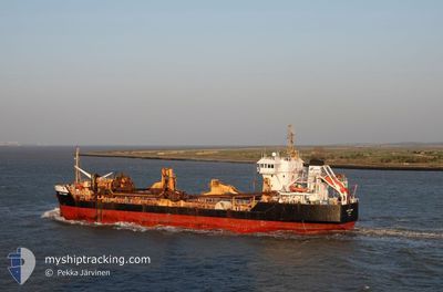
SAND FULMAR
Trailing Suction Hopper Dredger
Current Trip
===DREDGEA514>GBCHN
| Time Travelled | 1 day |
|---|---|
| Remaining Time | --- |
| Distance Travelled | 270.27 nm |
| Remaining Distance | --- |
| AVG Speed | 11 Knots |
| MAX Speed | 13 Knots |
| AVG Wind | 5 knots |
| MAX Wind | 10.8 knots |
| MIN Temp | 10.8°C / 51.44°F |
| MAX Temp | 14.5°C / 58.1°F |
| Draught | 7.2 m |
| Position Received | Now |
Current Position
| Longitude | 1.48693° |
|---|---|
| Latitude | 51.42978° |
| Status | Under way using engine |
| Speed | 8.2 Knots |
| Course | 245° |
| Area | North Sea |
| Station | T-AIS |
| Position Received | Now |
Info
Information
The current position of SAND FULMAR is in North Sea with coordinates 51.42978° / 1.48693° as reported on 2024-05-16 20:05 by AIS to our vessel tracker app. The vessel's current speed is 8.2 Knots
The vessel SAND FULMAR (IMO: 9174127, MMSI: 232003580) is a Trailing Suction Hopper Dredger that was built in 1998 ( 26 years old ). It's sailing under the flag of [GB] United Kingdom.
In this page you can find informations about the vessels current position, last detected port calls, and current voyage information. If the vessels is not in coverage by AIS you will find the latest position.
The current position of SAND FULMAR is detected by our AIS receivers and we are not responsible for the reliability of the data. The last position was recorded while the vessel was in Coverage by the Ais receivers of our vessel tracking app.
The current draught of SAND FULMAR as reported by AIS is 7.2 meters
Weather
| Temperature | 13.7°C / 56.66°F |
|---|---|
| Wind Speed | 4 knots |
| Direction | 189° S |
| Pressure | 1006.2 hPa |
| Humidity | 83.8 % |
| Cloud Coverage | 9 % |
Featured Company
Last Port Calls
| Port | Arrival | Departure | Time In Port |
|---|---|---|---|
| 2024-05-14 06:00 | 2024-05-15 17:43 | 1 d | |
| 2024-05-07 10:04 | 2024-05-07 16:51 | 6 h | |
| 2024-04-30 05:02 | 2024-04-30 12:37 | 7 h | |
| 2024-04-22 08:34 | 2024-04-25 14:08 | 3 d | |
| 2024-04-14 14:46 | 2024-04-17 08:10 | 2 d | |
| 2024-04-07 18:41 | 2024-04-10 12:34 | 2 d | |
| 2024-04-03 03:59 | 2024-04-03 17:30 | 13 h | |
| 2024-04-03 03:45 | 2024-04-03 03:49 | 3 m | |
| 2024-03-28 08:06 | 2024-03-29 08:32 | 1 d | |
| 2024-03-28 00:44 | 2024-03-28 07:24 | 6 h |
Last Trips
| Origin | Departure | Destination | Arrival | Distance | |
|---|---|---|---|---|---|
| 2024-05-07 17:51 | 2024-05-14 07:00 | 1086.18 nm | |||
| 2024-04-30 13:37 | 2024-05-07 11:04 | 775.62 nm | |||
| 2024-04-25 15:08 | 2024-04-30 06:02 | 301.87 nm | |||
| 2024-04-17 10:10 | 2024-04-22 09:34 | 662.02 nm | |||
| 2024-04-10 13:34 | 2024-04-14 16:46 | 393.20 nm | |||
| 2024-04-03 18:30 | 2024-04-07 19:41 | 256.91 nm | |||
| 2024-04-03 04:49 | 2024-04-03 04:59 | 0.70 nm | |||
| 2024-03-29 08:32 | 2024-04-03 04:45 | 93.63 nm | |||
| 2024-03-28 07:24 | 2024-03-28 08:06 | 4.65 nm | |||
| 2024-03-24 20:35 | 2024-03-28 00:44 | 596.30 nm |
Events
| Time | Event | Details | Position / Dest | Info |
|---|---|---|---|---|
| 2024-05-16 15:00 | Status Changed | Under way using engine Default |
52.29819 / 1.82041
===DREDGEA514>GBCHN
|
Speed: 12.1 kn Course: 187° |
| 2024-05-16 14:53 | Status Changed | Default Under way using engine |
52.32439 / 1.82567
===DREDGEA514>GBCHN
|
Speed: 12 kn Course: 187° |
| 2024-05-16 09:25 | Draught Changed | 7.2 5 |
53.11599 / .95163
===DREDGEA514>GBCHN
|
Speed: 10.3 kn Course: 131.2° |
| 2024-05-16 09:25 | Destination Changed | ===DREDGEA514>GBCHN GB TYN>===DREDGEA514 |
53.11599 / .95163
===DREDGEA514>GBCHN
|
Speed: 10.3 kn Course: 131.2° |
| 2024-05-16 09:25 | ETA Changed | 2024/05/17 07:30 2024/05/16 04:00 |
53.11599 / .95163
===DREDGEA514>GBCHN
|
Speed: 10.3 kn Course: 131.2° |
| 2024-05-16 08:42 | Status Changed | Under way using engine Default |
53.20040 / .80543
GB TYN>===DREDGEA514
|
Speed: 10.2 kn Course: 132° |
| 2024-05-16 08:37 | IN Coverage |
53.20040 / .80543
North Sea
GB TYN>===DREDGEA514
|
Speed: 10.2 kn Course: 132° |
|
| 2024-05-16 04:57 | Status Changed | Default Restricted manoeuverability |
53.60408 / .30923
GB TYN>===DREDGEA514
|
Speed: 1.7 kn Course: 259° |
| 2024-05-16 04:49 | OUT of Coverage |
53.60077 / .30846
North Sea
GB TYN>===DREDGEA514
|
Speed: 1.7 kn Course: 229° |
|
| 2024-05-16 04:45 | Status Changed | Restricted manoeuverability Default |
53.60246 / .31059
GB TYN>===DREDGEA514
|
Speed: 1.7 kn Course: 211° |