
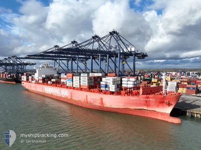
SANTA CATARINA
Container Ship
Current Trip
| Time Travelled | 7 days |
|---|---|
| Remaining Time | 1 day |
| Distance Travelled | 2082.29 nm |
| Remaining Distance | 569.99 nm |
| AVG Speed | 14.4 Knots |
| MAX Speed | 20.5 Knots |
| AVG Wind | 9.4 knots |
| MAX Wind | 22 knots |
| MIN Temp | 18.9°C / 66.02°F |
| MAX Temp | 33°C / 91.4°F |
| Draught | 13 m |
| Position Received | Now |
Current Position
| Longitude | 5.95875° |
|---|---|
| Latitude | 37.83963° |
| Status | Under way using engine |
| Speed | 19.3 Knots |
| Course | 262° |
| Area | Mediterranean Sea - Western Basin |
| Station | T-AIS |
| Position Received | Now |
Info
Information
The current position of SANTA CATARINA is in Mediterranean Sea - Western Basin with coordinates 37.83963° / 5.95875° as reported on 2024-05-27 01:24 by AIS to our vessel tracker app. The vessel's current speed is 19.3 Knots and is heading at the port of TANGER MED. The estimated time of arrival as calculated by vessel tracking app is 2024-05-28 06:47 LT
The vessel SANTA CATARINA (IMO: 9444730, MMSI: 219072000) is a Container Ship that was built in 2011 ( 13 years old ). It's sailing under the flag of [DK] Denmark.
In this page you can find informations about the vessels current position, last detected port calls, and current voyage information. If the vessels is not in coverage by AIS you will find the latest position.
The current position of SANTA CATARINA is detected by our AIS receivers and we are not responsible for the reliability of the data. The last position was recorded while the vessel was in Coverage by the Ais receivers of our vessel tracking app.
The current draught of SANTA CATARINA as reported by AIS is 13 meters
Weather
| Temperature | 20.7°C / 69.26°F |
|---|---|
| Wind Speed | 16 knots |
| Direction | 118° ESE |
| Pressure | 1015.9 hPa |
| Humidity | 79.7 % |
| Cloud Coverage | 9 % |
Featured Company
Last Port Calls
| Port | Arrival | Departure | Time In Port |
|---|---|---|---|
| 2024-05-22 01:42 | 2024-05-23 16:18 | 1 d | |
| 2024-05-19 07:21 | 2024-05-19 15:33 | 8 h | |
| 2024-05-17 07:36 | 2024-05-18 14:55 | 1 d | |
| 2024-05-15 06:47 | 2024-05-15 15:27 | 8 h | |
| 2024-05-14 04:11 | 2024-05-14 22:07 | 17 h | |
| 2024-05-07 22:19 | 2024-05-08 19:09 | 20 h | |
| 2024-04-27 03:05 | 2024-04-28 17:24 | 1 d | |
| 2024-04-23 22:24 | 2024-04-24 10:36 | 12 h | |
| 2024-04-21 21:07 | 2024-04-23 16:12 | 1 d | |
| 2024-04-19 05:14 | 2024-04-20 11:43 | 1 d |
Most Visited Ports (Last year)
| Port | Arrivals | |
|---|---|---|
| 16 | ||
| 7 | ||
| 7 | ||
| 6 | ||
| 6 | ||
| 4 |
Last Trips
| Origin | Departure | Destination | Arrival | Distance | |
|---|---|---|---|---|---|
| 2024-05-19 18:33 | 2024-05-22 03:42 | 606.60 nm | |||
| 2024-05-18 17:55 | 2024-05-19 10:21 | 95.77 nm | |||
| 2024-05-08 20:09 | 2024-05-17 10:36 | 2716.66 nm | |||
| 2024-05-08 20:09 | 2024-05-15 08:47 | 1999.61 nm | |||
| 2024-05-08 20:09 | 2024-05-14 06:11 | 1961.63 nm | |||
| 2024-04-24 13:36 | 2024-05-07 23:19 | 2747.71 nm | |||
| 2024-04-24 13:36 | 2024-04-27 05:05 | 610.70 nm | |||
| 2024-04-23 19:12 | 2024-04-24 01:24 | 86.19 nm | |||
| 2024-04-14 01:20 | 2024-04-22 00:07 | 2678.80 nm | |||
| 2024-04-14 01:20 | 2024-04-19 07:14 | 1959.71 nm |
Events
| Time | Event | Details | Position / Dest | Info |
|---|---|---|---|---|
| 2024-05-27 00:25 | Status Changed | Under way using engine Default |
37.88223 / 6.35126
EGPSD>MAPTM
|
Speed: 19.3 kn Course: 265° |
| 2024-05-27 00:21 | Status Changed | Default Under way using engine |
37.88441 / 6.38089
EGPSD>MAPTM
|
Speed: 19.2 kn Course: 264.8° |
| 2024-05-26 22:26 | Status Changed | Under way using engine Default |
37.95912 / 7.16066
EGPSD>MAPTM
|
Speed: 19.5 kn Course: 264° |
| 2024-05-26 22:13 | Status Changed | Default Under way using engine |
37.96587 / 7.24607
EGPSD>MAPTM
|
Speed: 19.7 kn Course: 264.8° |
| 2024-05-26 20:55 | Change Sea Area | Algerian part of the Mediterranean Sea - Western Basin Italian part of the Mediterranean Sea - Western Basin |
38.00793 / 7.77948
Mediterranean Sea - Western Basin
EGPSD>MAPTM
|
Speed: 19.5 kn Course: 260.4° |
| 2024-05-26 20:29 | Change Sea Area | Italian part of the Mediterranean Sea - Western Basin Tunisian part of the Mediterranean Sea - Western Basin |
38.03084 / 7.95501
Mediterranean Sea - Western Basin
EGPSD>MAPTM
|
Speed: 19.6 kn Course: 261.2° |
| 2024-05-26 19:14 | Status Changed | Under way using engine Under way sailing |
38.08350 / 8.45435
EGPSD>MAPTM
|
Speed: 9.6 kn Course: 137.9° |
| 2024-05-26 19:13 | Status Changed | Under way sailing Default |
38.08445 / 8.46417
EGPSD>MAPTM
|
Speed: 18.7 kn Course: 263° |
| 2024-05-26 19:09 | Status Changed | Default Under way using engine |
38.08683 / 8.48836
EGPSD>MAPTM
|
Speed: 18.6 kn Course: 262.6° |
| 2024-05-26 17:08 | Status Changed | Under way using engine Default |
38.13255 / 9.27949
EGPSD>MAPTM
|
Speed: 18.8 kn Course: 273° |