
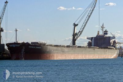
SANTA CRUZ
Bulk Carrier
Current Trip
| Time Travelled | 2 days |
|---|---|
| Remaining Time | 28 days |
| Distance Travelled | 780.35 nm |
| Remaining Distance | 8240.97 nm |
| AVG Speed | 12.2 Knots |
| MAX Speed | 13.3 Knots |
| AVG Wind | 15.2 knots |
| MAX Wind | 21 knots |
| MIN Temp | 20.6°C / 69.08°F |
| MAX Temp | 31.6°C / 88.88°F |
| Draught | 13.1 m |
| Position Received | 1 d ago |
Current Position
| Longitude | -43.36890° |
|---|---|
| Latitude | -26.39425° |
| Status | Under way using engine |
| Speed | 11.7 Knots |
| Course | 115° |
| Area | South Atlantic Ocean |
| Station | T-AIS |
| Position Received | 1 d ago |
Info
Information
The current position of SANTA CRUZ is in South Atlantic Ocean with coordinates -26.39425° / -43.36890° as reported on 2024-05-02 10:11 by AIS to our vessel tracker app. The vessel's current speed is 11.7 Knots and is heading at the port of SINGAPORE. The estimated time of arrival as calculated by vessel tracking app is 2024-06-02 01:47 LT
The vessel SANTA CRUZ (IMO: 9287170, MMSI: 636016671) is a Bulk Carrier that was built in 2005 ( 19 years old ). It's sailing under the flag of [LR] Liberia.
In this page you can find informations about the vessels current position, last detected port calls, and current voyage information. If the vessels is not in coverage by AIS you will find the latest position.
The current position of SANTA CRUZ is detected by our AIS receivers and we are not responsible for the reliability of the data. The last position was recorded while the vessel was in Coverage by the Ais receivers of our vessel tracking app.
The current draught of SANTA CRUZ as reported by AIS is 13.1 meters
Weather
| Temperature | 20.7°C / 69.26°F |
|---|---|
| Wind Speed | 13 knots |
| Direction | 164° SSE |
| Pressure | 1017.6 hPa |
| Humidity | 74.2 % |
| Cloud Coverage | 73 % |
Featured Company
Last Trips
Events
| Time | Event | Details | Position / Dest | Info |
|---|---|---|---|---|
| 2024-05-02 10:14 | Status Changed | Default Under way using engine |
-26.39885 / -43.35773
BRSSZ > SGSIN
|
Speed: 11.7 kn Course: 115° |
| 2024-05-02 10:11 | OUT of Coverage |
-26.39425 / -43.36890
South Atlantic Ocean
BRSSZ > SGSIN
|
Speed: 11.7 kn Course: 115° |
|
| 2024-05-02 10:05 | Status Changed | Under way using engine Default |
-26.38640 / -43.38748
BRSSZ > SGSIN
|
Speed: 11.7 kn Course: 114° |
| 2024-05-02 10:05 | IN Coverage |
-26.38690 / -43.38638
South Atlantic Ocean
BRSSZ > SGSIN
|
Speed: 11.7 kn Course: 116° |
|
| 2024-05-01 22:14 | Destination Changed | BRSSZ > SGSIN SINGAPORE |
-25.09298 / -45.66733
BRSSZ > SGSIN
|
Speed: 12.8 kn Course: 139° |
| 2024-05-01 22:14 | ETA Changed | 2024/06/01 03:09 2024/05/30 03:09 |
-25.09298 / -45.66733
BRSSZ > SGSIN
|
Speed: 12.8 kn Course: 139° |
| 2024-05-01 15:05 | Status Changed | Default Under way using engine |
-24.00387 / -46.33523
SINGAPORE
|
Speed: 8.5 kn Course: 223° |
| 2024-05-01 15:05 | PORT DEPARTURE |
|
-24.00387 / -46.33523
SINGAPORE
|
Speed: 8.5 kn Course: 223° |
| 2024-05-01 15:01 | Status Changed | Under way using engine Default |
-23.99505 / -46.32847
[BR] SANTOS
|
Speed: 8.9 kn Course: 264° |
| 2024-05-01 15:01 | OUT of Coverage |
-23.99505 / -46.32847
South Atlantic Ocean
SINGAPORE
|
Speed: 8.5 kn Course: 233° |