
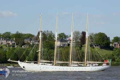
SANTA MARIA MANUELA
Sailing Vessel
Current Trip
| Time Travelled | 1 day |
|---|---|
| Remaining Time | --- |
| Distance Travelled | 76.84 nm |
| Remaining Distance | --- |
| AVG Speed | 5.9 Knots |
| MAX Speed | 6.6 Knots |
| AVG Wind | 12.7 knots |
| MAX Wind | 14.9 knots |
| MIN Temp | 15.9°C / 60.62°F |
| MAX Temp | 16.5°C / 61.7°F |
| Draught | 4.4 m |
| Position Received | 15 h, 0 m ago |
Current Position
| Longitude | -9.38845° |
|---|---|
| Latitude | 41.34052° |
| Status | Under way using engine |
| Speed | 6.4 Knots |
| Course | 349.8° |
| Area | North Atlantic Ocean |
| Station | T-AIS |
| Position Received | 15 h, 0 m ago |
Info
Information
The current position of SANTA MARIA MANUELA is in North Atlantic Ocean with coordinates 41.34052° / -9.38845° as reported on 2024-06-15 23:05 by AIS to our vessel tracker app. The vessel's current speed is 6.4 Knots
The vessel SANTA MARIA MANUELA (IMO: 5312628, MMSI: 255806006) is a Sailing Vessel that was built in 1937 ( 87 years old ). It's sailing under the flag of [PT] Portugal.
In this page you can find informations about the vessels current position, last detected port calls, and current voyage information. If the vessels is not in coverage by AIS you will find the latest position.
The current position of SANTA MARIA MANUELA is detected by our AIS receivers and we are not responsible for the reliability of the data. The last position was recorded while the vessel was in Coverage by the Ais receivers of our vessel tracking app.
The current draught of SANTA MARIA MANUELA as reported by AIS is 4.4 meters
Weather
| Temperature | 16.8°C / 62.24°F |
|---|---|
| Wind Speed | 7 knots |
| Direction | 287° WNW |
| Pressure | 1018.8 hPa |
| Humidity | 85.4 % |
| Cloud Coverage | 91 % |
Featured Company
Last Port Calls
| Port | Arrival | Departure | Time In Port |
|---|---|---|---|
| 2024-06-14 15:43 | 2024-06-15 10:13 | 18 h | |
| 2024-06-13 06:55 | 2024-06-14 09:40 | 1 d | |
| 2024-06-12 07:38 | 2024-06-12 20:29 | 12 h | |
| 2024-06-11 07:03 | 2024-06-11 18:34 | 11 h | |
| 2024-06-07 08:03 | 2024-06-08 16:43 | 1 d | |
| 2024-06-01 06:04 | 2024-06-02 16:13 | 1 d | |
| 2024-05-29 05:48 | 2024-05-29 15:23 | 9 h | |
| 2024-05-27 15:29 | |||
| 2024-05-23 07:11 | 2024-05-23 15:37 | 8 h | |
| 2024-05-19 08:52 | 2024-05-21 17:12 | 2 d |
Last Trips
| Origin | Departure | Destination | Arrival | Distance | |
|---|---|---|---|---|---|
| 2024-06-14 10:40 | 2024-06-14 16:43 | 34.91 nm | |||
| 2024-06-12 21:29 | 2024-06-13 07:55 | 33.66 nm | |||
| 2024-06-11 19:34 | 2024-06-12 08:38 | 34.36 nm | |||
| 2024-06-08 17:43 | 2024-06-11 08:03 | 217.27 nm | |||
| 2024-06-02 18:13 | 2024-06-07 09:03 | 428.50 nm | |||
| 2024-05-29 17:23 | 2024-06-01 08:04 | 254.34 nm | |||
| 2024-05-27 17:29 | 2024-05-29 07:48 | 164.48 nm | |||
| 2024-05-21 19:12 | 2024-05-23 09:11 | 169.39 nm | |||
| 2024-05-04 11:38 | 2024-05-13 08:30 | 686.92 nm | |||
| 2024-04-29 11:41 | 2024-05-02 08:26 | 248.14 nm |
Events
| Time | Event | Details | Position / Dest | Info |
|---|---|---|---|---|
| 2024-06-15 23:05 | OUT of Coverage |
41.34052 / -9.38845
North Atlantic Ocean
FRLRH
|
Speed: 6.4 kn Course: 349.8° |
|
| 2024-06-15 17:20 | IN Coverage |
40.78688 / -9.20171
North Atlantic Ocean
FRLRH
|
Speed: 5.6 kn Course: 344.8° |
|
| 2024-06-15 15:27 | OUT of Coverage |
40.61273 / -9.13377
North Atlantic Ocean
FRLRH
|
Speed: 6.1 kn Course: 343.3° |
|
| 2024-06-15 15:06 | IN Coverage |
40.57885 / -9.12101
North Atlantic Ocean
FRLRH
|
Speed: 5.9 kn Course: 345° |
|
| 2024-06-15 13:30 | OUT of Coverage |
40.42224 / -9.06209
North Atlantic Ocean
FRLRH
|
Speed: 6 kn Course: 341.3° |
|
| 2024-06-15 10:13 | PORT DEPARTURE |
|
40.14063 / -8.87875
FRLRH
|
Speed: 7.5 kn Course: 233° |
| 2024-06-15 10:02 | Status Changed | Under way using engine Moored |
40.14653 / -8.85449
[PT] FIGUEIRA DA FOZ
|
Speed: 3.4 kn Course: 265° |
| 2024-06-15 10:01 | START Moving |
40.14658 / -8.85406
[PT] FIGUEIRA DA FOZ
|
Speed: 3.1 kn Course: 264° |
|
| 2024-06-15 08:44 | ETA Changed | 2024/06/19 15:30 2024/06/19 16:30 |
40.14698 / -8.85254
[PT] FIGUEIRA DA FOZ
|
Speed: Course: 270° |
| 2024-06-15 08:38 | Destination Changed | FRLRH PT FDF |
40.14695 / -8.85254
[PT] FIGUEIRA DA FOZ
|
Speed: Course: 268° |