
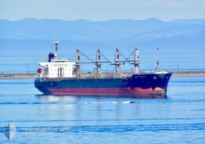
SANTA SERENA
General Cargo
Current Trip
CA CRO
| Time Travelled | 7 days |
|---|---|
| Remaining Time | --- |
| Distance Travelled | 1654.70 nm |
| Remaining Distance | --- |
| AVG Speed | 11 Knots |
| MAX Speed | 16.6 Knots |
| AVG Wind | 11.9 knots |
| MAX Wind | 24 knots |
| MIN Temp | 9.6°C / 49.28°F |
| MAX Temp | 25.5°C / 77.9°F |
| Draught | 6.8 m |
| Position Received | 2 d ago |
Current Position
| Longitude | 141.94097° |
|---|---|
| Latitude | 41.63487° |
| Status | Under way using engine |
| Speed | 11.4 Knots |
| Course | 84° |
| Area | North Pacific Ocean |
| Station | T-AIS |
| Position Received | 2 d ago |
Info
Information
The current position of SANTA SERENA is in North Pacific Ocean with coordinates 41.63487° / 141.94097° as reported on 2024-06-27 15:04 by AIS to our vessel tracker app. The vessel's current speed is 11.4 Knots
The vessel SANTA SERENA (IMO: 9527934, MMSI: 431256000) is a General Cargo that was built in 2011 ( 13 years old ). It's sailing under the flag of [JP] Japan.
In this page you can find informations about the vessels current position, last detected port calls, and current voyage information. If the vessels is not in coverage by AIS you will find the latest position.
The current position of SANTA SERENA is detected by our AIS receivers and we are not responsible for the reliability of the data. The last position was recorded while the vessel was in Coverage by the Ais receivers of our vessel tracking app.
The current draught of SANTA SERENA as reported by AIS is 6.8 meters
Weather
| Temperature | 10.2°C / 50.36°F |
|---|---|
| Wind Speed | 24 knots |
| Direction | 98° E |
| Pressure | 1007 hPa |
| Humidity | 97.7 % |
| Cloud Coverage | 100 % |
Featured Company
Last Port Calls
| Port | Arrival | Departure | Time In Port |
|---|---|---|---|
| 2024-06-21 02:33 | 2024-06-22 23:49 | 1 d | |
| 2024-06-11 22:50 | 2024-06-17 07:10 | 5 d | |
| 2024-06-05 02:11 | 2024-06-11 08:17 | 6 d | |
| 2024-06-01 21:42 | 2024-06-04 02:07 | 2 d | |
| 2024-05-05 20:58 | 2024-05-14 21:01 | 9 d | |
| 2024-04-16 06:06 | 2024-04-18 07:43 | 2 d | |
| 2024-04-09 23:28 | 2024-04-11 12:02 | 1 d |
Most Visited Ports (Last year)
| Port | Arrivals | |
|---|---|---|
| 4 | ||
| 4 | ||
| 2 | ||
| 2 | ||
| 2 | ||
| 2 |
Last Trips
| Origin | Departure | Destination | Arrival | Distance | |
|---|---|---|---|---|---|
| 2024-06-17 16:10 | 2024-06-21 11:33 | 223.18 nm | |||
| 2024-06-11 17:17 | 2024-06-12 07:50 | 117.67 nm | |||
| 2024-06-04 11:07 | 2024-06-05 11:11 | 289.80 nm | |||
| 2024-05-14 14:01 | 2024-06-02 06:42 | 4351.88 nm | |||
| 2024-04-18 15:43 | 2024-05-05 13:58 | 5223.38 nm | |||
| 2024-04-11 20:02 | 2024-04-16 14:06 | 438.74 nm | |||
| 2024-03-13 18:02 | 2024-04-10 07:28 | 5332.02 nm |
Events
| Time | Event | Details | Position / Dest | Info |
|---|---|---|---|---|
| 2024-06-27 15:10 | Status Changed | Default Under way using engine |
41.63686 / 141.96614
CA CRO
|
Speed: 11.4 kn Course: 84° |
| 2024-06-27 15:04 | OUT of Coverage |
41.63487 / 141.94097
North Pacific Ocean
CA CRO
|
Speed: 11.4 kn Course: 84° |
|
| 2024-06-27 15:03 | Status Changed | Under way using engine Default |
41.63481 / 141.94027
CA CRO
|
Speed: 11.4 kn Course: 80° |
| 2024-06-27 14:57 | Status Changed | Default Under way using engine |
41.63182 / 141.91306
CA CRO
|
Speed: 11.5 kn Course: 83.3° |
| 2024-06-27 14:55 | Status Changed | Under way using engine Default |
41.63074 / 141.90329
CA CRO
|
Speed: 11.7 kn Course: 86° |
| 2024-06-27 14:49 | Status Changed | Default Under way using engine |
41.62894 / 141.88135
CA CRO
|
Speed: 11.8 kn Course: 85.4° |
| 2024-06-27 14:45 | Status Changed | Under way using engine Default |
41.62780 / 141.86121
CA CRO
|
Speed: 11.7 kn Course: 86° |
| 2024-06-27 14:26 | Status Changed | Default Under way using engine |
41.62323 / 141.77805
CA CRO
|
Speed: 11.6 kn Course: 88.1° |
| 2024-06-27 12:43 | Change Sea Area | Japanese part of the North Pacific Ocean Japanese part of the Japan Sea |
41.61655 / 141.30078
North Pacific Ocean
CA CRO
|
Speed: 14.6 kn Course: 89.2° |
| 2024-06-27 11:41 | Status Changed | Under way using engine Default |
41.61439 / 140.94986
CA CRO
|
Speed: 14.7 kn Course: 92° |