
SANTA TERESA
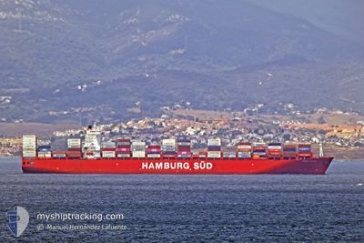
Container Ship
Current Trip
| Time Travelled | 6 days |
|---|---|
| Remaining Time | --- |
| Distance Travelled | 3208.69 nm |
| Remaining Distance | --- |
| AVG Speed | 19.6 Knots |
| MAX Speed | 21.4 Knots |
| AVG Wind | 14.5 knots |
| MAX Wind | 25.4 knots |
| MIN Temp | 15.5°C / 59.9°F |
| MAX Temp | 28.8°C / 83.84°F |
| Draught | 12.4 m |
| Position Received | 6 d ago |
Current Position
| Longitude | 17.94595° |
|---|---|
| Latitude | -33.48996° |
| Status | Under way using engine |
| Speed | 19.1 Knots |
| Course | 317.4° |
| Area | South Atlantic Ocean |
| Station | T-AIS |
| Position Received | 6 d ago |
Info
Information
The current position of SANTA TERESA is in South Atlantic Ocean with coordinates -33.48996° / 17.94595° as reported on 2024-05-10 16:09 by AIS to our vessel tracker app. The vessel's current speed is 19.1 Knots and is heading at the port of ROTTERDAM. The estimated time of arrival as calculated by vessel tracking app is 2024-05-24 02:00 LT
The vessel SANTA TERESA (IMO: 9430375, MMSI: 219088000) is a Container Ship that was built in 2011 ( 13 years old ). It's sailing under the flag of [DK] Denmark.
In this page you can find informations about the vessels current position, last detected port calls, and current voyage information. If the vessels is not in coverage by AIS you will find the latest position.
The current position of SANTA TERESA is detected by our AIS receivers and we are not responsible for the reliability of the data. The last position was recorded while the vessel was in Coverage by the Ais receivers of our vessel tracking app.
The current draught of SANTA TERESA as reported by AIS is 12.4 meters
Weather
| Temperature | 28°C / 82.4°F |
|---|---|
| Wind Speed | 10 knots |
| Direction | 351° N |
| Pressure | 1011.9 hPa |
| Humidity | 80.8 % |
| Cloud Coverage | 23 % |
Featured Company
Last Port Calls
| Port | Arrival | Departure | Time In Port |
|---|---|---|---|
| 2024-05-05 08:56 | 2024-05-10 13:50 | 5 d | |
| 2024-04-25 01:47 | 2024-04-29 07:25 | 4 d | |
| 2024-04-13 05:20 | 2024-04-15 22:34 | 2 d | |
| 2024-03-27 13:48 | 2024-03-28 05:33 | 15 h | |
| 2024-03-25 00:06 | 2024-03-25 17:23 | 17 h | |
| 2024-03-19 04:22 | 2024-03-20 16:11 | 1 d | |
| 2024-03-16 10:12 | 2024-03-17 18:22 | 1 d | |
| 2024-03-13 21:23 | 2024-03-15 07:35 | 1 d |
Last Trips
| Origin | Departure | Destination | Arrival | Distance | |
|---|---|---|---|---|---|
| 2024-04-29 09:25 | 2024-05-05 10:56 | 899.72 nm | |||
| 2024-04-16 00:34 | 2024-04-25 03:47 | 803.22 nm | |||
| 2024-03-28 06:33 | 2024-04-13 07:20 | 5648.92 nm | |||
| 2024-03-25 18:23 | 2024-03-27 14:48 | 15.86 nm | |||
| 2024-03-20 17:11 | 2024-03-25 01:06 | 1682.51 nm | |||
| 2024-03-17 18:22 | 2024-03-19 05:22 | 387.94 nm | |||
| 2024-03-15 08:35 | 2024-03-16 10:12 | 153.68 nm | |||
| 2024-02-21 15:19 | 2024-03-13 22:23 | 6324.60 nm |
Events
| Time | Event | Details | Position / Dest | Info |
|---|---|---|---|---|
| 2024-05-10 16:15 | Status Changed | Default Under way using engine |
-33.46548 / 17.91836
ZACPT>>>NLRTM
|
Speed: 19.1 kn Course: 317.4° |
| 2024-05-10 16:09 | Status Changed | Under way using engine Default |
-33.48996 / 17.94595
ZACPT>>>NLRTM
|
Speed: 18.5 kn Course: 314° |
| 2024-05-10 16:09 | OUT of Coverage |
-33.48996 / 17.94595
South Atlantic Ocean
ZACPT>>>NLRTM
|
Speed: 19.1 kn Course: 317.4° |
|
| 2024-05-10 16:07 | Status Changed | Default Under way using engine |
-33.49561 / 17.95243
ZACPT>>>NLRTM
|
Speed: 18.8 kn Course: 320.4° |
| 2024-05-10 15:53 | Status Changed | Under way using engine Default |
-33.54943 / 18.01485
ZACPT>>>NLRTM
|
Speed: 18.4 kn Course: 319° |
| 2024-05-10 15:51 | Status Changed | Default Under way using engine |
-33.55499 / 18.02123
ZACPT>>>NLRTM
|
Speed: 17.7 kn Course: 316° |
| 2024-05-10 13:50 | PORT DEPARTURE |
|
-33.89683 / 18.43644
ZACPT>>>NLRTM
|
Speed: 5.7 kn Course: 352° |
| 2024-05-10 13:39 | START Moving |
-33.91030 / 18.44393
[ZA] CAPE TOWN
|
Speed: 3.2 kn Course: 307° |
|
| 2024-05-10 13:02 | Status Changed | Under way using engine Moored |
-33.90777 / 18.44541
[ZA] CAPE TOWN
|
Speed: Course: 135° |
| 2024-05-10 10:19 | Draught Changed | 12.4 12.3 |
-33.90778 / 18.44542
[ZA] CAPE TOWN
|
Speed: Course: 135° |