
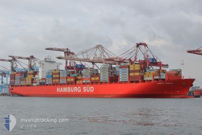
SANTA URSULA
Container Ship
Current Trip
| Time Travelled | 9 days |
|---|---|
| Remaining Time | 57 mins |
| Distance Travelled | 4412.84 nm |
| Remaining Distance | 941.18 nm |
| AVG Speed | 18.9 Knots |
| MAX Speed | 22.1 Knots |
| AVG Wind | 13 knots |
| MAX Wind | 30.9 knots |
| MIN Temp | 6.1°C / 42.98°F |
| MAX Temp | 23.3°C / 73.94°F |
| Draught | 13 m |
| Position Received | 8 d ago |
Current Position
| Longitude | -126.51631° |
|---|---|
| Latitude | 48.50144° |
| Status | Under way using engine |
| Speed | 19.1 Knots |
| Course | 270.9° |
| Area | North Pacific Ocean |
| Station | T-AIS |
| Position Received | 8 d ago |
Info
Information
The current position of SANTA URSULA is in North Pacific Ocean with coordinates 48.50144° / -126.51631° as reported on 2024-05-20 10:41 by AIS to our vessel tracker app. The vessel's current speed is 19.1 Knots and is heading at the port of YOKOHAMA. The estimated time of arrival as calculated by vessel tracking app is 2024-05-29 08:07 LT
The vessel SANTA URSULA (IMO: 9430387, MMSI: 219071000) is a Container Ship that was built in 2012 ( 12 years old ). It's sailing under the flag of [DK] Denmark.
In this page you can find informations about the vessels current position, last detected port calls, and current voyage information. If the vessels is not in coverage by AIS you will find the latest position.
The current position of SANTA URSULA is detected by our AIS receivers and we are not responsible for the reliability of the data. The last position was recorded while the vessel was in Coverage by the Ais receivers of our vessel tracking app.
The current draught of SANTA URSULA as reported by AIS is 13 meters
Weather
| Temperature | 21.8°C / 71.24°F |
|---|---|
| Wind Speed | 17 knots |
| Direction | 286° WNW |
| Pressure | 1010.3 hPa |
| Humidity | 81.1 % |
| Cloud Coverage | 100 % |
Featured Company
Last Port Calls
| Port | Arrival | Departure | Time In Port |
|---|---|---|---|
| 2024-05-16 02:45 | 2024-05-19 22:42 | 3 d | |
| 2024-05-10 05:21 | 2024-05-14 00:01 | 3 d | |
| 2024-05-10 04:44 | 2024-05-10 04:59 | 14 m | |
| 2024-04-30 04:50 | 2024-04-30 19:32 | 14 h | |
| 2024-04-27 05:54 | 2024-04-28 06:41 | 1 d | |
| 2024-04-23 14:50 | 2024-04-24 12:14 | 21 h | |
| 2024-04-17 09:12 | 2024-04-18 02:49 | 17 h | |
| 2024-04-13 16:15 | 2024-04-14 21:12 | 1 d | |
| 2024-03-27 23:11 | 2024-04-01 23:03 | 4 d | |
| 2024-03-10 22:03 | 2024-03-16 00:25 | 5 d |
Most Visited Ports (Last year)
| Port | Arrivals | |
|---|---|---|
| 8 | ||
| 5 | ||
| 4 | ||
| 4 | ||
| 4 | ||
| 3 |
Last Trips
| Origin | Departure | Destination | Arrival | Distance | |
|---|---|---|---|---|---|
| 2024-05-13 17:01 | 2024-05-15 19:45 | 677.50 nm | |||
| 2024-05-09 21:59 | 2024-05-09 22:21 | 0.90 nm | |||
| 2024-05-01 04:32 | 2024-05-09 21:44 | 3873.74 nm | |||
| 2024-04-28 15:41 | 2024-04-30 13:50 | 877.07 nm | |||
| 2024-04-24 20:14 | 2024-04-27 14:54 | 512.68 nm | |||
| 2024-04-18 10:49 | 2024-04-23 22:50 | 887.95 nm | |||
| 2024-04-15 06:12 | 2024-04-17 17:12 | 1166.57 nm | |||
| 2024-04-01 16:03 | 2024-04-14 01:15 | 4953.25 nm | |||
| 2024-03-15 17:25 | 2024-03-27 16:11 | 694.98 nm | |||
| 2024-03-10 14:32 | 2024-03-10 15:03 | 1.14 nm |
Events
| Time | Event | Details | Position / Dest | Info |
|---|---|---|---|---|
| 2024-05-20 10:45 | Status Changed | Default Under way using engine |
48.50167 / -126.54333
CAVAN>JPYOK
|
Speed: 19.1 kn Course: 270.9° |
| 2024-05-20 10:41 | OUT of Coverage |
48.50144 / -126.51631
North Pacific Ocean
CAVAN>JPYOK
|
Speed: 19.1 kn Course: 270.9° |
|
| 2024-05-20 09:51 | Status Changed | Under way using engine Default |
48.50290 / -126.11924
CAVAN>JPYOK
|
Speed: 18 kn Course: 268° |
| 2024-05-20 09:48 | Status Changed | Default Under way using engine |
48.50167 / -126.09167
CAVAN>JPYOK
|
Speed: 19 kn Course: 268° |
| 2024-05-20 09:20 | ETA Changed | 2024/05/29 09:00 2024/05/29 03:00 |
48.50638 / -125.87077
CAVAN>JPYOK
|
Speed: 19 kn Course: 269.4° |
| 2024-05-20 07:47 | Change Sea Area | Canadian part of the North Pacific Ocean Canadian part of the The Coastal Waters of Southeast Alaska and British Columbia |
48.50881 / -125.12416
North Pacific Ocean
CAVAN>JPYOK
|
Speed: 19.2 kn Course: 264.5° |
| 2024-05-20 07:47 | Status Changed | Under way using engine Default |
48.50881 / -125.12416
CAVAN>JPYOK
|
Speed: 19.4 kn Course: 271° |
| 2024-05-20 07:47 | IN Coverage |
48.50881 / -125.12416
North Pacific Ocean
CAVAN>JPYOK
|
Speed: 19.2 kn Course: 264.5° |
|
| 2024-05-20 05:51 | Status Changed | Default Under way using engine |
48.36531 / -124.20901
CAVAN>JPYOK
|
Speed: 20.3 kn Course: 294° |
| 2024-05-20 05:46 | OUT of Coverage |
48.35402 / -124.17129
The Coastal Waters of Southeast Alaska and British Columbia
CAVAN>JPYOK
|
Speed: 20.3 kn Course: 294° |