
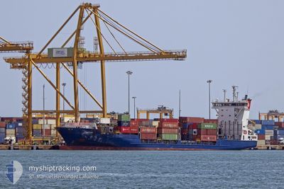
SANTUCA B
Container Ship
Current Trip
| Time Travelled | 1 day |
|---|---|
| Remaining Time | 1 day |
| Distance Travelled | 474.92 nm |
| Remaining Distance | 676.99 nm |
| AVG Speed | 14.2 Knots |
| MAX Speed | 16.5 Knots |
| AVG Wind | 10.5 knots |
| MAX Wind | 23 knots |
| MIN Temp | 16.6°C / 61.88°F |
| MAX Temp | 19.7°C / 67.46°F |
| Draught | 7.5 m |
| Position Received | 14 h, 40 m ago |
Current Position
| Longitude | -5.86609° |
|---|---|
| Latitude | 35.95166° |
| Status | Under way using engine |
| Speed | 15.5 Knots |
| Course | 268° |
| Area | Strait of Gibraltar |
| Station | T-AIS |
| Position Received | 14 h, 40 m ago |
Info
Information
The current position of SANTUCA B is in Strait of Gibraltar with coordinates 35.95166° / -5.86609° as reported on 2024-05-18 19:18 by AIS to our vessel tracker app. The vessel's current speed is 15.5 Knots and is heading at the port of LAS PALMAS. The estimated time of arrival as calculated by vessel tracking app is 2024-05-20 19:51 LT
The vessel SANTUCA B (IMO: 9287687, MMSI: 255805627) is a Container Ship that was built in 2003 ( 21 years old ). It's sailing under the flag of [PT] Portugal.
In this page you can find informations about the vessels current position, last detected port calls, and current voyage information. If the vessels is not in coverage by AIS you will find the latest position.
The current position of SANTUCA B is detected by our AIS receivers and we are not responsible for the reliability of the data. The last position was recorded while the vessel was in Coverage by the Ais receivers of our vessel tracking app.
The current draught of SANTUCA B as reported by AIS is 7.5 meters
Weather
| Temperature | 17.2°C / 62.96°F |
|---|---|
| Wind Speed | 11 knots |
| Direction | 347° NNW |
| Pressure | 1014.1 hPa |
| Humidity | 66.9 % |
| Cloud Coverage | 99 % |
Featured Company
Last Port Calls
| Port | Arrival | Departure | Time In Port |
|---|---|---|---|
| 2024-05-17 05:00 | 2024-05-17 20:27 | 15 h | |
| 2024-05-13 06:45 | 2024-05-14 02:51 | 20 h | |
| 2024-05-13 00:09 | 2024-05-13 03:19 | 3 h | |
| 2024-05-10 05:24 | 2024-05-11 03:45 | 22 h | |
| 2024-05-07 20:02 | 2024-05-07 23:17 | 3 h | |
| 2024-05-07 06:25 | 2024-05-07 13:02 | 6 h | |
| 2024-05-06 18:22 | 2024-05-07 00:41 | 6 h | |
| 2024-05-03 04:14 | 2024-05-03 21:33 | 17 h | |
| 2024-04-29 07:30 | 2024-04-30 01:16 | 17 h | |
| 2024-04-28 23:44 | 2024-04-29 04:05 | 4 h |
Last Trips
| Origin | Departure | Destination | Arrival | Distance | |
|---|---|---|---|---|---|
| 2024-05-14 03:51 | 2024-05-17 07:00 | 1019.34 nm | |||
| 2024-05-13 04:19 | 2024-05-13 07:45 | 53.70 nm | |||
| 2024-05-11 05:45 | 2024-05-13 01:09 | 704.10 nm | |||
| 2024-05-08 00:17 | 2024-05-10 07:24 | 750.35 nm | |||
| 2024-05-07 14:02 | 2024-05-07 21:02 | 100.38 nm | |||
| 2024-05-07 01:41 | 2024-05-07 07:25 | 54.12 nm | |||
| 2024-05-03 23:33 | 2024-05-06 19:22 | 1014.26 nm | |||
| 2024-04-30 02:16 | 2024-05-03 06:14 | 1012.44 nm | |||
| 2024-04-29 05:05 | 2024-04-29 08:30 | 53.62 nm | |||
| 2024-04-27 06:29 | 2024-04-29 00:44 | 701.97 nm |
Events
| Time | Event | Details | Position / Dest | Info |
|---|---|---|---|---|
| 2024-05-18 19:27 | Status Changed | Default Under way using engine |
35.95131 / -5.90918
ESLPA
|
Speed: 15.5 kn Course: 268° |
| 2024-05-18 19:18 | OUT of Coverage |
35.95166 / -5.86609
Strait of Gibraltar
ESLPA
|
Speed: 15.5 kn Course: 268° |
|
| 2024-05-18 19:12 | Status Changed | Under way using engine Default |
35.95229 / -5.83368
ESLPA
|
Speed: 15.5 kn Course: 268° |
| 2024-05-18 19:11 | Status Changed | Default Under way using engine |
35.95265 / -5.82419
ESLPA
|
Speed: 15.7 kn Course: 267° |
| 2024-05-18 19:01 | Status Changed | Under way using engine Default |
35.95494 / -5.77160
ESLPA
|
Speed: 15.7 kn Course: 267° |
| 2024-05-18 18:58 | Status Changed | Default Under way using engine |
35.95529 / -5.75957
ESLPA
|
Speed: 15.6 kn Course: 269.9° |
| 2024-05-18 18:44 | Status Changed | Under way using engine Default |
35.95693 / -5.68118
ESLPA
|
Speed: 15 kn Course: 269° |
| 2024-05-18 18:38 | Status Changed | Default Under way using engine |
35.95717 / -5.65393
ESLPA
|
Speed: 14.5 kn Course: 260° |
| 2024-05-18 17:29 | Change Sea Area | Spanish part of the Strait of Gibraltar Gibraltarian part of the Alboran Sea |
36.01125 / -5.34676
Strait of Gibraltar
ESLPA
|
Speed: 12.4 kn Course: 254.4° |
| 2024-05-18 17:12 | Status Changed | Under way using engine Default |
36.02634 / -5.27776
ESLPA
|
Speed: 12.6 kn Course: 254° |