
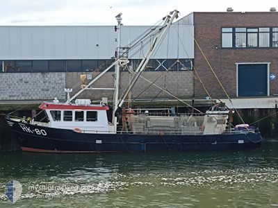
SARA HK80
Fishing
Current Trip
FISHING GROUNDS
| Time Travelled | 2 days |
|---|---|
| Remaining Time | --- |
| Distance Travelled | 170.95 nm |
| Remaining Distance | --- |
| AVG Speed | 4.3 Knots |
| MAX Speed | 10 Knots |
| AVG Wind | 11.8 knots |
| MAX Wind | 19.8 knots |
| MIN Temp | 12.9°C / 55.22°F |
| MAX Temp | 15.1°C / 59.18°F |
| Draught | 2 m |
| Position Received | 43 m ago |
Current Position
| Longitude | 5.62922° |
|---|---|
| Latitude | 53.40680° |
| Status | Under way using engine |
| Speed | 2.9 Knots |
| Course | 159° |
| Area | North Sea |
| Station | T-AIS |
| Position Received | 43 m ago |
Info
Information
The current position of SARA HK80 is in North Sea with coordinates 53.40680° / 5.62922° as reported on 2024-05-28 23:49 by AIS to our vessel tracker app. The vessel's current speed is 2.9 Knots
The vessel SARA HK80 (MMSI: 244710206) is a Fishing It's sailing under the flag of [NL] Netherlands.
In this page you can find informations about the vessels current position, last detected port calls, and current voyage information. If the vessels is not in coverage by AIS you will find the latest position.
The current position of SARA HK80 is detected by our AIS receivers and we are not responsible for the reliability of the data. The last position was recorded while the vessel was in Coverage by the Ais receivers of our vessel tracking app.
The current draught of SARA HK80 as reported by AIS is 2 meters
Weather
| Temperature | 14.2°C / 57.56°F |
|---|---|
| Wind Speed | 21 knots |
| Direction | 194° SSW |
| Pressure | 1008.8 hPa |
| Humidity | 96.7 % |
| Cloud Coverage | 100 % |
Featured Company
Last Port Calls
| Port | Arrival | Departure | Time In Port |
|---|---|---|---|
| 2024-05-24 06:13 | 2024-05-26 22:02 | 2 d | |
| 2024-05-20 08:03 | 2024-05-20 16:44 | 8 h | |
| 2024-05-17 09:29 | 2024-05-20 05:55 | 2 d | |
| 2024-05-16 05:17 | 2024-05-17 07:39 | 1 d | |
| 2024-05-14 23:49 | 2024-05-15 00:08 | 19 m | |
| 2024-05-09 10:54 | 2024-05-12 21:59 | 3 d | |
| 2024-05-08 11:15 | 2024-05-08 11:21 | 5 m | |
| 2024-05-03 05:14 | 2024-05-05 21:59 | 2 d | |
| 2024-04-30 23:35 | 2024-04-30 23:54 | 18 m | |
| 2024-04-30 16:28 | 2024-04-30 16:33 | 5 m |
Last Trips
| Origin | Departure | Destination | Arrival | Distance | |
|---|---|---|---|---|---|
| 2024-05-20 18:44 | 2024-05-24 08:13 | 287.00 nm | |||
| 2024-05-20 07:55 | 2024-05-20 10:03 | 17.32 nm | |||
| 2024-05-17 09:39 | 2024-05-17 11:29 | 16.69 nm | |||
| 2024-05-15 02:08 | 2024-05-16 07:17 | 100.34 nm | |||
| 2024-05-12 23:59 | 2024-05-15 01:49 | 164.92 nm | |||
| 2024-05-08 13:21 | 2024-05-09 12:54 | 62.58 nm | |||
| 2024-05-05 23:59 | 2024-05-08 13:15 | 166.48 nm | |||
| 2024-05-01 01:54 | 2024-05-03 07:14 | 148.41 nm | |||
| 2024-04-30 18:33 | 2024-05-01 01:35 | 15.63 nm | |||
| 2024-04-28 23:59 | 2024-04-30 18:28 | 143.32 nm |
Events
| Time | Event | Details | Position / Dest | Info |
|---|---|---|---|---|
| 2024-05-28 23:24 | IN Coverage |
53.42286 / 5.61135
North Sea
|
Speed: 3.1 kn Course: 151.1° |
|
| 2024-05-28 19:57 | OUT of Coverage |
53.42663 / 5.60799
North Sea
|
Speed: 5.8 kn Course: 326.7° |
|
| 2024-05-28 11:53 | START Moving | 2.88 nm, South East of AMELAND |
53.40174 / 5.80290
FISHING GROUNDS
|
Speed: 4 kn Course: 25° |
| 2024-05-28 11:52 | STOP Moving | 2.97 nm, South East of AMELAND |
53.39991 / 5.80347
FISHING GROUNDS
|
Speed: 0.3 kn Course: 315° |
| 2024-05-28 08:46 | START Moving | 2.37 nm, South of AMELAND |
53.39664 / 5.74390
FISHING GROUNDS
|
Speed: 5.1 kn Course: 272.4° |
| 2024-05-28 08:45 | STOP Moving | 2.37 nm, South of AMELAND |
53.39670 / 5.74746
FISHING GROUNDS
|
Speed: 0.2 kn Course: 273° |
| 2024-05-28 05:59 | START Moving | 5.03 nm, West of AMELAND |
53.43868 / 5.60713
FISHING GROUNDS
|
Speed: 4.3 kn Course: 154° |
| 2024-05-28 05:57 | STOP Moving | 5.08 nm, West of AMELAND |
53.44024 / 5.60561
FISHING GROUNDS
|
Speed: 0.3 kn Course: 152° |
| 2024-05-28 04:47 | START Moving | 4.88 nm, West of AMELAND |
53.43642 / 5.61113
FISHING GROUNDS
|
Speed: 5.2 kn Course: 149.3° |
| 2024-05-28 04:45 | STOP Moving | 4.95 nm, West of AMELAND |
53.43804 / 5.60917
FISHING GROUNDS
|
Speed: 0.3 kn Course: 134° |