
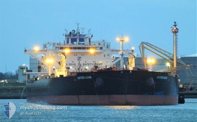
SATURN MOON
Tanker
Current Trip
| Time Travelled | 16 days |
|---|---|
| Remaining Time | 5 days |
| Distance Travelled | 2680.48 nm |
| Remaining Distance | 1523.53 nm |
| AVG Speed | 10.8 Knots |
| MAX Speed | 10.8 Knots |
| AVG Wind | 9.5 knots |
| MAX Wind | 24 knots |
| MIN Temp | 8.9°C / 48.02°F |
| MAX Temp | 25°C / 77°F |
| Draught | 15.7 m |
| Position Received | 21 h, 12 m ago |
Current Position
| Longitude | 2.02322° |
|---|---|
| Latitude | 37.21056° |
| Status | Under way using engine |
| Speed | 12.3 Knots |
| Course | 254.6° |
| Area | Mediterranean Sea - Western Basin |
| Station | T-AIS |
| Position Received | 21 h, 12 m ago |
Info
Information
The current position of SATURN MOON is in Mediterranean Sea - Western Basin with coordinates 37.21056° / 2.02322° as reported on 2024-05-23 22:49 by AIS to our vessel tracker app. The vessel's current speed is 12.3 Knots and is heading at the port of ROTTERDAM. The estimated time of arrival as calculated by vessel tracking app is 2024-05-30 00:52 LT
The vessel SATURN MOON (IMO: 9814430, MMSI: 636019541) is a Tanker It's sailing under the flag of [LR] Liberia.
In this page you can find informations about the vessels current position, last detected port calls, and current voyage information. If the vessels is not in coverage by AIS you will find the latest position.
The current position of SATURN MOON is detected by our AIS receivers and we are not responsible for the reliability of the data. The last position was recorded while the vessel was in Coverage by the Ais receivers of our vessel tracking app.
The current draught of SATURN MOON as reported by AIS is 15.7 meters
Weather
| Temperature | 18.9°C / 66.02°F |
|---|---|
| Wind Speed | 1 knots |
| Direction | 95° E |
| Pressure | 1015.8 hPa |
| Humidity | 82 % |
| Cloud Coverage | --- |
Featured Company
Most Visited Ports (Last year)
| Port | Arrivals | |
|---|---|---|
| 3 | ||
| 2 | ||
| 2 | ||
| 2 | ||
| 1 | ||
| 1 |
Last Trips
Events
| Time | Event | Details | Position / Dest | Info |
|---|---|---|---|---|
| 2024-05-23 22:57 | Status Changed | Default Under way using engine |
37.20256 / 1.99400
NLRTM
|
Speed: 12.3 kn Course: 254.6° |
| 2024-05-23 22:49 | Status Changed | Under way using engine Default |
37.21056 / 2.02322
NLRTM
|
Speed: 12.3 kn Course: 248° |
| 2024-05-23 22:49 | OUT of Coverage |
37.21056 / 2.02322
Mediterranean Sea - Western Basin
NLRTM
|
Speed: 12.3 kn Course: 254.6° |
|
| 2024-05-23 22:33 | Status Changed | Default Under way using engine |
37.23139 / 2.09114
NLRTM
|
Speed: 12.2 kn Course: 248.5° |
| 2024-05-23 22:26 | Status Changed | Under way using engine Default |
37.23972 / 2.11775
NLRTM
|
Speed: 12.3 kn Course: 249° |
| 2024-05-23 21:53 | Status Changed | Default Under way using engine |
37.27850 / 2.25320
NLRTM
|
Speed: 12.4 kn Course: 251.6° |
| 2024-05-23 20:03 | Draught Changed | 15.7 15 |
37.36437 / 2.71663
NLRTM
|
Speed: 12.5 kn Course: 263.2° |
| 2024-05-23 20:03 | ETA Changed | 2024/05/30 01:00 |
37.36437 / 2.71663
NLRTM
|
Speed: 12.5 kn Course: 263.2° |
| 2024-05-23 19:45 | Draught Changed | 15 15.7 |
37.37230 / 2.79405
NLRTM
|
Speed: 11.9 kn Course: 262° |
| 2024-05-23 17:52 | Status Changed | Under way using engine Default |
37.41198 / 3.26791
NLRTM
|
Speed: 11.8 kn Course: 264° |