
SAVA
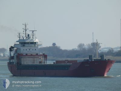
General Cargo
Current Trip
| Time Travelled | 2 days |
|---|---|
| Remaining Time | --- |
| Distance Travelled | 688.41 nm |
| Remaining Distance | --- |
| AVG Speed | 11.6 Knots |
| MAX Speed | 15.4 Knots |
| AVG Wind | 16.8 knots |
| MAX Wind | 24.9 knots |
| MIN Temp | 10.3°C / 50.54°F |
| MAX Temp | 16.8°C / 62.24°F |
| Draught | 4.9 m |
| Position Received | 5 h, 33 m ago |
Current Position
| Longitude | -10.33710° |
|---|---|
| Latitude | 51.43464° |
| Status | Under way using engine |
| Speed | 9.1 Knots |
| Course | 307.9° |
| Area | North Atlantic Ocean |
| Station | T-AIS |
| Position Received | 5 h, 33 m ago |
Info
Information
The current position of SAVA is in North Atlantic Ocean with coordinates 51.43464° / -10.33710° as reported on 2024-06-02 23:45 by AIS to our vessel tracker app. The vessel's current speed is 9.1 Knots and is heading at the port of AUGHINISH. The estimated time of arrival as calculated by vessel tracking app is 2024-06-03 15:00 LT
The vessel SAVA (IMO: 9158082, MMSI: 314661000) is a General Cargo that was built in 1999 ( 25 years old ). It's sailing under the flag of [BB] Barbados.
In this page you can find informations about the vessels current position, last detected port calls, and current voyage information. If the vessels is not in coverage by AIS you will find the latest position.
The current position of SAVA is detected by our AIS receivers and we are not responsible for the reliability of the data. The last position was recorded while the vessel was in Coverage by the Ais receivers of our vessel tracking app.
The current draught of SAVA as reported by AIS is 4.9 meters
Weather
| Temperature | 12.6°C / 54.68°F |
|---|---|
| Wind Speed | 11 knots |
| Direction | 324° NW |
| Pressure | 1028.7 hPa |
| Humidity | 90.3 % |
| Cloud Coverage | 100 % |
Featured Company
Last Port Calls
| Port | Arrival | Departure | Time In Port |
|---|---|---|---|
| 2024-05-26 19:53 | 2024-05-31 14:48 | 4 d | |
| 2024-05-13 17:04 | 2024-05-19 19:53 | 6 d | |
| 2024-05-03 21:04 | 2024-05-05 10:38 | 1 d | |
| 2024-04-23 12:13 | 2024-04-30 22:31 | 7 d | |
| 2024-04-08 21:57 | 2024-04-15 19:12 | 6 d |
Most Visited Ports (Last year)
| Port | Arrivals | |
|---|---|---|
| 8 | ||
| 6 | ||
| 6 | ||
| 4 | ||
| 2 | ||
| 2 |
Last Trips
| Origin | Departure | Destination | Arrival | Distance | |
|---|---|---|---|---|---|
| 2024-05-19 22:53 | 2024-05-26 21:53 | 1431.27 nm | |||
| 2024-05-05 11:38 | 2024-05-13 20:04 | 2180.53 nm | |||
| 2024-05-01 00:31 | 2024-05-03 22:04 | 758.51 nm | |||
| 2024-04-15 22:12 | 2024-04-23 14:13 | 1451.86 nm | |||
| 2024-03-20 16:14 | 2024-04-09 00:57 | 2954.83 nm |
Events
| Time | Event | Details | Position / Dest | Info |
|---|---|---|---|---|
| 2024-06-02 23:45 | OUT of Coverage |
51.43464 / -10.33710
North Atlantic Ocean
IEAUG
|
Speed: 9.1 kn Course: 307.9° |
|
| 2024-06-02 23:44 | Status Changed | Under way using engine Default |
51.43227 / -10.33225
IEAUG
|
Speed: 8.8 kn Course: 308° |
| 2024-06-02 23:31 | Status Changed | Default Under way using engine |
51.41278 / -10.29167
IEAUG
|
Speed: 9.2 kn Course: 307.2° |
| 2024-06-02 22:53 | Detected in Sea | Irish part of the North Atlantic Ocean |
51.35431 / -10.16915
North Atlantic Ocean
IEAUG
|
Speed: 9.2 kn Course: 307.2° |
| 2024-06-02 22:53 | Status Changed | Under way using engine Default |
51.35431 / -10.16915
IEAUG
|
Speed: 9.7 kn Course: 305° |
| 2024-06-02 22:53 | IN Coverage |
51.35431 / -10.16915
North Atlantic Ocean
IEAUG
|
Speed: 9.2 kn Course: 307.2° |
|
| 2024-06-02 22:01 | Status Changed | Default Under way using engine |
51.27555 / -9.98975
IEAUG
|
Speed: 9.7 kn Course: 303.5° |
| 2024-06-02 21:49 | OUT of Coverage |
51.25710 / -9.94623
Celtic Sea
IEAUG
|
Speed: 9.7 kn Course: 303.5° |
|
| 2024-06-02 17:10 | Status Changed | Under way using engine Default |
50.77821 / -8.99246
IEAUG
|
Speed: 10.5 kn Course: 309° |
| 2024-06-02 16:51 | Status Changed | Default Under way using engine |
50.74274 / -8.92362
IEAUG
|
Speed: 10.2 kn Course: 309.2° |