
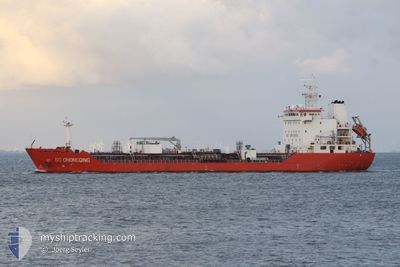
SC CHONGQING
Oil/Chemical Tanker
Current Trip
| Time Travelled | --- |
|---|---|
| Remaining Time | 3 days |
| Distance Travelled | --- |
| Remaining Distance | 1181.68 nm |
| AVG Speed | --- |
| MAX Speed | --- |
| AVG Wind | --- |
| MAX Wind | --- |
| MIN Temp | --- |
| MAX Temp | --- |
| Draught | 8.3 m |
| Position Received | 1 d ago |
Current Position
| Longitude | 121.05492° |
|---|---|
| Latitude | 34.84613° |
| Status | Under way using engine |
| Speed | 10.1 Knots |
| Course | 276.6° |
| Area | Yellow Sea |
| Station | T-AIS |
| Position Received | 1 d ago |
Info
Information
The current position of SC CHONGQING is in Yellow Sea with coordinates 34.84613° / 121.05492° as reported on 2024-06-16 07:13 by AIS to our vessel tracker app. The vessel's current speed is 10.1 Knots and is heading at the port of NANSHA. The estimated time of arrival as calculated by vessel tracking app is 2024-06-21 10:25 LT
The vessel SC CHONGQING (IMO: 9425045, MMSI: 477950900) is a Oil/Chemical Tanker that was built in 2010 ( 14 years old ). It's sailing under the flag of [HK] Hong Kong.
In this page you can find informations about the vessels current position, last detected port calls, and current voyage information. If the vessels is not in coverage by AIS you will find the latest position.
The current position of SC CHONGQING is detected by our AIS receivers and we are not responsible for the reliability of the data. The last position was recorded while the vessel was in Coverage by the Ais receivers of our vessel tracking app.
The current draught of SC CHONGQING as reported by AIS is 8.3 meters
Weather
| Temperature | 21.9°C / 71.42°F |
|---|---|
| Wind Speed | 11 knots |
| Direction | 209° SSW |
| Pressure | 1006.5 hPa |
| Humidity | 70.9 % |
| Cloud Coverage | 2 % |
Featured Company
Last Port Calls
| Port | Arrival | Departure | Time In Port |
|---|---|---|---|
| 2024-06-03 23:37 | |||
| 2024-05-29 08:35 | 2024-05-30 10:08 | 1 d | |
| 2024-05-12 15:12 | 2024-05-15 02:12 | 2 d | |
| 2024-05-06 17:00 | 2024-05-07 23:20 | 1 d | |
| 2024-04-24 18:24 | 2024-04-26 04:30 | 1 d | |
| 2024-04-17 22:15 | 2024-04-18 23:37 | 1 d | |
| 2024-04-01 22:01 | 2024-04-03 02:21 | 1 d |
Last Trips
| Origin | Departure | Destination | Arrival | Distance | |
|---|---|---|---|---|---|
| 2024-05-30 18:08 | 2024-06-04 06:37 | 1144.57 nm | |||
| 2024-05-15 10:12 | 2024-05-29 16:35 | 2819.17 nm | |||
| 2024-05-08 07:20 | 2024-05-12 23:12 | 848.57 nm | |||
| 2024-04-26 12:30 | 2024-05-07 01:00 | 2376.57 nm | |||
| 2024-04-19 07:37 | 2024-04-25 02:24 | 883.02 nm | |||
| 2024-04-03 10:21 | 2024-04-18 06:15 | 2371.65 nm | |||
| 2024-03-19 07:05 | 2024-04-02 06:01 | 1731.51 nm |
Events
| Time | Event | Details | Position / Dest | Info |
|---|---|---|---|---|
| 2024-06-16 13:40 | STOP Moving | 16.44 nm, East of LIANYUNGANG |
34.82314 / 119.80580
CN NSA
|
Speed: 0.3 kn Course: 104° |
| 2024-06-16 07:21 | Status Changed | Default Under way using engine |
34.84819 / 121.02992
CN NSA
|
Speed: 10.1 kn Course: 276.6° |
| 2024-06-16 07:13 | Detected in Sea | Chinese part of the Yellow Sea |
34.84613 / 121.05492
Yellow Sea
|
Speed: 10.1 kn Course: 276.6° |
| 2024-06-16 07:13 | Status Changed | Under way using engine Default |
34.84613 / 121.05492
CN NSA
|
Speed: 10.2 kn Course: 277° |
| 2024-06-16 07:13 | IN Coverage |
34.84613 / 121.05492
Yellow Sea
|
Speed: 10.1 kn Course: 276.6° |
|
| 2024-06-16 07:13 | OUT of Coverage |
34.84613 / 121.05492
Yellow Sea
|
Speed: 10.1 kn Course: 276.6° |
|
| 2024-06-13 06:56 | Status Changed | Default Under way using engine |
23.82165 / 118.46152
CN NSA
|
Speed: 11.7 kn Course: 49.9° |
| 2024-06-13 06:53 | OUT of Coverage |
23.81466 / 118.45247
South China Sea
CN NSA
|
Speed: 11.7 kn Course: 49.9° |
|
| 2024-06-13 06:43 | Change Sea Area | Chinese part of the South China Sea Malaysian part of the Singapore Strait |
23.79550 / 118.42826
South China Sea
CN NSA
|
Speed: 11.6 kn Course: 48.3° |
| 2024-06-13 06:42 | Status Changed | Under way using engine Default |
23.79301 / 118.42523
CN NSA
|
Speed: 11.7 kn Course: 47° |