
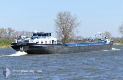
SCALDIS
Other Type
Current Trip
NLBRS131G1CITYX00010
| Time Travelled | 23 h, 57 mins |
|---|---|
| Remaining Time | --- |
| Distance Travelled | 37.93 nm |
| Remaining Distance | --- |
| AVG Speed | 8 Knots |
| MAX Speed | 9.8 Knots |
| AVG Wind | 5.6 knots |
| MAX Wind | 12.1 knots |
| MIN Temp | 13.2°C / 55.76°F |
| MAX Temp | 17.2°C / 62.96°F |
| Draught | 0.2 m |
| Position Received | 1 m ago |
Current Position
| Longitude | 4.57076° |
|---|---|
| Latitude | 51.90149° |
| Status | Moored |
| Speed | |
| Course | --- |
| Area | North Sea |
| Station | T-AIS |
| Position Received | 1 m ago |
Info
Information
The current position of SCALDIS is in North Sea with coordinates 51.90149° / 4.57076° as reported on 2024-06-01 05:57 by AIS to our vessel tracker app. The vessel's current speed is 0 Knots
The vessel SCALDIS (MMSI: 244740167) is a Other Type It's sailing under the flag of [NL] Netherlands.
In this page you can find informations about the vessels current position, last detected port calls, and current voyage information. If the vessels is not in coverage by AIS you will find the latest position.
The current position of SCALDIS is detected by our AIS receivers and we are not responsible for the reliability of the data. The last position was recorded while the vessel was in Coverage by the Ais receivers of our vessel tracking app.
The current draught of SCALDIS as reported by AIS is 0.2 meters
Weather
| Temperature | 13.8°C / 56.84°F |
|---|---|
| Wind Speed | 10 knots |
| Direction | 348° NNW |
| Pressure | 1015.8 hPa |
| Humidity | 90 % |
| Cloud Coverage | 100 % |
Featured Company
Last Port Calls
| Port | Arrival | Departure | Time In Port |
|---|---|---|---|
| 2024-05-30 13:30 | 2024-05-31 06:01 | 16 h | |
| 2024-05-29 19:38 | 2024-05-30 13:17 | 17 h | |
| 2024-05-29 16:49 | 2024-05-29 17:57 | 1 h | |
| 2024-05-29 05:04 | 2024-05-29 08:59 | 3 h | |
| 2024-05-28 08:46 | 2024-05-28 09:02 | 15 m | |
| 2024-05-27 13:19 | 2024-05-27 13:55 | 36 m | |
| 2024-05-24 09:30 | 2024-05-27 11:09 | 3 d | |
| 2024-05-23 10:29 | 2024-05-23 10:48 | 19 m | |
| 2024-05-22 13:36 | 2024-05-23 05:32 | 15 h | |
| 2024-05-21 20:17 | 2024-05-22 09:00 | 12 h |
Last Trips
| Origin | Departure | Destination | Arrival | Distance | |
|---|---|---|---|---|---|
| 2024-05-30 15:17 | 2024-05-30 15:30 | 1.81 nm | |||
| 2024-05-29 19:57 | 2024-05-29 21:38 | 5.81 nm | |||
| 2024-05-29 10:59 | 2024-05-29 18:49 | 36.81 nm | |||
| 2024-05-28 11:02 | 2024-05-29 07:04 | 78.07 nm | |||
| 2024-05-27 15:55 | 2024-05-28 10:46 | 3.85 nm | |||
| 2024-05-27 13:09 | 2024-05-27 15:19 | 15.13 nm | |||
| 2024-05-23 12:48 | 2024-05-24 11:30 | 62.72 nm | |||
| 2024-05-23 07:32 | 2024-05-23 12:29 | 26.34 nm | |||
| 2024-05-22 11:00 | 2024-05-22 15:36 | 32.03 nm | |||
| 2024-05-21 19:16 | 2024-05-21 22:17 | 6.47 nm |
Events
| Time | Event | Details | Position / Dest | Info |
|---|---|---|---|---|
| 2024-05-31 11:15 | Status Changed | Moored Under way using engine |
51.90142 / 4.57114
NLBRS131G1CITYX00010
|
Speed: 0.7 kn Course: 511° |
| 2024-05-31 11:07 | Status Changed | Under way using engine Moored |
51.90186 / 4.57465
NLBRS131G1CITYX00010
|
Speed: 1.7 kn Course: 511° |
| 2024-05-31 11:06 | Status Changed | Moored Under way using engine |
51.90156 / 4.57417
NLBRS131G1CITYX00010
|
Speed: 0.4 kn Course: 511° |
| 2024-05-31 11:06 | STOP Moving | 0.43 nm, South of KRIMPEN |
51.90155 / 4.57413
NLBRS131G1CITYX00010
|
Speed: 0.2 kn Course: 511° |
| 2024-05-31 09:27 | Status Changed | Under way using engine Default |
51.73667 / 4.63065
NLBRS131G1CITYX00010
|
Speed: 6.8 kn Course: 11° |
| 2024-05-31 09:18 | Status Changed | Default Under way using engine |
51.71936 / 4.62324
NLBRS131G1CITYX00010
|
Speed: 7.8 kn Course: 49° |
| 2024-05-31 09:08 | Status Changed | Under way using engine Default |
51.70791 / 4.59611
NLBRS131G1CITYX00010
|
Speed: 8.4 kn Course: 73° |
| 2024-05-31 09:02 | IN Coverage |
51.70858 / 4.59972
North Sea
|
Speed: 8.4 kn Course: 71.3° |
|
| 2024-05-31 08:19 | START Moving | 1.04 nm, West of WILLEMSTAD |
51.69282 / 4.41211
NLBRS131G1CITYX00010
|
Speed: 8 kn Course: 49° |
| 2024-05-31 07:35 | OUT of Coverage |
51.66366 / 4.36550
North Sea
|
Speed: 9.1 kn Course: 64.9° |