
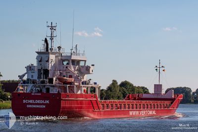
SCHELDEDIJK
General Cargo
Current Trip
| Trip Time | 1 day |
|---|---|
| Trip Distance | 336.47 nm |
| AVG Speed | 9.6 Knots |
| MAX Speed | 10.7 Knots |
| Draught | 4 m |
| AVG Wind | 9.1 knots |
| MAX Wind | 20 knots |
| MIN Temp | 18.2°C / 64.76°F |
| MAX Temp | 22.5°C / 72.5°F |
| Position Received | 7 h, 16 m ago |
Current Position
| Longitude | 4.89684° |
|---|---|
| Latitude | 43.38645° |
| Status | At anchor |
| Speed | |
| Course | 111° |
| Area | Mediterranean Sea - Western Basin |
| Station | T-AIS |
| Position Received | 7 h, 16 m ago |
Info
Information
The current position of SCHELDEDIJK is in Mediterranean Sea - Western Basin with coordinates 43.38645° / 4.89684° as reported on 2024-06-06 19:10 by AIS to our vessel tracker app. The vessel's current speed is 0 Knots and is currently inside the port of FOS.
The vessel SCHELDEDIJK (IMO: 9514925, MMSI: 245060000) is a General Cargo that was built in 2010 ( 14 years old ). It's sailing under the flag of [NL] Netherlands.
In this page you can find informations about the vessels current position, last detected port calls, and current voyage information. If the vessels is not in coverage by AIS you will find the latest position.
The current position of SCHELDEDIJK is detected by our AIS receivers and we are not responsible for the reliability of the data. The last position was recorded while the vessel was in Coverage by the Ais receivers of our vessel tracking app.
The current draught of SCHELDEDIJK as reported by AIS is 4 meters
Weather
| Temperature | 20.6°C / 69.08°F |
|---|---|
| Wind Speed | 5 knots |
| Direction | 115° ESE |
| Pressure | 1017.8 hPa |
| Humidity | 67.5 % |
| Cloud Coverage | 100 % |
Featured Company
Last Port Calls
| Port | Arrival | Departure | Time In Port |
|---|---|---|---|
| 2024-06-06 06:34 | |||
| 2024-06-04 06:55 | 2024-06-04 19:52 | 12 h | |
| 2024-06-01 12:54 | 2024-06-02 16:38 | 1 d | |
| 2024-05-30 08:32 | 2024-05-30 19:07 | 10 h | |
| 2024-05-27 10:36 | 2024-05-28 19:29 | 1 d | |
| 2024-05-24 22:11 | 2024-05-25 03:13 | 5 h | |
| 2024-05-23 16:52 | 2024-05-24 10:49 | 17 h | |
| 2024-05-18 18:12 | 2024-05-22 13:32 | 3 d | |
| 2024-05-16 18:00 | 2024-05-17 07:41 | 13 h | |
| 2024-05-13 17:28 | 2024-05-15 07:04 | 1 d |
Last Trips
| Origin | Departure | Destination | Arrival | Distance | |
|---|---|---|---|---|---|
| 2024-06-04 21:52 | 2024-06-06 08:34 | 336.47 nm | |||
| 2024-06-02 18:38 | 2024-06-04 08:55 | 340.59 nm | |||
| 2024-05-30 21:07 | 2024-06-01 14:54 | 363.83 nm | |||
| 2024-05-28 21:29 | 2024-05-30 10:32 | 340.02 nm | |||
| 2024-05-25 05:13 | 2024-05-27 12:36 | 341.56 nm | |||
| 2024-05-24 12:49 | 2024-05-25 00:11 | 111.32 nm | |||
| 2024-05-22 15:32 | 2024-05-23 18:52 | 240.31 nm | |||
| 2024-05-17 09:41 | 2024-05-18 20:12 | 335.96 nm | |||
| 2024-05-15 09:04 | 2024-05-16 20:00 | 337.31 nm | |||
| 2024-05-12 11:09 | 2024-05-13 19:28 | 336.20 nm |
Events
| Time | Event | Details | Position / Dest | Info |
|---|---|---|---|---|
| 2024-06-06 19:10 | OUT of Coverage |
43.38645 / 4.89684
Mediterranean Sea - Western Basin
[FR] FOS
|
Speed: Course: 253.1° |
|
| 2024-06-06 18:19 | IN Coverage |
43.38633 / 4.89678
Mediterranean Sea - Western Basin
[FR] FOS
|
Speed: 0.1 kn Course: 253.1° |
|
| 2024-06-06 07:07 | Status Changed | Default Under way using engine |
43.38694 / 4.89816
[FR] FOS
|
Speed: 6.9 kn Course: 247° |
| 2024-06-06 07:07 | STOP Moving |
43.38694 / 4.89816
[FR] FOS
|
Speed: 0.2 kn Course: 169° |
|
| 2024-06-06 06:36 | OUT of Coverage |
43.39600 / 4.90482
Mediterranean Sea - Western Basin
[FR] FOS
|
Speed: 6.9 kn Course: 258.5° |
|
| 2024-06-06 06:34 | PORT ARRIVAL |
|
43.39574 / 4.90916
[FR] FOS
|
Speed: 9.3 kn Course: 315.4° |
| 2024-06-06 00:13 | Change Sea Area | French part of the Mediterranean Sea - Western Basin Spanish part of the Mediterranean Sea - Western Basin |
42.69089 / 4.34625
Mediterranean Sea - Western Basin
FRFOS
|
Speed: 8.9 kn Course: 46.4° |
| 2024-06-05 21:40 | IN Coverage |
42.42188 / 3.97305
Mediterranean Sea - Western Basin
FRFOS
|
Speed: 9.6 kn Course: 43.9° |
|
| 2024-06-05 20:36 | OUT of Coverage |
42.30129 / 3.81762
Mediterranean Sea - Western Basin
FRFOS
|
Speed: 9.3 kn Course: 39.8° |
|
| 2024-06-05 17:04 | Change Sea Area | Spanish part of the Mediterranean Sea - Western Basin Spanish part of the Balearic Sea |
41.89372 / 3.30290
Mediterranean Sea - Western Basin
FRFOS
|
Speed: 10.1 kn Course: 42° |