
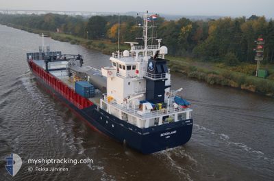
SCHOKLAND
General Cargo
Current Trip
| Time Travelled | 2 days |
|---|---|
| Remaining Time | --- |
| Distance Travelled | 646.13 nm |
| Remaining Distance | --- |
| AVG Speed | 10.7 Knots |
| MAX Speed | 13 Knots |
| AVG Wind | 10.9 knots |
| MAX Wind | 21 knots |
| MIN Temp | 15.3°C / 59.54°F |
| MAX Temp | 21°C / 69.8°F |
| Draught | 4.1 m |
| Position Received | 18 m ago |
Current Position
| Longitude | -8.51595° |
|---|---|
| Latitude | 36.61953° |
| Status | Under way using engine |
| Speed | 11.8 Knots |
| Course | 286.1° |
| Area | North Atlantic Ocean |
| Station | T-AIS |
| Position Received | 18 m ago |
Info
Information
The current position of SCHOKLAND is in North Atlantic Ocean with coordinates 36.61953° / -8.51595° as reported on 2024-05-23 07:20 by AIS to our vessel tracker app. The vessel's current speed is 11.8 Knots and is heading at the port of GIJON. The estimated time of arrival as calculated by vessel tracking app is 2024-05-25 04:00 LT
The vessel SCHOKLAND (IMO: 9431599, MMSI: 246655000) is a General Cargo that was built in 2010 ( 14 years old ). It's sailing under the flag of [NL] Netherlands.
In this page you can find informations about the vessels current position, last detected port calls, and current voyage information. If the vessels is not in coverage by AIS you will find the latest position.
The current position of SCHOKLAND is detected by our AIS receivers and we are not responsible for the reliability of the data. The last position was recorded while the vessel was in Coverage by the Ais receivers of our vessel tracking app.
The current draught of SCHOKLAND as reported by AIS is 4.1 meters
Weather
| Temperature | 14.5°C / 58.1°F |
|---|---|
| Wind Speed | 12 knots |
| Direction | 354° N |
| Pressure | 1017.4 hPa |
| Humidity | 69.1 % |
| Cloud Coverage | 100 % |
Featured Company
Last Port Calls
| Port | Arrival | Departure | Time In Port |
|---|---|---|---|
| 2024-05-18 21:38 | 2024-05-20 20:20 | 1 d | |
| 2024-05-16 04:23 | 2024-05-16 12:10 | 7 h | |
| 2024-05-11 04:11 | 2024-05-11 13:03 | 8 h | |
| 2024-05-04 09:36 | 2024-05-06 12:50 | 2 d | |
| 2024-04-28 17:01 | 2024-04-30 17:29 | 2 d | |
| 2024-04-24 02:15 | 2024-04-24 18:24 | 16 h | |
| 2024-04-19 19:31 | 2024-04-23 15:48 | 3 d | |
| 2024-04-18 21:28 | 2024-04-18 22:04 | 36 m | |
| 2024-04-17 00:47 | 2024-04-18 20:11 | 1 d | |
| 2024-04-15 12:29 | 2024-04-16 17:18 | 1 d |
Last Trips
| Origin | Departure | Destination | Arrival | Distance | |
|---|---|---|---|---|---|
| 2024-05-16 14:10 | 2024-05-18 23:38 | 435.63 nm | |||
| 2024-05-11 15:03 | 2024-05-16 06:23 | 870.39 nm | |||
| 2024-05-06 14:50 | 2024-05-11 06:11 | 1112.68 nm | |||
| 2024-04-30 18:29 | 2024-05-04 11:36 | 1013.51 nm | |||
| 2024-04-24 20:24 | 2024-04-28 18:01 | 991.50 nm | |||
| 2024-04-23 16:48 | 2024-04-24 04:15 | 125.20 nm | |||
| 2024-04-19 00:04 | 2024-04-19 20:31 | 109.11 nm | |||
| 2024-04-18 22:11 | 2024-04-18 23:28 | 10.67 nm | |||
| 2024-04-16 19:18 | 2024-04-17 02:47 | 65.66 nm | |||
| 2024-04-12 21:04 | 2024-04-15 14:29 | 794.38 nm |
Events
| Time | Event | Details | Position / Dest | Info |
|---|---|---|---|---|
| 2024-05-23 07:27 | Status Changed | Default Under way using engine |
36.62544 / -8.54159
GIJON
|
Speed: 11.8 kn Course: 286.1° |
| 2024-05-23 07:20 | Detected in Sea | Portuguese part of the North Atlantic Ocean |
36.61953 / -8.51595
North Atlantic Ocean
GIJON
|
Speed: 11.8 kn Course: 286.1° |
| 2024-05-23 07:20 | Status Changed | Under way using engine Default |
36.61953 / -8.51595
GIJON
|
Speed: 11.8 kn Course: 286° |
| 2024-05-23 07:10 | IN Coverage |
36.61953 / -8.51595
North Atlantic Ocean
GIJON
|
Speed: 11.8 kn Course: 286.1° |
|
| 2024-05-23 02:13 | Status Changed | Default Under way using engine |
36.33910 / -7.31475
GIJON
|
Speed: 11.6 kn Course: 286° |
| 2024-05-23 02:09 | OUT of Coverage |
36.33550 / -7.29949
North Atlantic Ocean
GIJON
|
Speed: 11.6 kn Course: 286° |
|
| 2024-05-22 23:36 | IN Coverage |
36.21104 / -6.72751
North Atlantic Ocean
GIJON
|
Speed: 11.3 kn Course: 285.9° |
|
| 2024-05-22 23:35 | Status Changed | Under way using engine Default |
36.20891 / -6.71803
GIJON
|
Speed: 11.4 kn Course: 286° |
| 2024-05-22 22:42 | Status Changed | Default Under way using engine |
36.16333 / -6.52000
GIJON
|
Speed: 11.5 kn Course: 286.6° |
| 2024-05-22 22:34 | OUT of Coverage |
36.15659 / -6.49115
North Atlantic Ocean
GIJON
|
Speed: 11.5 kn Course: 286.6° |