
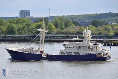
SCINTILLA MARIS
Pleasure Craft
Current Trip
| Time Travelled | 4 days |
|---|---|
| Remaining Time | --- |
| Distance Travelled | 13.88 nm |
| Remaining Distance | --- |
| AVG Speed | 12.8 Knots |
| MAX Speed | 14.3 Knots |
| AVG Wind | 7.9 knots |
| MAX Wind | 8 knots |
| MIN Temp | 10.1°C / 50.18°F |
| MAX Temp | 10.6°C / 51.08°F |
| Draught | 5 m |
| Position Received | 4 d ago |
Current Position
| Longitude | -7.04862° |
|---|---|
| Latitude | 61.95969° |
| Status | Under way using engine |
| Speed | 11.8 Knots |
| Course | 286.3° |
| Area | North Atlantic Ocean |
| Station | T-AIS |
| Position Received | 4 d ago |
Info
Information
The current position of SCINTILLA MARIS is in North Atlantic Ocean with coordinates 61.95969° / -7.04862° as reported on 2024-05-27 17:59 by AIS to our vessel tracker app. The vessel's current speed is 11.8 Knots
The vessel SCINTILLA MARIS (IMO: 8807222, MMSI: 538071876) is a Pleasure Craft It's sailing under the flag of [MH] Marshall Is.
In this page you can find informations about the vessels current position, last detected port calls, and current voyage information. If the vessels is not in coverage by AIS you will find the latest position.
The current position of SCINTILLA MARIS is detected by our AIS receivers and we are not responsible for the reliability of the data. The last position was recorded while the vessel was in Coverage by the Ais receivers of our vessel tracking app.
The current draught of SCINTILLA MARIS as reported by AIS is 5 meters
Weather
| Temperature | 10.3°C / 50.54°F |
|---|---|
| Wind Speed | 8 knots |
| Direction | 86° E |
| Pressure | 1007.6 hPa |
| Humidity | 91.4 % |
| Cloud Coverage | 100 % |
Featured Company
Last Port Calls
| Port | Arrival | Departure | Time In Port |
|---|---|---|---|
| 2024-05-26 09:39 | 2024-05-27 16:49 | 1 d | |
| 2024-05-14 13:20 | 2024-05-16 08:13 | 1 d | |
| 2024-04-27 15:21 | 2024-05-04 10:42 | 6 d | |
| 2024-04-19 11:21 | 2024-04-26 07:19 | 6 d | |
| 2024-04-19 09:16 | 2024-04-19 09:57 | 40 m | |
| 2024-04-18 14:23 | 2024-04-19 06:32 | 16 h | |
| 2024-04-18 07:45 |
Most Visited Ports (Last year)
| Port | Arrivals | |
|---|---|---|
| 12 | ||
| 1 | ||
| 1 | ||
| 1 |
Last Trips
| Origin | Departure | Destination | Arrival | Distance | |
|---|---|---|---|---|---|
| 2024-05-16 09:13 | 2024-05-26 10:39 | 345.74 nm | |||
| 2024-05-04 11:42 | 2024-05-14 14:20 | 895.93 nm | |||
| 2024-04-26 09:19 | 2024-04-27 16:21 | 230.16 nm | |||
| 2024-04-19 11:57 | 2024-04-19 13:21 | 2.83 nm | |||
| 2024-04-19 08:32 | 2024-04-19 11:16 | 8.34 nm | |||
| 2024-04-18 09:45 | 2024-04-18 16:23 | 28.76 nm |
Events
| Time | Event | Details | Position / Dest | Info |
|---|---|---|---|---|
| 2024-05-27 17:59 | OUT of Coverage |
61.95969 / -7.04862
North Atlantic Ocean
HOFN ICELAND
|
Speed: 11.8 kn Course: 286.3° |
|
| 2024-05-27 16:49 | PORT DEPARTURE |
|
61.99723 / -6.76256
HOFN ICELAND
|
Speed: 8.1 kn Course: 138° |
| 2024-05-27 16:44 | START Moving |
62.00585 / -6.76744
[FO] TORSHAVN
|
Speed: 3.7 kn Course: 195° |
|
| 2024-05-27 16:16 | Destination Changed | HOFN ICELAND TORSHAVN |
62.00790 / -6.76721
[FO] TORSHAVN
|
Speed: Course: 347° |
| 2024-05-27 16:16 | ETA Changed | 2024/05/29 10:00 2024/05/25 11:00 |
62.00790 / -6.76721
[FO] TORSHAVN
|
Speed: Course: 347° |
| 2024-05-27 16:16 | Status Changed | Under way using engine Moored |
62.00790 / -6.76721
[FO] TORSHAVN
|
Speed: Course: 346° |
| 2024-05-26 09:57 | Status Changed | Moored Under way using engine |
62.00792 / -6.76725
[FO] TORSHAVN
|
Speed: 0.1 kn Course: 347° |
| 2024-05-26 09:57 | ETA Changed | 2024/05/25 11:00 2024/05/25 12:00 |
62.00792 / -6.76726
[FO] TORSHAVN
|
Speed: 0.1 kn Course: 347° |
| 2024-05-26 09:53 | STOP Moving |
62.00782 / -6.76720
[FO] TORSHAVN
|
Speed: 0.3 kn Course: 343° |
|
| 2024-05-26 09:39 | PORT ARRIVAL |
|
61.99885 / -6.76478
[FO] TORSHAVN
|
Speed: 6 kn Course: 292.6° |