
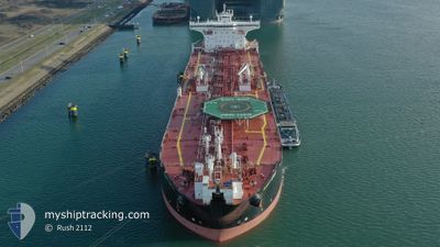
SCOTT SPIRIT
Oil Products Tanker
Current Trip
BALDER(NOR)
| Time Travelled | 1 day |
|---|---|
| Remaining Time | --- |
| Distance Travelled | 136.63 nm |
| Remaining Distance | --- |
| AVG Speed | 7.5 Knots |
| MAX Speed | 13.6 Knots |
| AVG Wind | 11.7 knots |
| MAX Wind | 17.9 knots |
| MIN Temp | 10.8°C / 51.44°F |
| MAX Temp | 12.9°C / 55.22°F |
| Draught | 9.3 m |
| Position Received | 21 h, 9 m ago |
Current Position
| Longitude | 3.30708° |
|---|---|
| Latitude | 52.23336° |
| Status | Under way using engine |
| Speed | 9.7 Knots |
| Course | 345.3° |
| Area | North Sea |
| Station | T-AIS |
| Position Received | 21 h, 9 m ago |
Info
Information
The current position of SCOTT SPIRIT is in North Sea with coordinates 52.23336° / 3.30708° as reported on 2024-06-09 09:17 by AIS to our vessel tracker app. The vessel's current speed is 9.7 Knots
The vessel SCOTT SPIRIT (IMO: 9466142, MMSI: 311027400) is a Oil Products Tanker that was built in 2011 ( 13 years old ). It's sailing under the flag of [BS] Bahamas.
In this page you can find informations about the vessels current position, last detected port calls, and current voyage information. If the vessels is not in coverage by AIS you will find the latest position.
The current position of SCOTT SPIRIT is detected by our AIS receivers and we are not responsible for the reliability of the data. The last position was recorded while the vessel was in Coverage by the Ais receivers of our vessel tracking app.
The current draught of SCOTT SPIRIT as reported by AIS is 9.3 meters
Weather
| Temperature | 10.6°C / 51.08°F |
|---|---|
| Wind Speed | 1 knots |
| Direction | 41° NE |
| Pressure | 1004.8 hPa |
| Humidity | 71.4 % |
| Cloud Coverage | 100 % |
Featured Company
Most Visited Ports (Last year)
| Port | Arrivals | |
|---|---|---|
| 6 | ||
| 3 | ||
| 3 | ||
| 2 | ||
| 2 | ||
| 1 |
Last Trips
Events
| Time | Event | Details | Position / Dest | Info |
|---|---|---|---|---|
| 2024-06-09 09:17 | Status Changed | Default Under way using engine |
52.23333 / 3.30667
BALDER(NOR)
|
Speed: 9.7 kn Course: 345.3° |
| 2024-06-09 09:17 | Status Changed | Under way using engine Default |
52.23336 / 3.30708
BALDER(NOR)
|
Speed: 9.9 kn Course: 323° |
| 2024-06-09 09:17 | OUT of Coverage |
52.23336 / 3.30708
North Sea
BALDER(NOR)
|
Speed: 9.7 kn Course: 345.3° |
|
| 2024-06-09 09:02 | Status Changed | Default Under way using engine |
52.19833 / 3.34167
BALDER(NOR)
|
Speed: 10.1 kn Course: 300.3° |
| 2024-06-09 08:58 | Status Changed | Under way using engine Default |
52.19179 / 3.35484
BALDER(NOR)
|
Speed: 10.5 kn Course: 291° |
| 2024-06-09 08:58 | IN Coverage |
52.19179 / 3.35484
North Sea
BALDER(NOR)
|
Speed: 10.1 kn Course: 300.3° |
|
| 2024-06-09 07:53 | Status Changed | Default Under way using engine |
52.10500 / 3.63500
BALDER(NOR)
|
Speed: 11 kn Course: 289.8° |
| 2024-06-09 07:51 | OUT of Coverage |
52.10390 / 3.64505
North Sea
BALDER(NOR)
|
Speed: 11 kn Course: 289.8° |
|
| 2024-06-09 05:58 | PORT DEPARTURE |
|
51.96807 / 4.11858
BALDER(NOR)
|
Speed: 8.5 kn Course: 299° |
| 2024-06-09 05:38 | START Moving |
51.94440 / 4.16299
[NL] ROTTERDAM
|
Speed: 3.2 kn Course: 351° |