
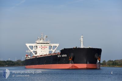
SDTR DORIS
Cargo
Current Trip
| Time Travelled | 7 days |
|---|---|
| Remaining Time | 9 days |
| Distance Travelled | 1955.96 nm |
| Remaining Distance | 2953.10 nm |
| AVG Speed | 11.2 Knots |
| MAX Speed | 15.1 Knots |
| AVG Wind | 15.8 knots |
| MAX Wind | 30 knots |
| MIN Temp | 15.6°C / 60.08°F |
| MAX Temp | 29.5°C / 85.1°F |
| Draught | 13.7 m |
| Position Received | 6 d ago |
Current Position
| Longitude | 152.84802° |
|---|---|
| Latitude | -32.63869° |
| Status | Under way using engine |
| Speed | 11.3 Knots |
| Course | 64° |
| Area | Tasman Sea |
| Station | T-AIS |
| Position Received | 6 d ago |
Info
Information
The current position of SDTR DORIS is in Tasman Sea with coordinates -32.63869° / 152.84802° as reported on 2024-05-13 22:56 by AIS to our vessel tracker app. The vessel's current speed is 11.3 Knots and is heading at the port of QINZHOU. The estimated time of arrival as calculated by vessel tracking app is 2024-05-30 10:46 LT
The vessel SDTR DORIS (IMO: 9877860, MMSI: 538009572) is a Cargo It's sailing under the flag of [MH] Marshall Is.
In this page you can find informations about the vessels current position, last detected port calls, and current voyage information. If the vessels is not in coverage by AIS you will find the latest position.
The current position of SDTR DORIS is detected by our AIS receivers and we are not responsible for the reliability of the data. The last position was recorded while the vessel was in Coverage by the Ais receivers of our vessel tracking app.
The current draught of SDTR DORIS as reported by AIS is 13.7 meters
Weather
| Temperature | 29.5°C / 85.1°F |
|---|---|
| Wind Speed | 19 knots |
| Direction | 148° SSE |
| Pressure | 1009.7 hPa |
| Humidity | 74.8 % |
| Cloud Coverage | 100 % |
Featured Company
Events
| Time | Event | Details | Position / Dest | Info |
|---|---|---|---|---|
| 2024-05-13 23:04 | Status Changed | Default Under way using engine |
-32.62814 / 152.87218
CNQZH
|
Speed: 11.3 kn Course: 64° |
| 2024-05-13 22:56 | Status Changed | Under way using engine Default |
-32.63869 / 152.84802
CNQZH
|
Speed: 11.2 kn Course: 65° |
| 2024-05-13 22:56 | OUT of Coverage |
-32.63869 / 152.84802
Tasman Sea
CNQZH
|
Speed: 11.3 kn Course: 64° |
|
| 2024-05-13 22:44 | Status Changed | Default Under way using engine |
-32.65488 / 152.80553
CNQZH
|
Speed: 11.3 kn Course: 65.3° |
| 2024-05-13 22:33 | Status Changed | Under way using engine Default |
-32.66817 / 152.76988
CNQZH
|
Speed: 11.2 kn Course: 65° |
| 2024-05-13 22:32 | Status Changed | Default Under way using engine |
-32.67013 / 152.76483
CNQZH
|
Speed: 11.2 kn Course: 64.6° |
| 2024-05-13 22:26 | Status Changed | Under way using engine Default |
-32.67726 / 152.74626
CNQZH
|
Speed: 11.3 kn Course: 69° |
| 2024-05-13 22:24 | Status Changed | Default Under way using engine |
-32.68054 / 152.73782
CNQZH
|
Speed: 11.1 kn Course: 65.6° |
| 2024-05-13 22:12 | Status Changed | Under way using engine Default |
-32.69494 / 152.69949
CNQZH
|
Speed: 11.2 kn Course: 67° |
| 2024-05-13 21:43 | Status Changed | Default Under way using engine |
-32.73224 / 152.60289
CNQZH
|
Speed: 11.1 kn Course: 63.8° |