
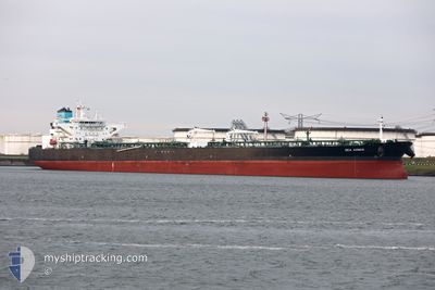
SEA AMBER
Tanker
Current Trip
| Time Travelled | 2 days |
|---|---|
| Remaining Time | 4 days |
| Distance Travelled | 541.29 nm |
| Remaining Distance | 1271.87 nm |
| AVG Speed | 9.6 Knots |
| MAX Speed | 15.2 Knots |
| AVG Wind | 10 knots |
| MAX Wind | 15.8 knots |
| MIN Temp | 11.2°C / 52.16°F |
| MAX Temp | 14.9°C / 58.82°F |
| Draught | 9.5 m |
| Position Received | 5 h, 37 m ago |
Current Position
| Longitude | -6.39677° |
|---|---|
| Latitude | 48.16329° |
| Status | Under way using engine |
| Speed | 10.8 Knots |
| Course | 209° |
| Area | Celtic Sea |
| Station | T-AIS |
| Position Received | 5 h, 37 m ago |
Info
Information
The current position of SEA AMBER is in Celtic Sea with coordinates 48.16329° / -6.39677° as reported on 2024-06-08 08:39 by AIS to our vessel tracker app. The vessel's current speed is 10.8 Knots and is heading at the port of LAS PALMAS. The estimated time of arrival as calculated by vessel tracking app is 2024-06-13 13:57 LT
The vessel SEA AMBER (IMO: 9772931, MMSI: 241466000) is a Tanker It's sailing under the flag of [GR] Greece.
In this page you can find informations about the vessels current position, last detected port calls, and current voyage information. If the vessels is not in coverage by AIS you will find the latest position.
The current position of SEA AMBER is detected by our AIS receivers and we are not responsible for the reliability of the data. The last position was recorded while the vessel was in Coverage by the Ais receivers of our vessel tracking app.
The current draught of SEA AMBER as reported by AIS is 9.5 meters
Weather
| Temperature | 14.8°C / 58.64°F |
|---|---|
| Wind Speed | 15 knots |
| Direction | 4° N |
| Pressure | 1018 hPa |
| Humidity | 76.2 % |
| Cloud Coverage | 11 % |
Featured Company
Last Trips
Events
| Time | Event | Details | Position / Dest | Info |
|---|---|---|---|---|
| 2024-06-08 08:41 | Status Changed | Default Under way using engine |
48.15760 / -6.40147
LAS PALMAS
|
Speed: 10.8 kn Course: 209° |
| 2024-06-08 08:39 | OUT of Coverage |
48.16329 / -6.39677
Celtic Sea
LAS PALMAS
|
Speed: 10.8 kn Course: 209° |
|
| 2024-06-08 06:55 | Status Changed | Under way using engine Default |
48.44035 / -6.17410
LAS PALMAS
|
Speed: 10.5 kn Course: 206° |
| 2024-06-08 06:43 | Status Changed | Default Under way using engine |
48.47159 / -6.15100
LAS PALMAS
|
Speed: 10.5 kn Course: 205.8° |
| 2024-06-08 06:02 | Status Changed | Under way using engine Default |
48.58006 / -6.07085
LAS PALMAS
|
Speed: 10.1 kn Course: 206° |
| 2024-06-08 05:55 | IN Coverage |
48.57968 / -6.07113
Celtic Sea
LAS PALMAS
|
Speed: 10.2 kn Course: 205.6° |
|
| 2024-06-08 01:37 | Status Changed | Default Under way using engine |
49.12151 / -5.28217
LAS PALMAS
|
Speed: 13.4 kn Course: 241.9° |
| 2024-06-08 01:33 | OUT of Coverage |
49.12911 / -5.26025
Celtic Sea
LAS PALMAS
|
Speed: 13.4 kn Course: 241.9° |
|
| 2024-06-08 00:49 | Detected in Sea | French part of the Celtic Sea |
49.21009 / -5.03410
Celtic Sea
LAS PALMAS
|
Speed: 14.3 kn Course: 239° |
| 2024-06-07 23:32 | Change Sea Area | French part of the English Channel United Kingdom part of the English Channel |
49.34493 / -4.67805
English Channel
LAS PALMAS
|
Speed: 11.8 kn Course: 239.5° |