
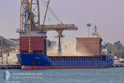
SEA BEAUTY
General Cargo
Current Trip
LA NOUVELE
| Time Travelled | 17 days |
|---|---|
| Remaining Time | --- |
| Distance Travelled | 187.93 nm |
| Remaining Distance | --- |
| AVG Speed | 7.5 Knots |
| MAX Speed | 11.9 Knots |
| AVG Wind | 6.9 knots |
| MAX Wind | 12.9 knots |
| MIN Temp | 14.5°C / 58.1°F |
| MAX Temp | 23.9°C / 75.02°F |
| Draught | 4.7 m |
| Position Received | 4 m ago |
Current Position
| Longitude | 28.91111° |
|---|---|
| Latitude | 40.97322° |
| Status | At anchor |
| Speed | |
| Course | 66° |
| Area | Sea of Marmara |
| Station | T-AIS |
| Position Received | 4 m ago |
Info
Information
The current position of SEA BEAUTY is in Sea of Marmara with coordinates 40.97322° / 28.91111° as reported on 2024-06-10 04:42 by AIS to our vessel tracker app. The vessel's current speed is 0 Knots
The vessel SEA BEAUTY (IMO: 9151096, MMSI: 312667000) is a General Cargo that was built in 1996 ( 28 years old ). It's sailing under the flag of [BZ] Belize.
In this page you can find informations about the vessels current position, last detected port calls, and current voyage information. If the vessels is not in coverage by AIS you will find the latest position.
The current position of SEA BEAUTY is detected by our AIS receivers and we are not responsible for the reliability of the data. The last position was recorded while the vessel was in Coverage by the Ais receivers of our vessel tracking app.
The current draught of SEA BEAUTY as reported by AIS is 4.7 meters
Weather
| Temperature | 21.6°C / 70.88°F |
|---|---|
| Wind Speed | 2 knots |
| Direction | 51° NE |
| Pressure | 1011 hPa |
| Humidity | 60.8 % |
| Cloud Coverage | 5 % |
Featured Company
Last Port Calls
| Port | Arrival | Departure | Time In Port |
|---|---|---|---|
| 2024-05-22 06:22 | 2024-05-23 20:25 | 1 d | |
| 2024-05-06 09:24 | 2024-05-09 15:38 | 3 d | |
| 2024-04-27 15:40 | 2024-04-27 18:05 | 2 h | |
| 2024-04-25 00:21 | 2024-04-26 02:13 | 1 d | |
| 2024-04-21 17:08 |
Most Visited Ports (Last year)
| Port | Arrivals | |
|---|---|---|
| 1 | ||
| 1 | ||
| 1 | ||
| 1 |
Last Trips
| Origin | Departure | Destination | Arrival | Distance | |
|---|---|---|---|---|---|
| 2024-04-27 20:05 | 2024-05-06 11:24 | 1657.24 nm | |||
| 2024-04-26 03:13 | 2024-04-27 17:40 | 328.62 nm | |||
| 2024-04-21 18:08 | 2024-04-25 01:21 | 740.76 nm |
Events
| Time | Event | Details | Position / Dest | Info |
|---|---|---|---|---|
| 2024-06-10 02:27 | Status Changed | At anchor Under way using engine |
40.97283 / 28.91222
LA NOUVELE
|
Speed: 0.2 kn Course: 344° |
| 2024-06-10 02:24 | STOP Moving | 0.96 nm, South East of ZEYTINBURNU |
40.97286 / 28.91244
LA NOUVELE
|
Speed: 0.1 kn Course: 346° |
| 2024-06-10 00:05 | Change Sea Area | Turkish part of the Sea of Marmara Turkish part of the Black Sea |
41.22647 / 29.12580
Sea of Marmara
LA NOUVELE
|
Speed: 9 kn Course: 197.4° |
| 2024-06-09 23:28 | START Moving | 2.8 nm, North West of RUMELI FENERI |
41.26799 / 29.07476
LA NOUVELE
|
Speed: 3.4 kn Course: 110° |
| 2024-06-09 15:51 | STOP Moving | 2.89 nm, North West of RUMELI FENERI |
41.26788 / 29.07161
LA NOUVELE
|
Speed: 0.3 kn Course: 69° |
| 2024-06-09 14:36 | Draught Changed | 4.7 3 |
41.34889 / 29.23282
LA NOUVELE
|
Speed: 9.7 kn Course: 253.9° |
| 2024-06-09 14:36 | Destination Changed | LA NOUVELE YEISK |
41.34889 / 29.23282
LA NOUVELE
|
Speed: 9.7 kn Course: 253.9° |
| 2024-06-09 14:36 | ETA Changed | 2024/06/14 09:00 2024/05/27 06:00 |
41.34889 / 29.23282
LA NOUVELE
|
Speed: 9.7 kn Course: 253.9° |
| 2024-06-09 14:32 | IN Coverage |
41.35042 / 29.23974
Black Sea
|
Speed: 9.7 kn Course: 253.6° |