
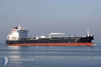
SEA CIRRUS
Tanker
Current Trip
| Time Travelled | 23 h, 50 mins |
|---|---|
| Remaining Time | 14 mins |
| Distance Travelled | 130.78 nm |
| Remaining Distance | 4.15 nm |
| AVG Speed | 8 Knots |
| MAX Speed | 11.7 Knots |
| AVG Wind | 18.6 knots |
| MAX Wind | 23 knots |
| MIN Temp | 14.1°C / 57.38°F |
| MAX Temp | 18.9°C / 66.02°F |
| Draught | 8.2 m |
| Position Received | 1 m ago |
Current Position
| Longitude | -6.87690° |
|---|---|
| Latitude | 37.07564° |
| Status | Under way using engine |
| Speed | 0.4 Knots |
| Course | 324° |
| Area | North Atlantic Ocean |
| Station | T-AIS |
| Position Received | 1 m ago |
Info
Information
The current position of SEA CIRRUS is in North Atlantic Ocean with coordinates 37.07564° / -6.87690° as reported on 2024-05-15 11:13 by AIS to our vessel tracker app. The vessel's current speed is 0.4 Knots and is heading at the port of HUELVA. The estimated time of arrival as calculated by vessel tracking app is 2024-05-15 11:28 LT
The vessel SEA CIRRUS (IMO: 9724568, MMSI: 538010128) is a Tanker It's sailing under the flag of [MH] Marshall Is.
In this page you can find informations about the vessels current position, last detected port calls, and current voyage information. If the vessels is not in coverage by AIS you will find the latest position.
The current position of SEA CIRRUS is detected by our AIS receivers and we are not responsible for the reliability of the data. The last position was recorded while the vessel was in Coverage by the Ais receivers of our vessel tracking app.
The current draught of SEA CIRRUS as reported by AIS is 8.2 meters
Weather
| Temperature | 16.8°C / 62.24°F |
|---|---|
| Wind Speed | 8 knots |
| Direction | 317° NW |
| Pressure | 1013.7 hPa |
| Humidity | 55.3 % |
| Cloud Coverage | 1 % |
Featured Company
Last Port Calls
| Port | Arrival | Departure | Time In Port |
|---|---|---|---|
| 2024-05-12 19:24 | 2024-05-14 11:24 | 1 d | |
| 2024-05-08 21:11 | 2024-05-09 20:36 | 23 h | |
| 2024-04-30 13:43 | 2024-05-03 08:30 | 2 d | |
| 2024-04-23 09:27 | 2024-04-24 11:07 | 1 d | |
| 2024-04-14 15:58 | 2024-04-14 16:33 | 35 m | |
| 2024-04-12 18:07 | 2024-04-14 06:07 | 1 d | |
| 2024-04-07 22:59 | 2024-04-09 04:10 | 1 d | |
| 2024-03-29 15:33 | 2024-04-01 10:17 | 2 d | |
| 2024-03-26 10:56 | 2024-03-27 20:27 | 1 d | |
| 2024-03-20 08:59 | 2024-03-23 06:21 | 2 d |
Most Visited Ports (Last year)
| Port | Arrivals | |
|---|---|---|
| 7 | ||
| 4 | ||
| 4 | ||
| 3 | ||
| 3 | ||
| 3 |
Last Trips
| Origin | Departure | Destination | Arrival | Distance | |
|---|---|---|---|---|---|
| 2024-05-09 21:36 | 2024-05-12 20:24 | 703.34 nm | |||
| 2024-05-03 09:30 | 2024-05-08 22:11 | 1583.58 nm | |||
| 2024-04-24 12:07 | 2024-04-30 14:43 | 1696.82 nm | |||
| 2024-04-14 18:33 | 2024-04-23 10:27 | 739.39 nm | |||
| 2024-04-14 07:07 | 2024-04-14 17:58 | 119.23 nm | |||
| 2024-04-09 05:10 | 2024-04-12 18:07 | 761.94 nm | |||
| 2024-04-01 11:17 | 2024-04-07 23:59 | 1578.96 nm | |||
| 2024-03-27 20:27 | 2024-03-29 15:33 | 286.71 nm | |||
| 2024-03-23 07:21 | 2024-03-26 10:56 | 152.69 nm | |||
| 2024-03-13 21:56 | 2024-03-20 09:59 | 86.62 nm |
Events
| Time | Event | Details | Position / Dest | Info |
|---|---|---|---|---|
| 2024-05-15 11:13 | Status Changed | At anchor Under way using engine |
37.07562 / -6.87686
ESHUV
|
Speed: 0.4 kn Course: 324° |
| 2024-05-15 11:09 | STOP Moving | 4.24 nm, South of HUELVA |
37.07579 / -6.87719
ESHUV
|
Speed: 0.2 kn Course: 315° |
| 2024-05-15 07:41 | Status Changed | Under way using engine Default |
36.67426 / -7.04389
ESHUV
|
Speed: 5.5 kn Course: 319° |
| 2024-05-15 07:38 | Status Changed | Default Under way using engine |
36.67501 / -7.04471
ESHUV
|
Speed: 3.6 kn Course: 320° |
| 2024-05-15 07:11 | Status Changed | Under way using engine Default |
36.65450 / -7.01959
ESHUV
|
Speed: 2.6 kn Course: 320° |
| 2024-05-15 07:02 | Status Changed | Default Under way using engine |
36.65144 / -7.01527
ESHUV
|
Speed: 2.5 kn Course: 317° |
| 2024-05-15 06:17 | Status Changed | Under way using engine Default |
36.62781 / -6.98495
ESHUV
|
Speed: 2.3 kn Course: 334° |
| 2024-05-15 06:10 | IN Coverage |
36.62781 / -6.98495
North Atlantic Ocean
|
Speed: 2.3 kn Course: 328.2° |
|
| 2024-05-15 04:55 | Status Changed | Default Under way using engine |
36.57596 / -6.94440
ESHUV
|
Speed: 3.1 kn Course: 335° |
| 2024-05-15 04:43 | OUT of Coverage |
36.56482 / -6.93553
North Atlantic Ocean
|
Speed: 3.1 kn Course: 329.1° |